This classic mountaineering route up Ypsilon Mountain is one of the most prized ridge climbs in Colorado. Mountain Project link here.
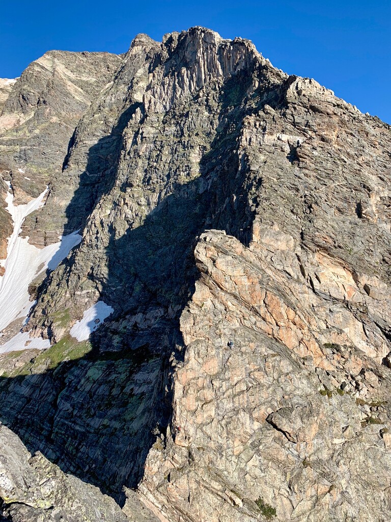
Start from the Lawn Lake Trailhead, where Fall River Road splits from Highway 34 in Rocky Mountain National Park. From there climb the trail towards Lawn Lake and after a little more than 1.25 miles, turn left for the Ypsilon Lake turnoff. Follow this trail all the way to Ypsilon Lake (3 more miles). Go left (clockwise) around the lake until you meet up with an easy-looking chute directly north of the lake. Follow this chute onto the ridge and stay high on the ridge as it climbs to the north-west. At about 12,000' you'll run into the four Aces. These are four, "A" shaped crests on the ridge that present the crux of the route. For the first two, traverse ledges to left (south) side of the ridge proper. The third ace is best climbed directly up a corner that's slightly right of center, then cut left to reach the top of the ace (YDS 5.3). From here, there are either anchors to rappel or it's a quick (YDS 5.0) downclimb to reach the col before the fourth and final ace. For the last Ace, climb slabs on the right (north) side (YDS 5.4) until you reach easy ledges that wrap left towards a white boulder, from there cross to the left (south) side of the ridge and climb either a corner or chossy ledges to the top of the ace (YDS 5.2). After you descend the final ace, the ridge climbs continuously to the summit. The first part is steeper and offers some 5.easy climbing before it evens off a bit and continues to be class 4 all the way to the summit.
Descend via Donner Ridge (see our map), or another way.
Here's Anton Krupicka's Mountain Project report from a run (probably FKT) in August 2015:
"Really nice ridge scramble. I was surprised at how consistently quality the rock was
seemed to be very little choss (relatively speaking, for the alpine) in general. I made it car-to-car in 3h52---or, rather, bike-to-bike, I suppose, as I approached via bike from Boulder. This might now supersede Kiener's and/or the Keyhole Ridge as my favorite alpine scramble in the park, simply for the quality of rock and length of the ridge.
A couple beta points: at Ypsilon Lake, I went around its west end, bushwhacked on a very faint trail parallel to the lakeshore for maybe 5min, and then went left/NW/uphill in the steep, somewhat narrow grassy gully. This took me straight to the ridge and felt quite efficient.
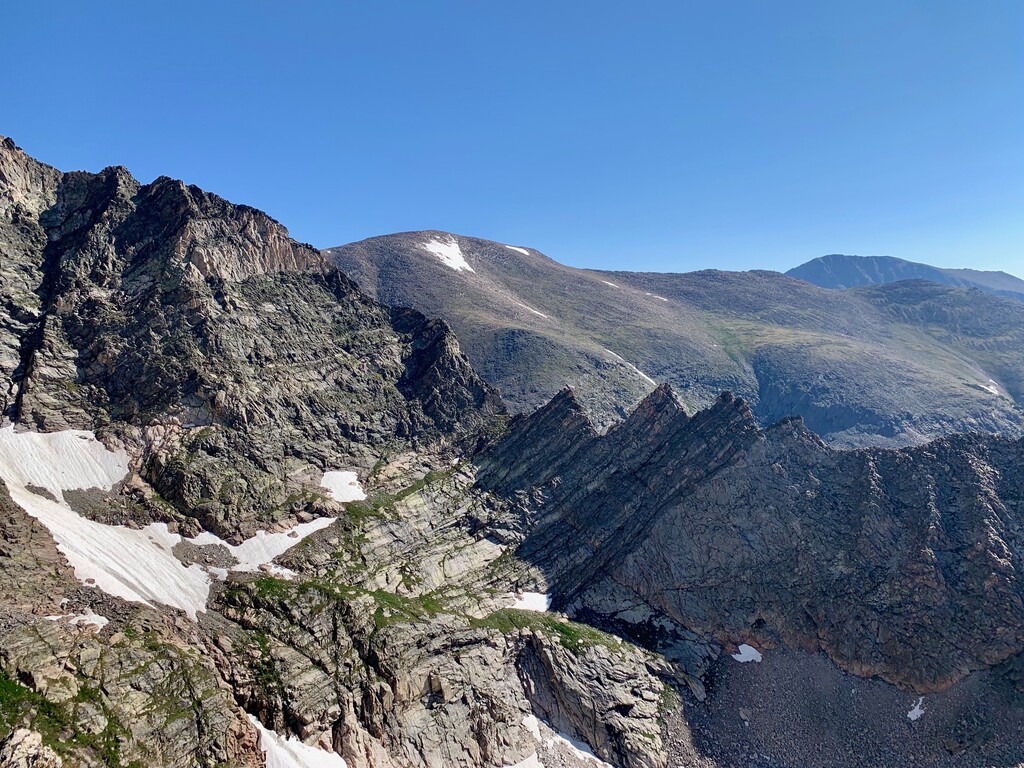
I came down Donner Ridge, and when I got to the big, seemingly impassable cliff/notch in the ridge at ~12,300', I dropped down a loose-ish gully SOUTH off the ridge, stayed high on descender's left out of the underbrush in the basin and at treeline eventually picked up a very faint use path, crossed the stream to the right on a giant log, and soon ran right into a very obvious social trail that quickly led me right back down to Ypsilon Lake. Need to be heads-up, but this felt like a very logical, efficient descent."
Anton's Strava for this is saved as a bicycling activity.

Comments
My weekend-warrior time on Aug 7 201 - 4:18:36 TH2TH.