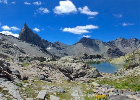
Location
France
Distance
113 km
Vertical Gain
9.082 m
Description
GPS Track
GR58-correct-track (3).gpx387.08 KB
FKTs
Male
| Hugo Questroy | 1d 1h 42m 22s |
Images
Comments
In this article, https://www.ledauphine.com/hautes-alpes/2018/08/23/l-exploit-de-remy-et-victor-garcin Remy Garcin did it in 2018 in 26h22.
I found a guy on Strava that did it in 2021 in 26h06.
I'm gonna try it on June 5th 2025, and I hope to go sub 24h.
It was too snowy, on the highest parts. I'm gonna try again soon!
I was having a look at this one, and on this site the route outlined is going along a ‘variante’ through Ristolas. Assuming a clockwise direction then the official route from the Collette de Gilly does not go down to Ristolas, it goes along the Crete de Gilly, then the Crete de Peyra Plata and then heads down the hillside to La Monta.
If you look on the IGN map you can see the other route going along the river between Ristolas and La Monta has ‘GR 58 variante’ written on it. Mon GR has the official route on it.
https://www.mongr.fr/trouver-prochaine-randonnee/suggestion/gr-58-de-saint-veran-a-abries
There is a MTB record as well for this circuit which stands at 14h53
https://www.ledauphine.com/sport/2020/06/29/tour-du-queyras-en-vtt-en-14-h-53-glenn-macarthur-l-a-fait
Good point, you're right.
I'm not sure which of the two routes is the most commonly used nowadays. I went through Ristolas when I did it as a hike, but I don’t think it makes much of a difference — it shortens the route by about a kilometer but adds around 170 meters of elevation gain, so we're talking about a 5–10 minute difference at most. In the end, it could just be considered an optional variant left up to the runner.
Actually, I believe the route through Les Fonts — which is quite popular — is also a variant compared to the original GR58 trail.