The route is a figure-of-eight circuit of Richmond Park (‘the Park’) and Wimbledon Common (‘the Common’). These two magical and historical open spaces are within easy reach of London and SE England and hence have for centuries played a crucial role in providing a place for recreation and sporting activities.
The Route aims to stay as close to the boundaries as practical, with the Common and the Park providing more or less the same share of the distance of 15 miles, and the elevation of 565ft. The Park and the Common are separated by a valley which from ancient times has been the main approach to London from the SE, now the A3 highway. The route can be started from any point, with the first recorded start being from the Wimbledon War Memorial, located on the edge of the Common, just north of Wimbledon Village, easily accessible by public transport.
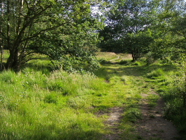
In 1868, Thames Hare and Hounds (Thames) introduced competitive cross-country team racing to the world. The club has always been located between the Park and the Common. The Common has been a protected open space for 150 years, and is owned by a charitable trust. It is the location for major cross-country events and a number of clubs enjoy its varied features of winding trails, often muddy, woodland, short steep hills, longer hills, and open heathland. Thames has hosted the annual Oxford U. v. Cambridge U. team race over 7.5 miles on the Common since 1880. It is also the home for Belgrave Harriers, founded in 1887, and a leading club for both cross-country and athletics. Windmilers and Common Runners are more recent, very active, clubs based here. The worldwide phenomenon of Parkrun was first launched nearby in Bushy Park, and in 2007 Wimbledon Common became their second venue, with to date 697 runs and almost 300,000 finishers.
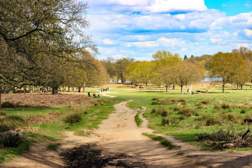
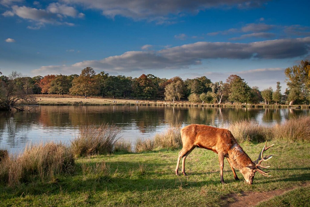
The Park is the largest Royal Park in the London region, covering an area of 2,500 acres. From its heights there is an uninterrupted view of St Paul's Cathedral, twelve miles away. The park has changed little over the centuries and the varied landscape of hills, woodland gardens and grasslands, set among huge gnarled ancient oak trees, abound in wild life. The royal connections begin with Edward II (1272-1307), when the area was known as the Manor of Sheen. The name was changed to Richmond during Henry VII's reign. In 1625 Charles I brought his court to Richmond Palace to escape the plague in London, and in 1837 turned it into an enclosed park for red and fallow deer, allowing pedestrians the right of way. Its sweeping views and open parkland contrast with the more sylvan WC.
The Wimbledon-Richmond circuit, forming a figure of eight, enable the walker, trekker and runner to enjoy the best features of both the Common and the Park.

Comments
Wimbledon-Richmond
The route to be followed blends pragmatic point-to-point with edging purity. Starts can be made anywhere. The original route started at the Wimbledon War Memorial, just north of Wimbledon Village. The following is a guide from that point.
PP (point-to-point) to Tibbetts Corner where Parkside meets the A3 underpass, but leaving the houses in the middle of this stretch to R (‘the right’).
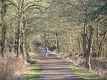
Hard L, then PP to the underpass below the A3 just NE of the A3 entrance to the Putney Vale Cemetery, but leaving Kingsmere to the L and staying on the Common paths – which meander through the woods.
L with cemetery on R, PP to where the track meets the playing fields, hard R and down the edge with the playing fields on the L, turning L round signpost.
PP to the brick bridge across BB (‘Beverley Brook’), then A3 crossing. Into the Park.
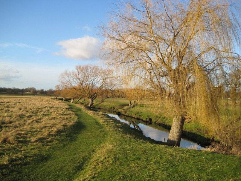
Hard R round the fence/hedge to the bridge in the corner. L then PP to Roehampton Gate keeping as close to BB as possible. Crossing it by the pedestrian bridge.
Stay on track over first bridge then follow the wall as close as possible to Sheen Gate. Leave the fenced area to the R and then again follow the wall past Bog Gate, Bishops Gate to Richmond Gate.
Take metal gate just past toilets down steep track to Petersham Gate, turning L round to L.
Take track nearest to wall and then fence/hedge alongside golf course. When this ends, R leaving meadow on L. Ease right to cross small brook by bridge. Keep brook on L and then cross back at next bridge, on to Ham Gate. PP – Kingston Gate, keeping close to wall. L to cross road at toilets.
PP Robin Hood Gate, exit Park. On return to Common go straight for gap in trees, right of track from brick bridge. Into playing fields, R and keep close to right edge. Exit by gap into small car park, L over BB bridge then R along BB path.
At next bridge, L up track to cross-paths, where going ahead crosses golf course. But go L with golf course on R. Track veers right and continues up with GC on right. Near top stay ahead onto Common and aim for gorse bushes, then track through trees with road on R and fairway on L.
Pass putting green on L, and then L, R and R keeping road on R. PP to corner of Southside and Westside near Zebra crossing. Leave large tree on L. PP to corner of Common near Village, L to finish.