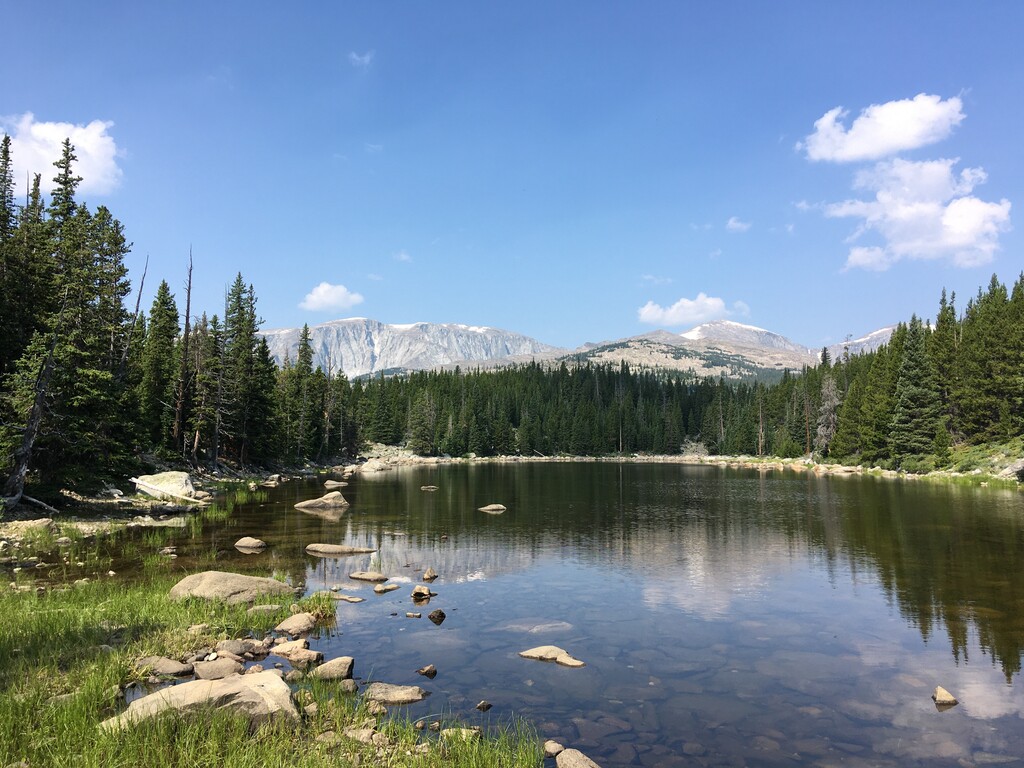
Bighorn Peak is a prominent peak in the Bighorn Mountains in northern Wyoming. It is located in the Cloud Peak Wilderness which requires a self-issue permit for day use. It is sometimes mistaken for the more popular Cloud Peak, being easier to see from Highway 16 and from the town of Buffalo. It's elevation is 12,324'.
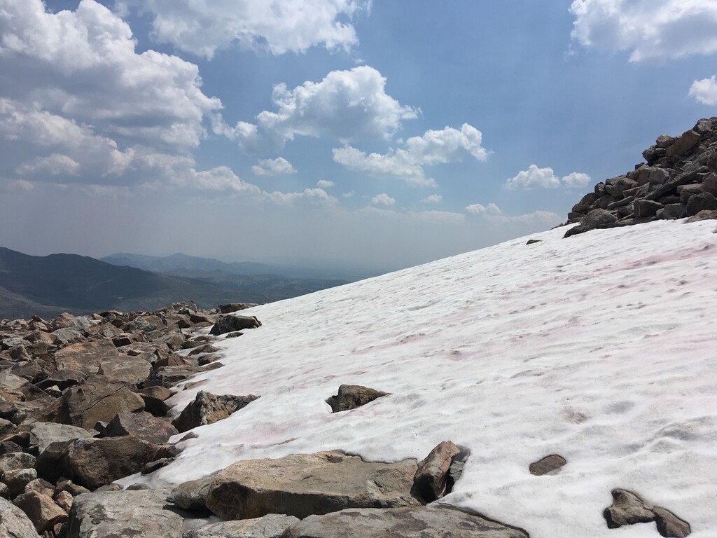
Bighorn Peak is not climbed as often as one would think based on its spectacular scenery. This is likely because it requires at least 4.5 miles of off trail travel through rugged terrain, much of this hopping between large boulders. The most popular way to approach Bighorn Peak seems to be from the east, from Circle Park Trailhead. Roundtrip mileage from here is around 18 if you take the most direct route, 9 miles for the ascent only with just shy of 5000' of gain. You may also be able to approach from West Tensleep Lake or Maybelle Lake. Any gps track for this route should be taken as a general guide, not an exact route.
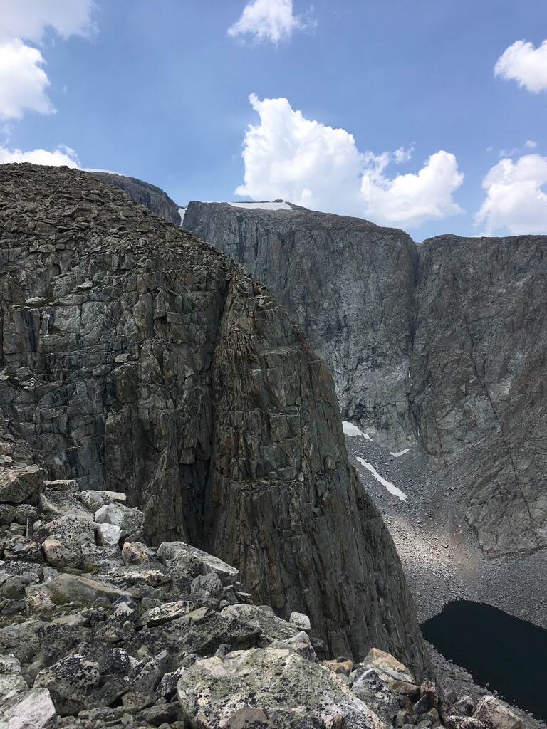
Coming from Circle Park you take trail #046 to trail #090. This gets you about 4.8 miles, to the shore of Old Crow Lake (not on some maps). At this point local knowledge becomes very important. The north side of this lake has a good game trail that heads WNW toward Lame Deer Lake. At some point you need to cross South Clear Creek and make your way up one of the 3 distinct ridges on the east side of the peak. The central one seem like the best option. The north ridge has a notch in it that would likely turn this into a technical route. I took the central ridge, which has an incredible amount of large boulders. It is likely quicker to stay just south of this ridge for as long as possible to avoid some of the boulders, even though this adds some distance.
This is truly a spectacular peak and should not be underestimated. 6 hours would be a VERY good roundtrip time. Though not exactly a technical route, probably class 3, some of the boulders shift when you step on them. It would be easy to injure yourself if you weren't paying close attention. I would definitely recommend doing this with a partner, or at least telling someone where you're going.
https://www.summitpost.org/bighorn-peak/154419
https://www.fs.usda.gov/recarea/bighorn/recarea/?recid=80618


Comments
Just wanted to make a brief note on this peak and the area: We just returned from a backpacking trip starting at Circle Park TH. We went ccw and climbed Cloud Peak and then Bighorn Peak from the west (Lost Twin Lakes). We had scouted the approach to Bighorn Peak from Circle Park TH up to Lame Deer which was easy and straightforward, but the scramble between Lame Deer and Bighorn from the east appeared to be too difficult for our entire party to accomplish with full packs to complete our full loop. We did summit Bighorn from the west (from our campsite at Lost Twin Lakes) but only with day packs, then went back to Lost Twin, grabbed our full backpacks and exited at West Tensleep TH after previously hitchhiking and shuttling our vehicle.
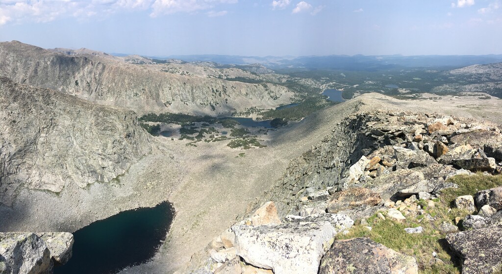
The point: Matt's subjective description of the scramble from the east seems accurate and you would probably gain time if summiting Bighorn from the west instead. Also, Matt's GPS distance of 18.69mi from the east (Circle Park TH) was longer than our GPS distance of ~17.5mi from the west (West Tensleep TH), Lost Twin Lakes is ~5.6mi of rugged but clear trail to the base of the steep waterfall drainage that takes you up toward Bighorn Peak. From there, we found it fairly easy to alternate between boulder hopping and high alpine meadow. We side-hilled at about 11,200' below Darton Peak to the first saddle, some steeper scrambling sections up a false summit, slightly descended to a second saddle, then up two false summits to Bighorn Peak. The best views of the snowfields and Chill Lakes are closer to the first saddle, but we had a clear day and could see for 100 miles from Bighorn well past Buffalo, Lake Desmet and beyond.
Stats:
From our Lost Twin Lakes campsite to Bighorn Peak: (~0.15mi below the trail intersection) we ascended 3.6mi in 2:10 elapsed, spent ~15min on the summit, descended in ~1:40 (we took a more direct way down: 3.12mi). Total elapsed: 4:07:08, 2,270' at a moderate pace)
From West Tensleep TH to campsite: 5.7mi each way, 2:58 up, 2:40 down, ~1800' (with full packs)
I agree with Matt that there is very little beta on this peak and I want to give my high recommendation for attempting it, especially from the West Tensleep TH. Lost Twin Lakes is a beautiful area with thousand-foot cliffs descending to the lakes, the ascent to Bighorn Peak is fairly straightforward from here and could reasonably be accomplished in a 6-7 hour trail run. This trail is still not to be taken lightly, though: SAR passed us within a mile from Lost Twin Lakes responding to an accident in which a horse fell on his rider on a particularly rough patch of trail. The man, unfortunately did not survive and his body was airlifted out just a few minutes before we arrived. A good reminder of the risks we take in the wilderness and the frailty of our lives (Job 1:21).