General Information:
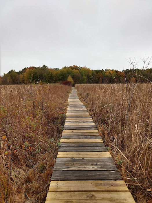
The Blue Heron Trail was created by the Massachusetts Department of Conservation & Recreation. The 8.8 mile loop outlines the perimeter of the Cutler Park Reservation and travels through Needham, Dedham, West Roxbury (Boston), and Newton. The Loop combines singletrack and a small amount of doublewide trail in wooded areas, boardwalks over marshland, and several sections of pavement, (roughly 2.8 miles) in order to connect noncontiguous trails. Cutler Park is a 600-acre reservation that protects a large freshwater marsh along the Charles River and Kendrick Pond. These bodies of water attract over 100 species of birds to the area, most notably the trail’s namesake, The Great Blue Heron.
This FKT route follows the original Blue Heron Trail created by the DCR except for a section of trail along the border of Millenium Park and the Brook Farm Historic Site that is blocked off by a gate. The gate was presumably placed there during renovations to the West Roxbury High School’s athletic fields in 2015 and the trail behind it has become severely overgrown.
Trail Directions:
Directions below are for the loop to be run counter-clockwise but note that there are markers so that it can be done in both directions.
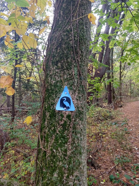
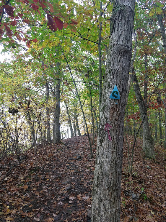
- Follow the blue triangles that have the outline of a Great Blue Heron on them. Whenever there is a turn, the top point of the triangle is angled in the direction that the trail is going.
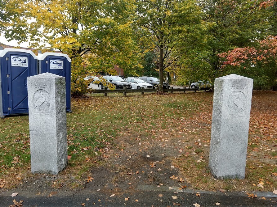
- The trail starts at the granite stone posts that say ‘Charles River Reservation’. Continue straight past them and then turn left onto the Kendrick Pond Loop. The trail is exceptionally well marked for the next 2.5 miles.
- Navigation becomes more difficult once you reach the section that travels under a railroad bridge.
- After passing under the bridge take a right and follow the large double wide trail for .25 miles and then turn left back onto singletrack. Continue following the trail markers until the trail intersects with Needham St.
- Turn left onto Needham St and run on the side of the road very briefly (please be careful) in order to cross over the Charles River before turning left to get back onto singletrack shortly thereafter.
- Continue on the trail for the next .8 miles and then exit the trail and follow markers along Vine Rock St.
- Continue along Vine Rock St until you reach Riverdale Park where the trail turns right and follows a concrete path that travels parallel to the Charles River.
- (Note that trail markings become sparse once you leave the singletrack. Don’t be concerned if you follow these directions as they will take you back to marked areas.)
- Turn left once the path reaches Spring St and cross the bridge over the Charles. Then immediately turn left again onto the VFW Parkway and continue for .4 miles until you reach Charles Park Rd. Turn left onto Charles Park Rd (which eventually turns into Gardner St) and continue straight until you enter Millennium Park.
- Next, turn onto the Millenium Park Loop, which is a paved walkway that passes by the left side of the track and football field that you will notice upon entering the park. Follow this path for .6 miles until you see a small bridge on your right. Cross over the bridge to get back onto a wooded trail.
- This trail passes through West Roxbury's Brook Farm Historic Site and then back into the Cutler Park Reservation in Newton.
- The Blue Heron Trail eventually turns right and passes by a soccer field (the short side of the field with a goal) and then into the Valeo Sports Center parking lot.
- Run to the end of the parking lot and turn left onto Wells Ave very briefly before turning left again and entering another parking lot. Run through the lot by following the perimeter of Cutler Park on your left.
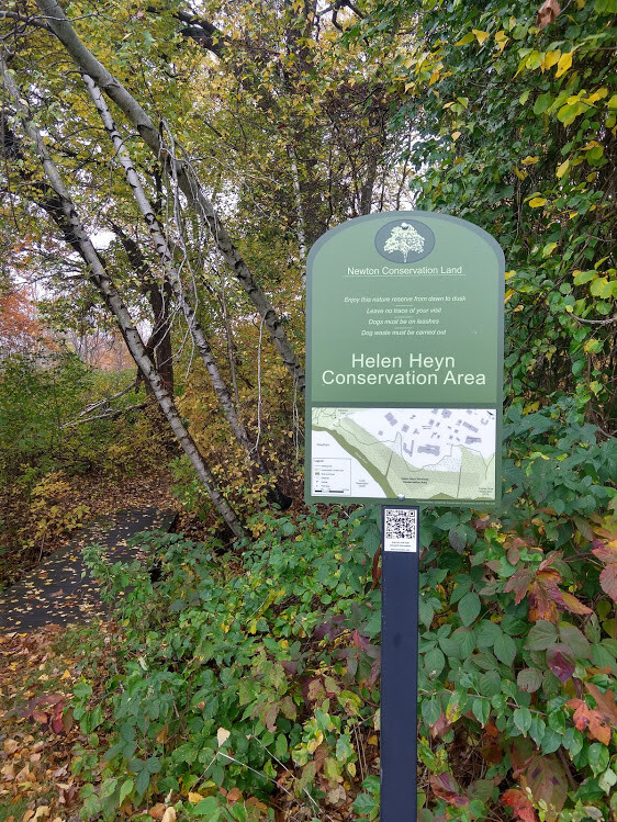
- From here on out the trail passes through a small section of trail denoted by a sign that says Helen Heyn Conservation Area, another parking lot, and then an additional section of trail in the Helen Heyn Conservation Area before returning to Kendrick St, .3 mile east of the start.
- Once you reach Kendrick St turn left and you will soon return to the Cutler Parking lot and the start of The Blue Heron Loop.
Additional Information:
There are variations of this trail on Trail Run Project, AllTrails, MTB Project, and other sites. The Trail Run Project route is almost identical to the original DCR route but for some reason, it takes a .3 mile detour off of the Blue Heron Trail at mile 1.1 and then connects back to the trail at mile 1.4. The GPX file that has been uploaded to the FKT website runs the course as it is actually marked.
There is also some confusion surrounding the designation of the Kendrick Pond Loop (the start of the Blue Heron Trail) as one of the 70 Healthy Heart Trails marked across the state park system. It is classified as a Healthy Heart Trail, it is not named the Healthy Heart Trail.
Parking:
Here are directions to the Cutler Park lot and the start of the trail.
Parking is super easy, and if the lot is full, the kind folks at PTC (the adjacent lot) let you park there on the weekends (please be respectful of their space though during the week though)
Future proposed changes the trail to make it more contiguous:
https://newtonconservators.org/blue-heron-trail-current-and-future-links/#blueheronheyn