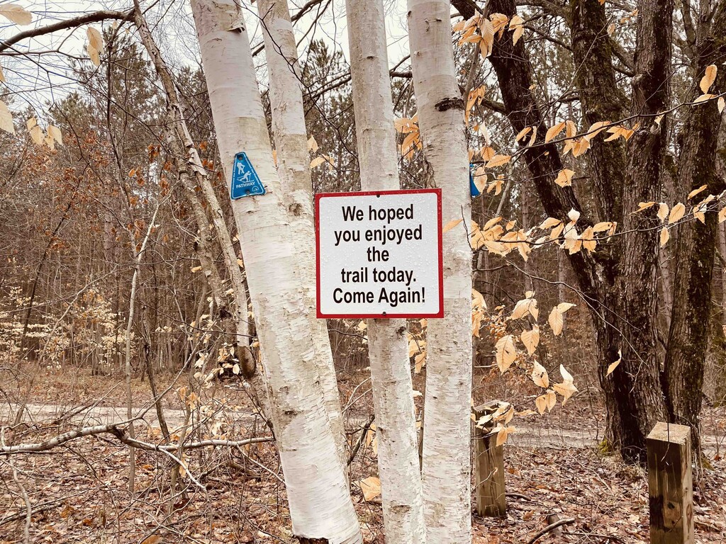
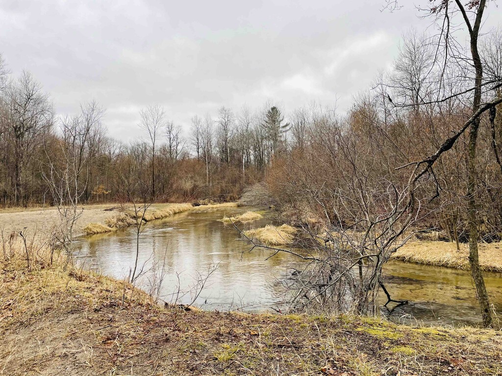
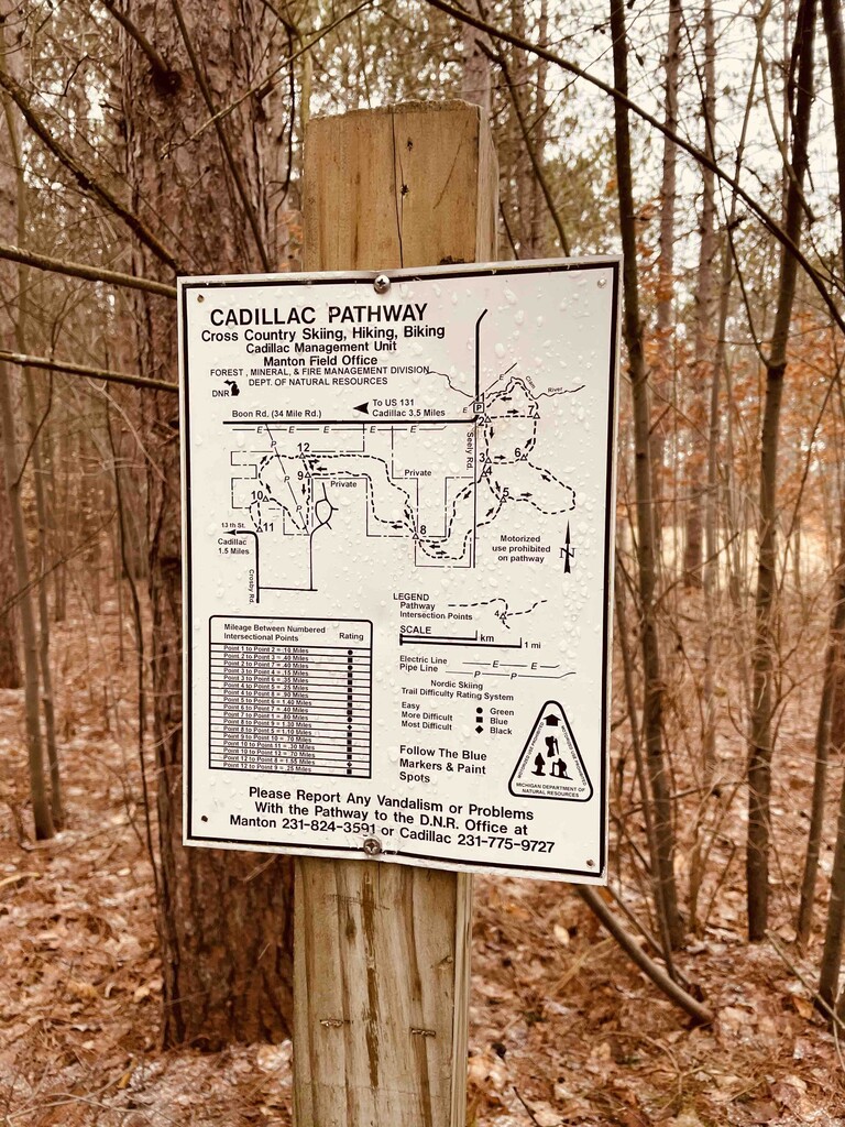
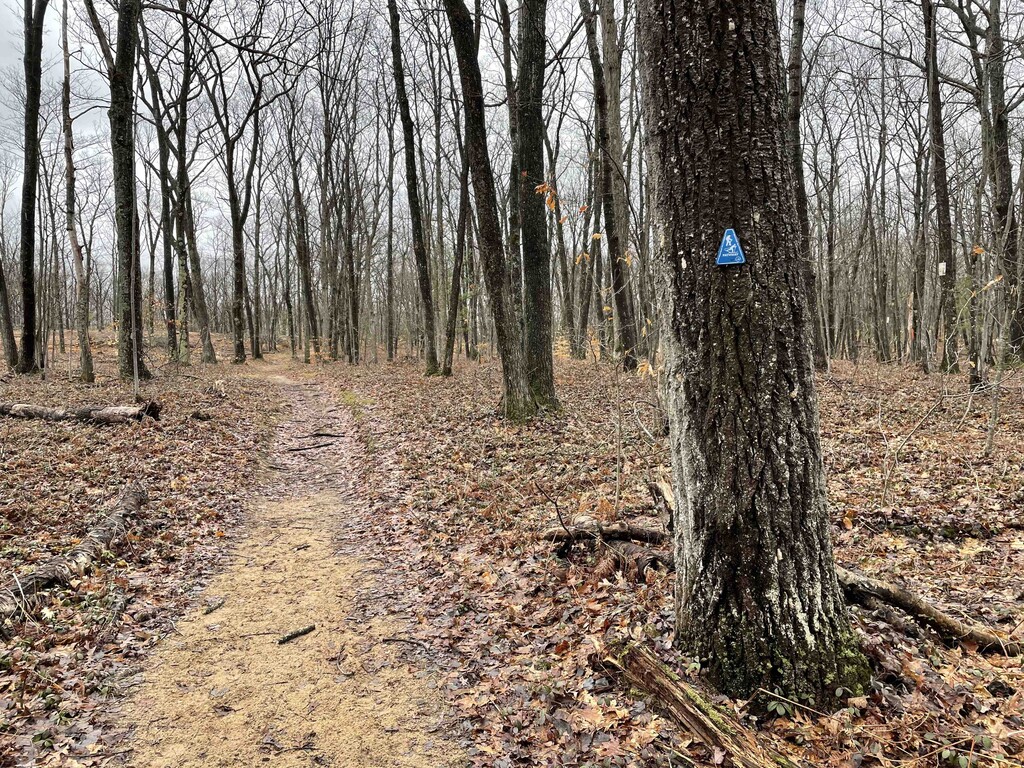
Had a day off and was excited to explore some trails around Cadillac, Michigan near the state's Huron-Manistee National Forest. The Cadillac Pathway appears to be a popular 10.3ish mile cross country ski trail route in the winter months that is very well maintained and beloved by the locals. Distance is 10.3-10.7 depending on Garmin vs. Strava as it brings together two separate loop routes. For elevation - AllTrails reports 721 ft where as my garmin recorded 935 ft of gain so its within that range. With the snow being melted - it was fun, easy single track for trail running. I was the only runner out there but came across only two hikers on the trail on a Sunday afternoon so it seems to fit the bill of "lightly-trafficked" (granted, the weather was extremely windy and a bit unfriendly to Michigan's attempt to start spring when I ran it). Very easy/practical to do solo as there are two parking lot entrance points to the trail where you would start/stop from. For this "double loop" route (which is really just a single loop where the route briefly intersects at the midpoint so you only run the route once) - the start line per the established AllTrails .gpx route I used was at the "brown pole" at the Career Technical Center school parking lot (it was a weekend, and the lot was entirely empty). Per a website that I just found regarding the trail - it looks like they respectfully request that people try to use the alternative, official Cadillac Pathway Pavillion parking lot during busier months of the year (see website below). This alternative would be at around 7.5ish miles into the original gpx route. You could easily park there and start/finish from that lot (and then be greeted by the very kind "come again" sign that is posted by that parking lot). Since it was relatively short, I carried my own water but the trail goes by Clam River which could be an easy refill spot if you had a Katadyn handheld or other quick water filtration option if you were in a pinch. Navigation is relatively easy as the trail is well marked with the blue Cadillac Pathway markers (see photos), but the actual route could be a little confusing especially towards the very end with the various intersecting trails if it was not on a watch/navigation system. As such, I still suggest uploading the route to your Garmin/watch of choice/Gaia to stay on track. Some really useful information about trail etiquette (e.g., cross country skiers wouldn't be thrilled about people ruining the tracks in the snow for obvious reasons) and care for the trail is found here: https://cadillacmichigan.com/cadillac-pathway/ Hope other trail runners will find this as enjoyable as I did!
Counterclockwise has a Strava segment: https://www.strava.com/segments/4265833