Route: Chesterfield Round Walk (United Kingdom)

Submitted by DaveBeno on Sat, 11/14/2020 - 09:59am
Location
United Kingdom
Distance
53 km
Vertical Gain
1,046 m
Description

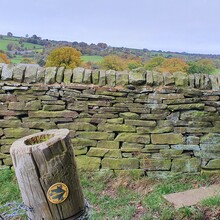
This loop circles Derbyshire's historic market town and it's famous Crooked Spire. Passing through the surrounding picturesque countryside, 95% of the route is on footpath, bridleways or trails.

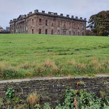
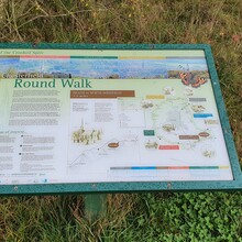
The Chesterfield Round Walk is a popular well maintained walking route which encircles the Derbyshire town of the Crooked Spire. Starting to the north-west of Chesterfield at Common Side the walk heads east and south across rolling farmland and varied types of countryside before encountering restored industrial landscapes south of the town. The northward leg is one of high moorland, woodland, ancient industrial remains and reservoirs. Places visited on the Chesterfield Round Walk are Common Side, Monk Wood, Unstone, Hundall, West Handley, Nether Handley, New Whittington, Brimington, Calow, Sutton Scarsdale, Heath, Williamsthorpe Ponds Nature Reserve, North Wingfield, Clay Cross, Old Tupton, Bole Hill, Stone Edge, Nether Loads, Hemming Green, Linacre Reservoir, Ingmanthorpe and Newgate.
 

GPS Track

Comments