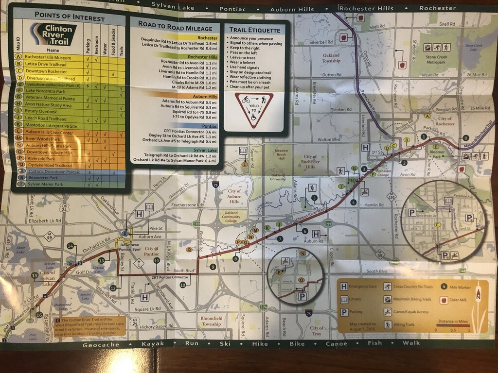
Route: Clinton River Trail (MI)

Submitted by SteveDavis on Fri, 11/27/2020 - 02:35pm
Location
Michigan, US
Distance
31.3 mi
Vertical Gain
497 ft
Description

The Clinton River Trail is a point to point East-West trail (15.7 miles) with dirt, gravel/cinder, sidewalks as surfaces. It starts at the border of Oakland and Macomb counties in Michigan. The trail connects to the Macomb Orchard Trail at the east end and the West Bloomfield Trail at the west end. The trail has mile post markers every half mile or paintings on sidewalks. It is a bike/run/walk/hiking path which extends from Rochester MI to Rochester Hills to Auburn Hills to Pontiac to West Bloomfield/ Sylvan Lake. Running the whole length and back is a good challenge and almost a perfect 50K run.

GPS Track
Images