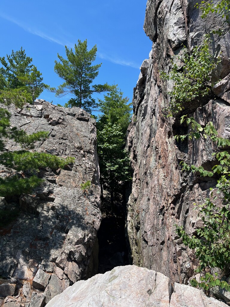
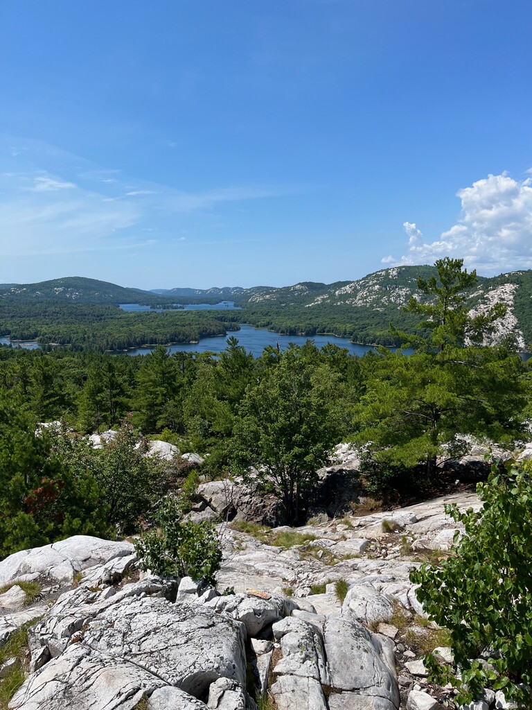
The Crack is a stunning, steep sided crevasse slicing through a quartzite rock cliff, located in Killarney Provincial Park. The destination is popular with hikers for the iconic Killarney views of pristine lakes framed by the white quartzite La Cloche mountains. Trail access on Highway 637 allows day hikers a short, but rugged hike to the top of the ridge.
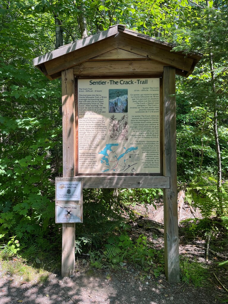
Make your way to the intersection of Highway 69 and Highway 637 (41 km south of Sudbury). Turn west on Highway 637 and travel for 50 km into Killarney Provincial Park to the parking area for The Crack Access Trail. You must pay at the automated pay station if you are a day use visitor and are not camping (permits must be displayed on the car dash).
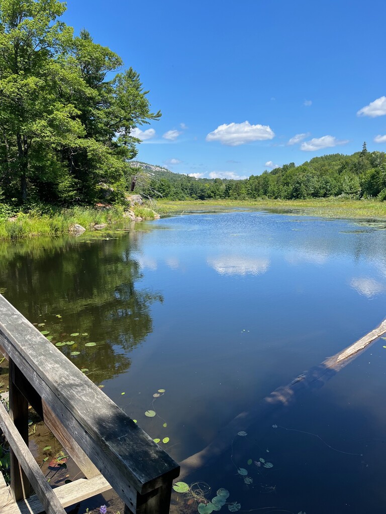
The hike begins on an old logging road that has been converted into a trail. The trail here is wide, level and easily navigated for 1.5 km until joining up with La Cloche Silhouette Trail. Follow the La Cloche Silhouette Trail north (right). At 1.9 km the trail crosses Kakakise Creek and it then follows the western shore of Kakakise lake for about 600 meters after which the trail turns northwest, away from the lake and becomes much more rugged.
Beyond Kakakise Lake, the trail becomes steeper and more rugged as the forest gives way to the exposed quartzite outcrops and cliffs which dominate the area. Nearer to The Crack, the trail becomes very rugged. Much care must be taken to climb over and around the large quartzite blocks that line the base and passageway of the rock formation.
Once reaching the top of The Crack, 3.8 km from the parking lot, hikers are presented with excellent views towards Killarney Lake and the Southern La Cloche range.
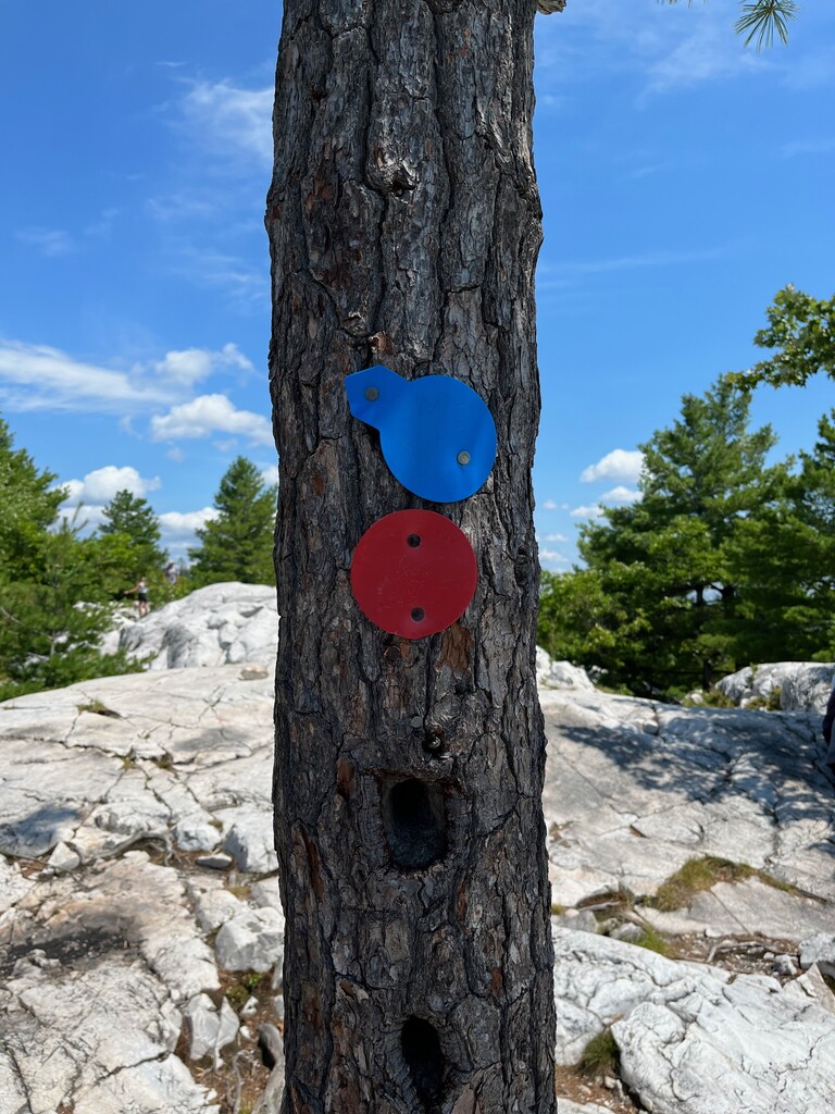
This OUT and BACK trail officially starts at The Crack sign in the parking lot. Follow the red trail markers all the way to the top. There will also be blue markers for some of the trail since it doubles as the La Cloche Silhouette Trail. The turn around point is at the final red trail marker at the top, above The Crack where you get the beautiful views. You will reach approximately 1165 feet of elevation at the top. Be careful descending The Crack and make your way back to the parking lot.
The Crack is easily one of the best, shorter hiking routes in all of Ontario! It is near the top of the list on articles that rate the greatest trails in Ontario. You get the most bang for your buck with a challenging climb and amazing views at the top. The quartzite rock is amazing and it really feels like you are making your way through a giant crack in the earth. This route is very popular, especially on weekends. There are many resources out there for more information...
http://www.ontariohighpoints.com/the-crack/
https://www.ontarioparks.ca/parksblog/hike-the-crack-killarney/
https://en.wikipedia.org/wiki/The_Crack_(trail)
https://northernontario.travel/northeastern-ontario/hiking-crack-killarney-provincial-park