From Summitpost:
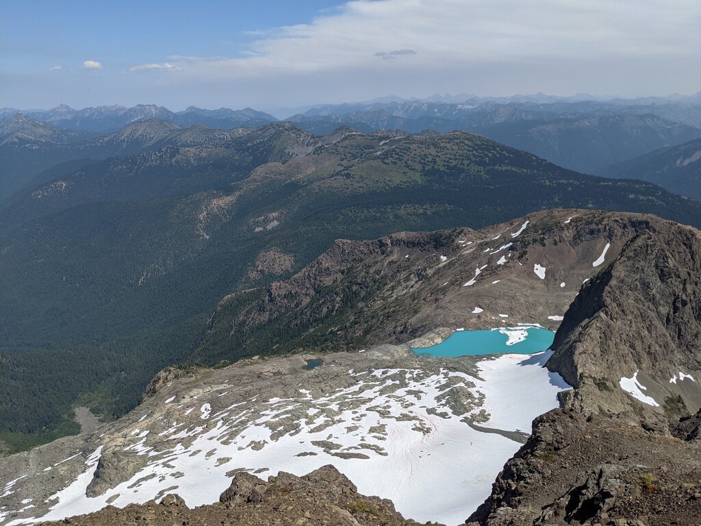
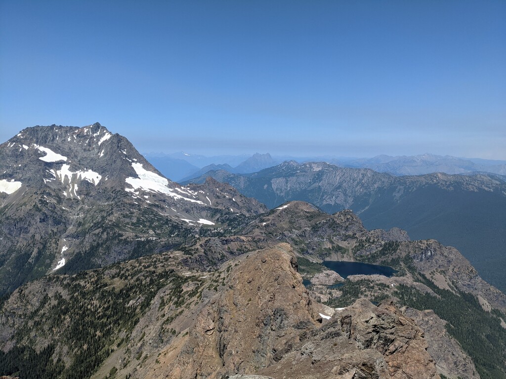
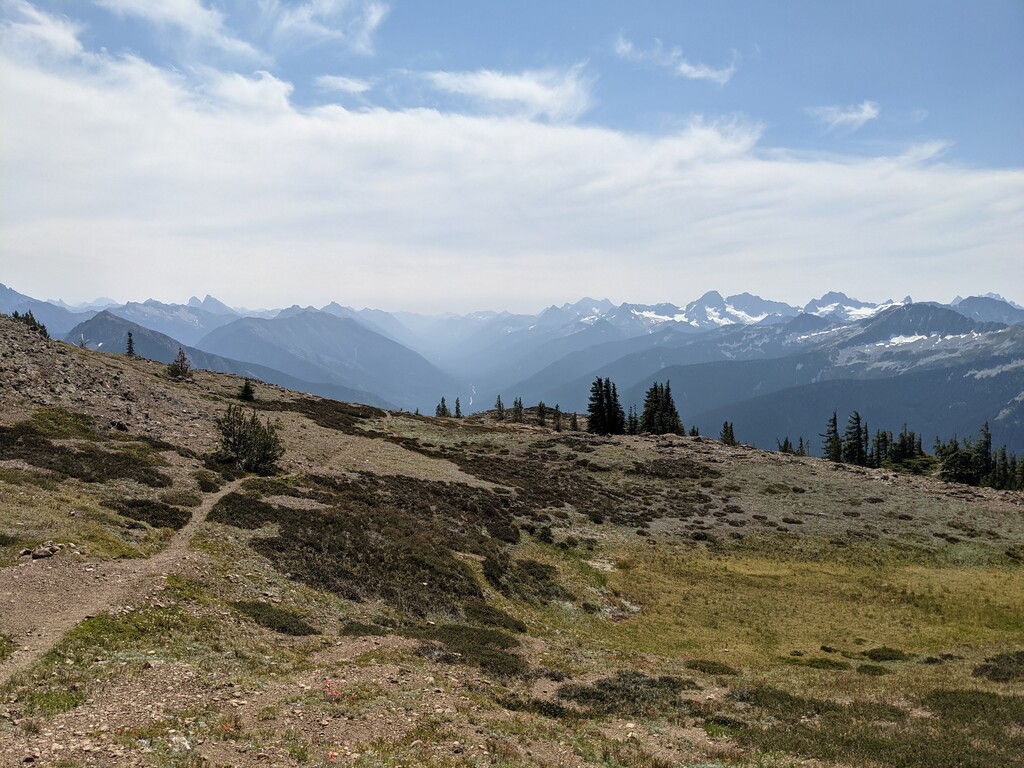
"Crater Mountain is a prominent peak rising north of Hwy. 20 about 5 mi. east of Ross Lake. It has deep valley footings with over 6000' of relief from the highway. Crater is the site of two former fire lookouts. One on the main summit and another on a 7054' point east of the east summit... The name "crater" probably comes from the mountain's appearance. A massive glacial cirque, holding crater lake, is carved out of the south side of the mountain. The out-of-print classic, Routes and Rocks, names the main summit of Crater as one of the five best viewpoints in the North Cascades!"
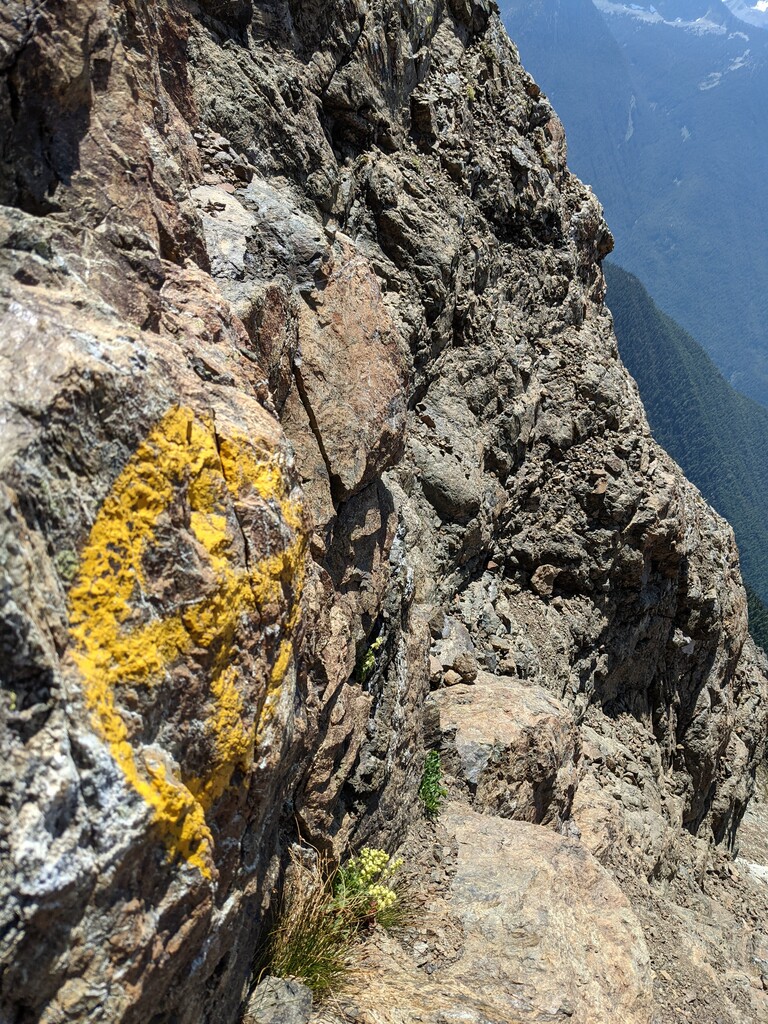
Crater Mountain is an 8,132-foot (2,479-metre) mountain summit located in the North Cascades of Washington state. It is the 29th highest mountain in the Pasayten Wilderness. The mountain is well known in the area for the fun 3rd class scramble that is marked with yellow paint. Big, yellow X's and arrows guide you to the summit plateau, where you'll find remnants of an old fire lookout tower.
The Mountain has an interesting history; The fire tower was built in 1932, but a camp had been established on the summit for three years prior to that. To collect water, those who worked there would have to scramble down to the Jerry Glacier on the North side of the mountain and chip off chunks of ice to be carried back up and melted in a tub in the sun. If a fire was spotted, the lookout would have to run 7.5 miles down to the guard station that was located near the present-day trailhead. The door to the fire lookout tower was nailed shut in 1955, and a new tower was built on a peak one mile to the East. At some point (unsure when) the Crater Mountain fire lookout was burned down. Also of note, author and poet, Gary Snyder, worked at the fire tower in the summer of 1952.
Getting there:
The trailhead for Crater Mountain is called the Canyon Creek Trailhead located on the scenic Highway 20 in Washington state.
The route:
Start at the trailhead sign at the Canyon Creek Trailhead. The trail winds through the forest, across a sturdy bridge at Granite Creek, and leads to a trail junction. Take the Jackita Ridge trail. The bridge across Canyon Creek was washed out a number of years ago, so you must ford the creek. During certain times of the year, this water crossing may be extremely dangerous, but when the water level is low it is an easy crossing and relatively low risk.
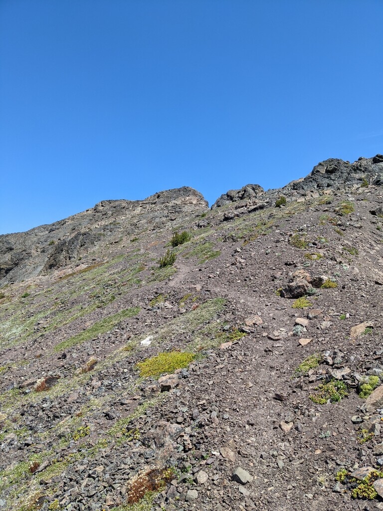
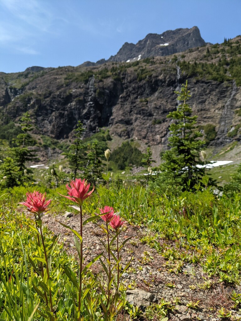
The trail switchbacks up until you get to a small lake. This shallow, silt-bottomed lake is sometimes called Crater Lake (although it's nothing like the National Park). Continue along the trail on the South side of the lake to an easy to follow, but overgrown trail that meanders up towards the West side of the peak. Around mile 7.2, you will find a gully that is marked with a faded yellow X. Follow the yellow painted X's and arrows to the summit plateau, where you'll find another clearly defined trail that leads to the summit. You know you've got to the right spot when you see the large metal pole!
Reverse everything to get get back to the trailhead.
There is generally good water available in multiple locations along the route in early summer. Good water may not be available in late summer.
Comments
I don't remember my time, but I do remember thinking Crater would be a great run/FKT when I did it. WA has lots of these great old lookout trails, but I think Crater's has the most elevation gain.
Thanks for suggesting this one to me, Sean! It was such a fun climb. Can't wait to see some faster times go up on it.