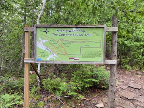
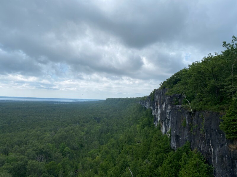
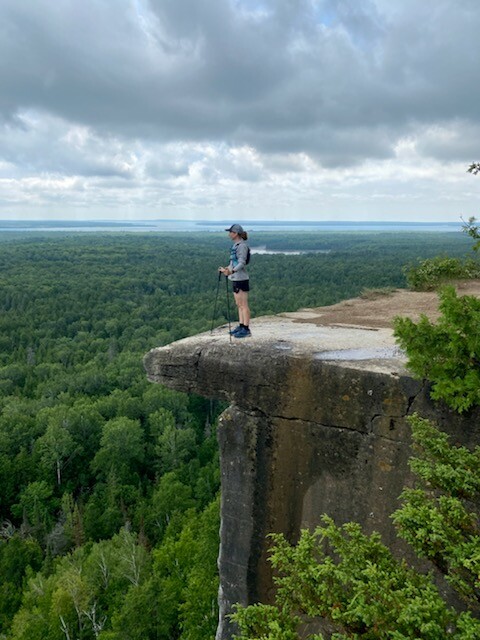
Twenty km west of Little Current, with ample parking and trailhead off Highway 540, 3 km past the Bidwell Road corner, is the well known Cup and Saucer trail. With its dramatic 70 metre cliffs and breathtaking views, up to 12km of hiking trails, and a 2km adventure trail, it is one of the most popular trails in Ontario. Anywhere from 1.5 to 4 hours. Spectacular views over both the North Channel and Lake Manitou.
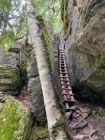
There is a sign of the map just beyond the parking lot. This is the official start of the route. The trail markers at first will be red (see map). The trail eventually splits off into the loop. Go left to follow red markers and right to follow the blue markers. No matter which direction you choose, you must include the yellow adventure trail to make it a true perimeter. On the yellow adventure trail, you must take the crevasse, the tunnel, and the 2 ladders. DO NOT take the bypasses that people have created. This section if done the way it's laid out, is truly unique. So please go through the fun stuff. Just be careful as these obstacles can be challenging. So you'll be following red, yellow, and blue markers throughout. The loop is really a lollipop, so you'll finish on the red markers and be done at the sign by the parking lot where you started.
I recommend doing a recon loop before you actually go for the FKT. Some sections as well as the adventure trail obstacles may confuse you on your very first time through.
Manitoulin Island is the largest fresh water island in the world. You can come in from the north via Highway 6, or the south via ferry from Tobermory.
http://manitoulin-island.com/