This is the twin sister of West Portal Point. They symmetrically frame the Portal, which is the deep and steep canyon where the Colorado River exits the broad Moab Valley. They both have a classic steep trail right out of the parking lot, a very scenic rolling middle section, then after a full 360 circle, top out onto amazing sandstone domes. They are about the same height, but East Portal Point has more vert due to the more complex and technical domes on top, and thus takes a tad longer even though it is slightly shorter.
It is a fantastic short route. People MUST be comfortable with exposed, smooth, 3rd class rock; if not, don't do it. Although almost identical overall, It's a bit more technical than West Portal Point. Running shoes with sticky rubber outsoles are not quite essential but will make this a lot more fun and relaxing.
Start/Finish: The parking lot for the Moab Rim Trail, which is up Kane Creek Blvd about 2mi from downtown Moab. There is a vault toilet and signs, as this is a well-known (and extremely difficult) jeep route.
Head up the rock ramp, and after only 25m turn right up onto Stair-Stepper Trail - do not use the large jeep track. After .9mi they rejoin, and follow the jeep road up and down across a flattish bench. At about 1.75mi the jeep track forks - take the right fork - and soon after it bears right (directly west) and goes down a purplish rock rib. When the jeep track bears left off the rib, keep going straight down the rib to its bottom. Then follow a tiny sandy wash to a small rock apron extending out from the main cliffs. It is important to stay on that soft sand; do NOT step on the dark crusty stuff because that is cryptobiotic soil which is very fragile.
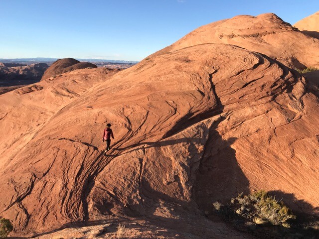
Turn right up into the obvious bowl - route finding is easy because everything else is impossible - and find your way up on top. It is an Open Course from here to the summit. There are some ups and downs over the remarkable Navaho Sandstone domes; finding the easiest way will take some looking around; there are numerous options. Make sure you go all the way north on the summit to the small cairn with the incredible overlook of all of Moab below you.
Retrace your route back down. Have fun. Don't do this on a summer afternoon.