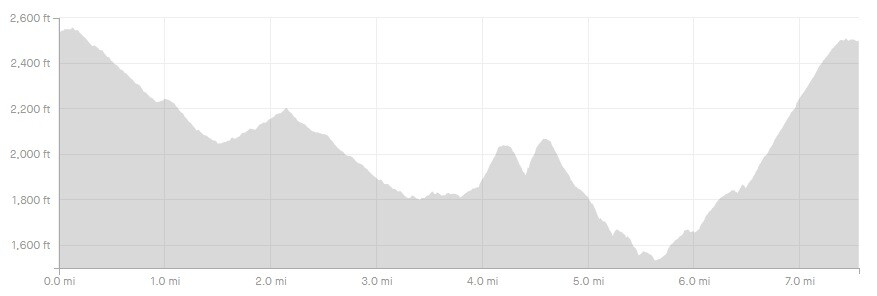
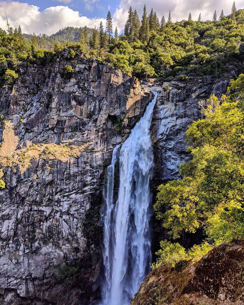
Feather Falls is arguably one of the most impressive waterfalls in California (outside of Yosemite of course). This 410-foot waterfall is located in the foothills of the Sierra Nevada mountains in Northern California.
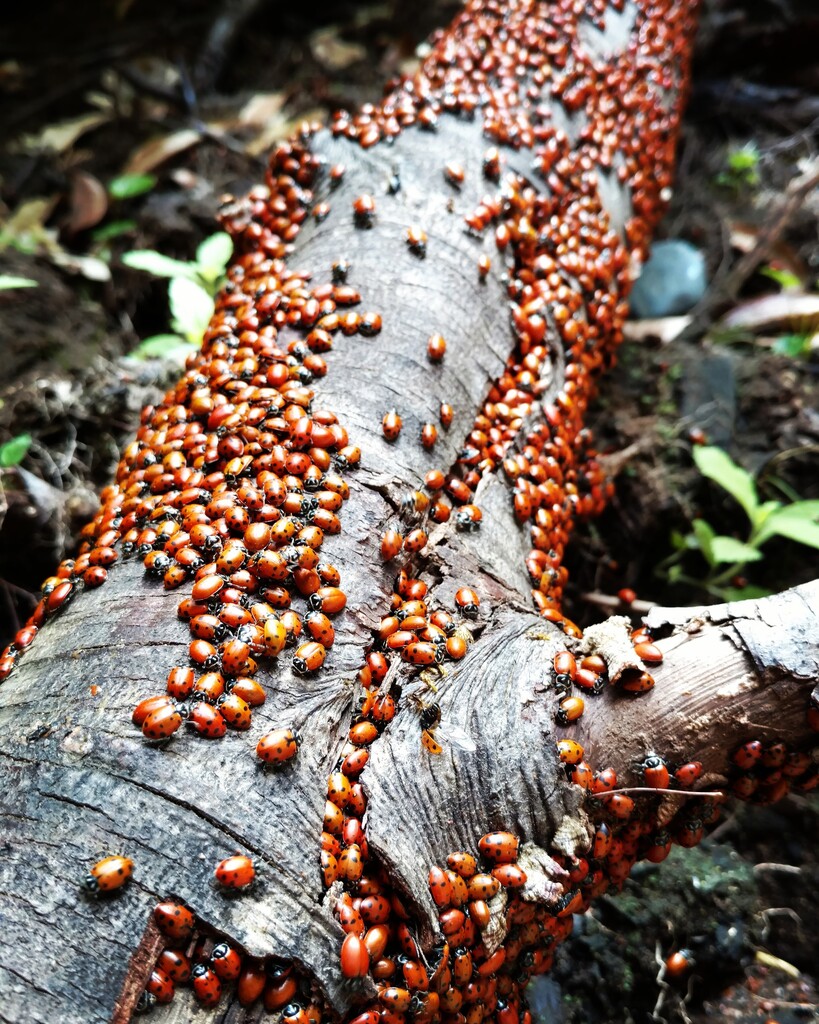
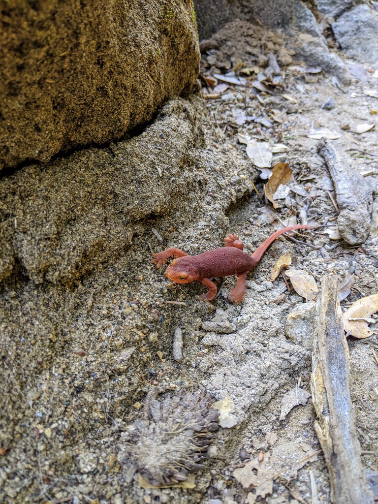
This is a (mostly) buttery, single-track trail that winds through heavily forested National Forest land (more detailed route description below), crosses numerous creeks, and has astounding views. During the winter months, you may be able to see an abundance of migrating ladybugs near Frey Creek. The California Newt may also be found on the trail or in the creeks, again depending on the time of year. The newts are usually found on the trails in the late spring and through the summer, please be aware and don't step on the little guys!
There's camping available at the trailhead, as well as pit toilets, but there is no potable water source. It also might be wise to bring your own toilet paper, as it's frequently out. The summer can be oppressively hot, and the winter can bring loads of water. There's also an abundance of poison oak. Be prepared!
There is a Strava segment for the entire loop going counter-clockwise. At the time of this posting, the female record is 1:32:27, and the male record is 1:24:13.
Route Description:
*Please note: this route is described as if running the loop counterclockwise, but may be reversed.
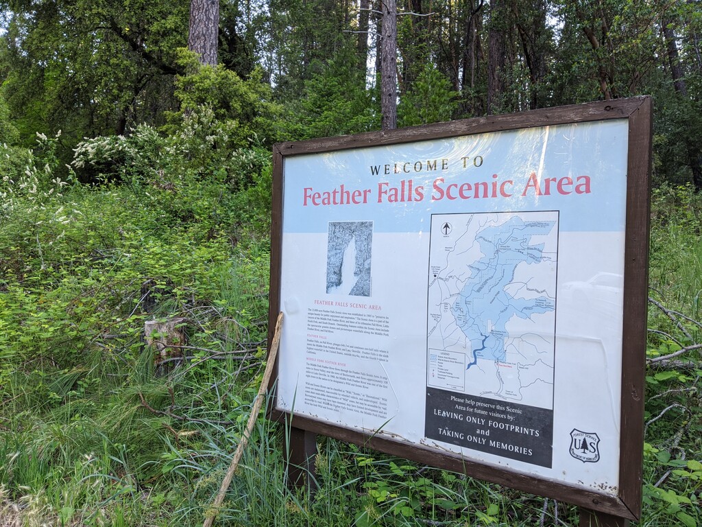
Start at the Feather Falls Scenic Area sign.
0.3mi: the trail splits. You can choose either direction, but it's classically done by taking the trail to the right.
3.9mi: the trails come back together, here, you'll do a short out and back to the viewing platform. Go right and head up the slightly techy, steep hill for about 0.4 miles, then take a sharp left to the viewing platform.
4.4mi: you should be at the viewing platform. Admire the waterfall, then turn around and go back the way you came. When you come to where the trail splits, go right and continue on a very runnable downhill for another 0.8 miles.
5.6mi: start the 1.8-mile, 850ish foot climb back to where the trail first split. Continue back to the trailhead.
7.6mi: tag the sign, and you're done!
- Submitted by Ashly Winchester.