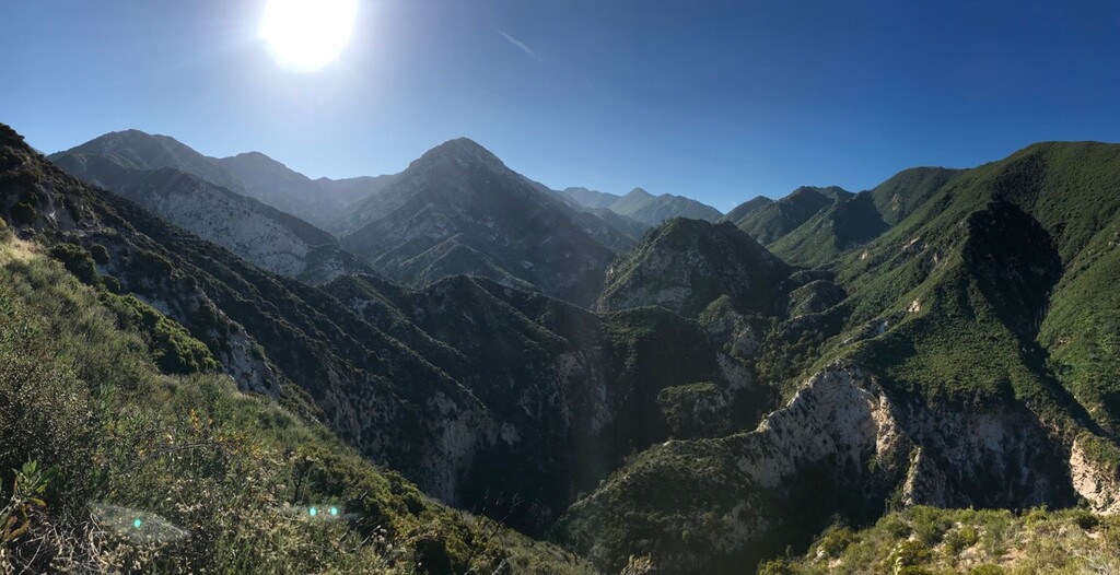
The Gabrielino Trail is a United States National Recreation Trail that runs through the Angeles National Forest in Los Angeles County, California. Its western trailhead is near the NASA Jet Propulsion Laboratory in Altadena, California, and it runs generally east/west, with its eastern terminus at Chantry Flats, just north of Arcadia, California. It passes through three major watersheds and has an elevation gain/loss of 5-6,000' depending on the direction. It consists almost entirely of singletrack trail in the wilderness areas to the West, North, and East of Mt. Wilson. The Gabrielino Trail was the first trail to earn the designation of National Recreational Trail by the USFS in 1970, and it remains an amazing point-to-point route for hikers, backpackers, and trail runners in the Pasadena/Altadena area.
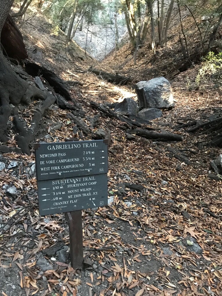
Since the western and eastern ends are largely running up water drainages, there can be several wild water sources available along the route depending on the season, but they must be filtered or treated for safety. The only reliable potable water source is a faucet at Red Box Trailhead. Pit toilets are available at Redbox, Switzer, Valley Forge, Spruce Grove, Gould Mesa, and the eastern terminus of the route.
Forest fires do affect this area somewhat frequently. Parts of the trail have been closed from 2009-2018 (Station Fire), 2020-2024 (Bobcat Fire), and 2025-2026 (Eaton Fire). Please look up relevant trail closures with USFS to ensure that you're not entering a closure area. Even when all closures are lifted, there are sections of the trail which can be very challenging due to trail upkeep in remote sections of the forest. Notably the section connecting West Fork Campground to Devore Campground to Newcomb Saddle is notorious for lack of maintenance due to its isolation. Users can expect downed trees, poison oak, poodle dog bush, significant brush, and missing trail tread unless recent trail work has occurred. That said, this is one of the most beautiful sections of the trail and is highly recommended.