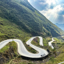
The Ha Giang Loop is a legendary mountain circuit in northern Vietnam. Covering approximately 300km, the loop winds through some of the most dramatic landscapes in Southeast Asia. The route passes limestone karst formations, sheer mountain passes, deep river valleys, and traditional villages near the Chinese border. The route is commonly done by motorcycle or bicycle, and has several variations, including optional out-and-back sections. The version we are adding as an FKT running route is a simple loop. Like all loops on our site, it may be started and finished at any location on the loop, though Ha Giang City is an obvious choice.
The loop follows primarily paved mountain roads, but the terrain is highly demanding due to relentless elevation changes, tight switchbacks, and exposure to extreme weather. The elevation gain across the full loop exceeds 7000m making it a serious endurance challenge.
Key highlights include the Dong Van Karst Plateau (a UNESCO Global Geopark), the Ma Pi Leng Pass overlooking the Nho Que River gorge, and remote ethnic minority settlements scattered throughout the highlands.
The Ha Giang Loop is both physically and mentally demanding, offering one of the most spectacular but challenging multi-day endurance routes in Vietnam.