Lorain Hiking Trails is 1 of 3 hidden gems around the Johnstown PA area. When looking at a map it may not seem that big but what it lacks in size it packs huge blows in terrain and scenery. The trail system at Lorian is relatively new, they were made within the last couple years.
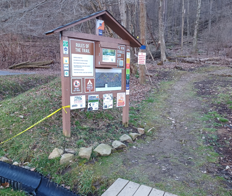
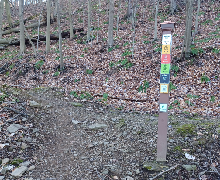
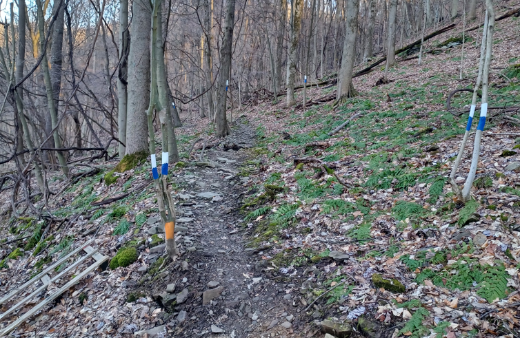
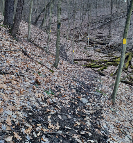
The trails are very well marked. They have markings on trees and posts for you to follow. When trails go the same way multiple colors can be found on the same tree and post directing you the correct way. When I say multiple trails go the same way, is because to get to one trail you have to take another trail to get to it, but they marked the trail as such.
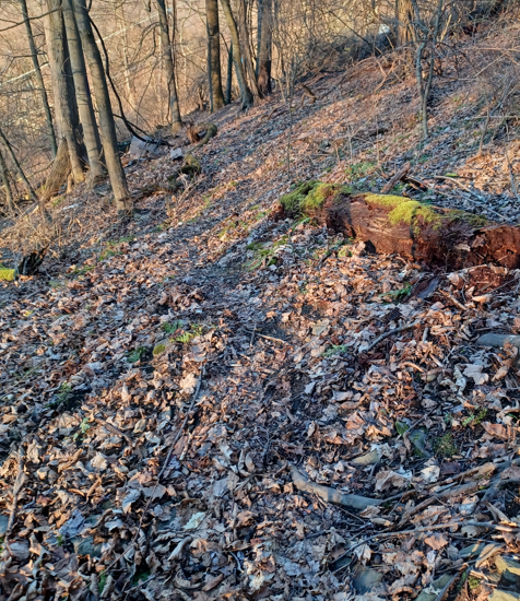
The terrain you will encounter ranges vastly. You could be on double wide grassy area or you could be on a 30 degree angled pitch on the side of the mountain where its rocky, rooty and no clear route to take with your feet, you just know where to go by markings on the trees. So be prepared for all levels of difficulty because you will encounter them all. You also will not be able to run every foot of this route unless you’re a true daredevil. It is that hard in some spots. I'd give this a 7 out 10 difficulty with some 10 out of 10 mixed in. Also there are some springs along the course so expect wet feet at some point unless it's been dry. There are a few small bridges and rocks set up in certain places to avoid water and wet spots but others there are none. This park and trail system does have a lot of cool things to see. A couple water falls, a nice overlook of town to name a few. There is even I believe over 20 geocaches to find. The scenery is very nice as well in the summer. The one thing about the trails if you would happen to get lost or turned around you not really that far a road or houses. Id say maybe .2 m at most. Though you really don’t notice them unless you're actually looking for them and it does feel secluded even though civilization is so close by. This also adds to the park, since it’s a nice quick get away and hardcore trail runner training grounds close to home without having to travel an hour away to get to some rough terrain.
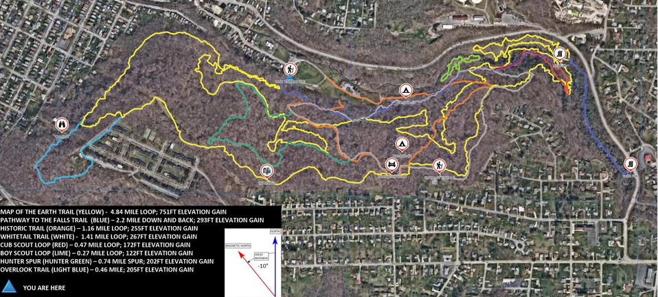
On to the good stuff the actual FKT part. To start and finish this FKT you will be at the trailhead entrance. Use the trailhead sign as your starting an ending point. For the most part you will be staying on the yellow trail once you hit it with like 3 quick exception: an addition of the small green loop at ca half mile, omitting the yellow loop close to Ohio Street to the NE, addition of the light blue trail at the SW.
As you start onto the trail you will be running on the blue trail which is to the left, the pathway to the falls trail. You will go left to follow the blue markings for about half a mile. At this point you will see lime green trail marking to your left. Follow the lime green trail marking on the quick little .27 of a mile loop. Go clockwise, so as you take the lime green trail keeping left. This will give you your first taste of how difficult the trail can be, and it’s a good warm up. Once you do the loop pop back out onto the blue trail. Then you'll start to see yellow marking on the trees. Stay to the left do not take the right when you first see yellow you will be coming down and out there later to finish up the way you started. Continue on you will come down to a creek, This is an actual creek not spring. Follow the yellow marking upstream on the right hand side. Do not cross the creek to the other side where you can see yellow. Water can get high here so I avoided that section for safety. From here you just follow the yellow markings. At times you’ll be able to run and others you will think is this even a trail and not some random person who just painted the trees since there is no real footpath to follow, just markings. So be careful. You will be going up the hillside and over. Still following the yellow markings. At one point you will pass a mailbox with Tiki on the side of it with a Mask on a tree to the left. Keep going this is still yellow markings. You will hit a grassy double wide section that takes you to an overlook of the town. There is park bench there. Keep taking the yellow after this overlook. Now you will see some light blue marking come into play (ca 2.5 miles in), that pop out towards houses. Follow this light blue trail. You will run along a fence line or can use the pavement if you want for maybe 50 yards then make a left. After the left go for another 30 yards and make a right into the woods right after a shed, still following the light blue. This is the only part of the route that has pavement. I emphasis looking for the light blue signs that are on random posts to you get back to the woods. Continue to follow the light blue until it hooks back up with the yellow trail. When you hook back up with the yellow trail take the left with is angles downward. (upward takes you back up to the lookout which is the wrong way). There will be one yellow intersection about a mile later. At this intersection take the right to go uphill. Follow the yellow trail the rest of the way until you hit the blue pathway (close to the green loop), you ran on when started this is that righthand turn I said you will pop back out on later. Follow the Blue pathway to the falls trail back out to where you started.
As you are on the yellow trail it does intersect with other trail at different points. Just stay on the yellow trail. The only real time you are off the yellow trail once you get to it is after the overlook when you take that light blue trail. This will all make sense if you look at the actual park map. It also is easier to read if you flip the map upside down from how it is on the website, this is because of how the “main” trailhead is positioned with reality once you go there. The trailhead is at the bottom of the hill whereas the map makes it seem like its at the top.
I recommend two things if attempting this FKT 1) download the gpx file I created for this route and use navigation on your watch so you know where to actual go. 2) wear gloves that way when your on some of the rougher sections you can grab things to balance out or if you fall which if your actually running this route you have close to if not a full 100% chance of falling.