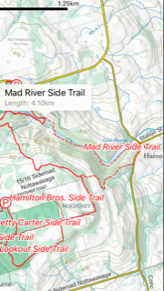
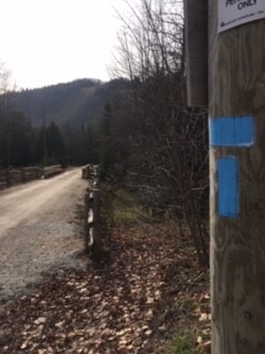
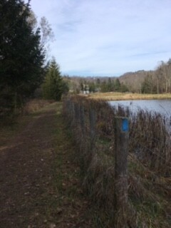
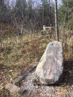
The Mad River Side Trail is an 8.2km out and back side trail of the famous Bruce Trail(900km oldest and longest foot path in Canada). There is plenty of parking at Devil's Glen Ski Club which is about 90km north of Toronto. There is also Devil's Glen Provincial Park nearby which the main part of the Bruce Trail runs through. The start of the trail is right near the main parking lot at the base of the ski hill. It connects with the Bruce Trail via a blue T-blaze. The trail heads through the parking lot, then proceeds to follow the base of the ski hill via blue blazes. It continues along the Mad River for a bit, then ends up in the small village of Glen Huron. Take a right on Concession 8 South Nottawasaga and start climbing. The trail then takes another right turn onto a seasonal dirt road which shouldn't have any vehicles due to its rough conditions. Keep ascending all the way to the top until you reach the rock which signifies the start of another trail system, the Ganaraska Trail(400km). The rock is located at the intersection of the Bruce Trail. Once you turn around at the big rock, you'll descend and get a beautiful view of the land. Being an out and back, just return to the T-blaze at the parking lot to complete the trail. One could also do the out and back starting at the rock depending on where you choose to do most of your climbing, beginning or end. For a short route, the climbing and descending will tax the legs quite well. The area is beautiful being near the ski resort and a warm up and or cool down on the Bruce though the Provincial Park would make it a great day.
Information aobut the ski club - https://www.devilsglen.com/About
Information about the park - https://www.ontarioparks.com/park/devilsglen