This contains two variations or routes up this 6,560'+ peak near Palm Springs:
1. Pinyon (Cactus Spring – XC NW Gully): 14 miles round trip, 4,500’ gain
2. La Quinta (Boo Hoff – Guadalupe – XC North Face): 18 miles round trip, 6,700’ gain
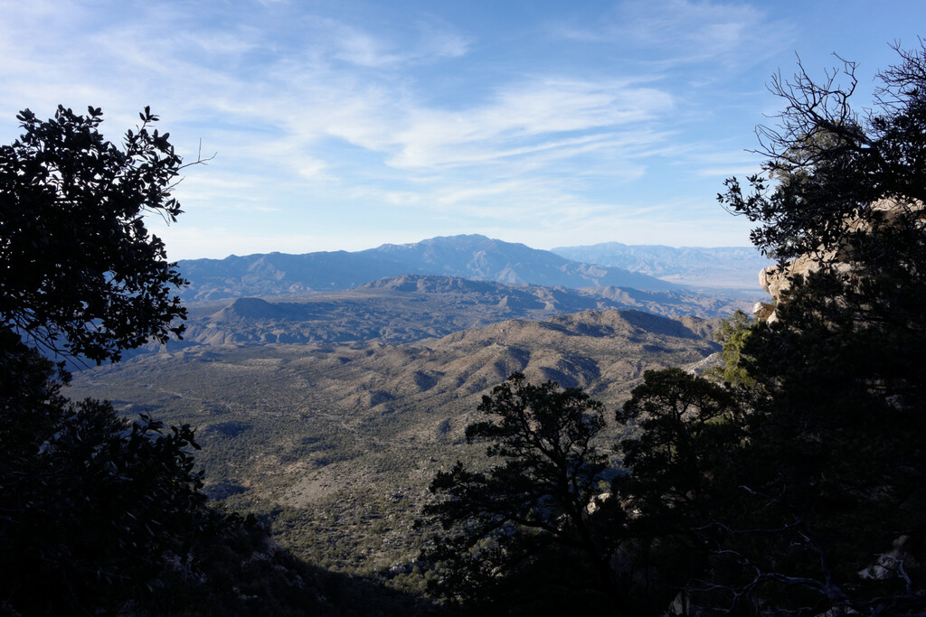
As part of the Sierra Club’s Hundred Peaks Section, this prominent peak in the Santa Rosa and San Jacinto National Monument, poses a big challenge for any mountain lover! There are both on and off-trail sections full of various cactus, scrub brush, manzanita and pinyon pines. There’s a great deal of history as well revealing 19th century primitive ranch settlements, rich Cahuilla Indian sites and even a crashed airplane if you happen to stumble across it. There are two main routes to choose from to attempt a summit on Martinez Mountain.
Pinyon Route
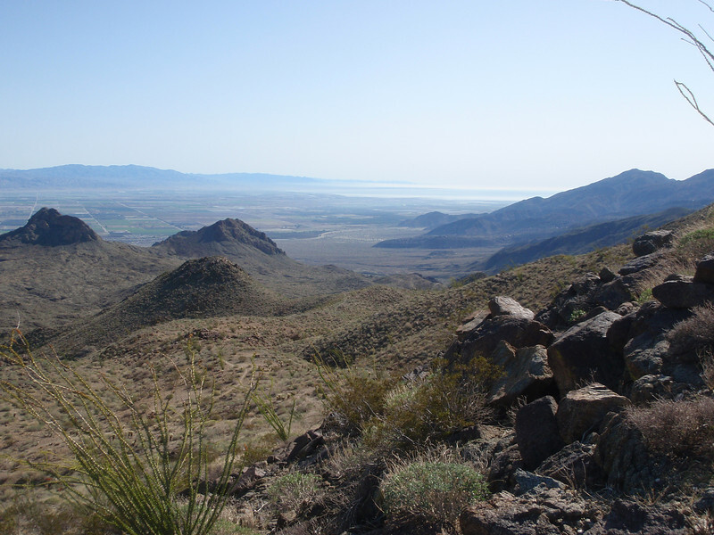
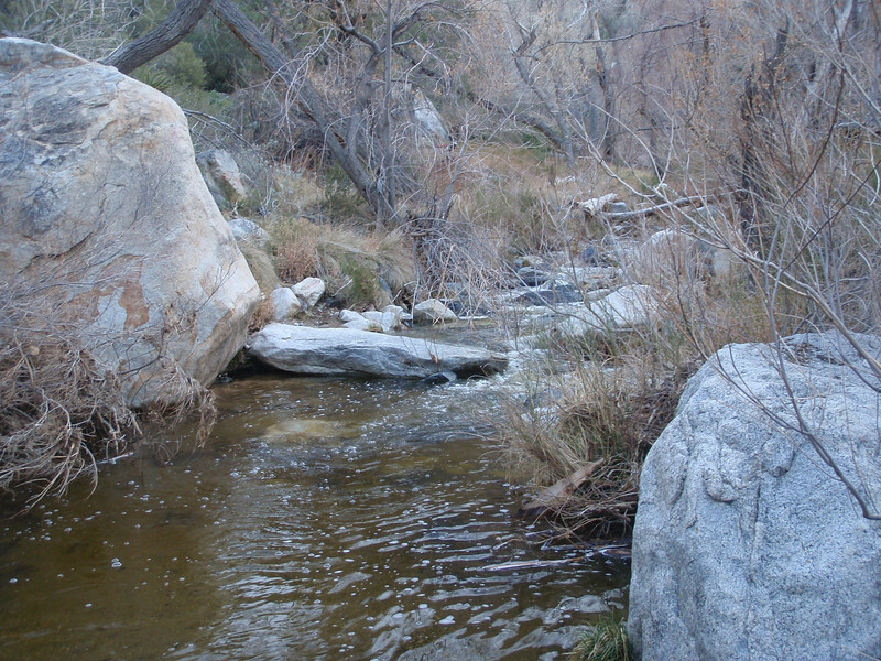
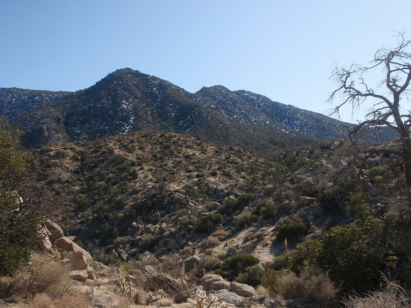
This easier and more popular version begins in the town of Pinyon Pines from the parking lot for the Cactus Spring Trail at about 4,050 ft. From the parking area, go east about 1000ft along the road to an intersection. Continue straight ahead at the beginning of the Cactus Spring Trail (originally a Cahuilla Indian path). The trail will descend to the right of an old dolomite mine. Veer left (east) on this road and follow it past the mine to where the trail leaves the road. This is the old trailhead. Continue east on the trail as it goes over several rises and then descends to Horse Thief Creek at 3,440’ about 2.25 miles in. Depending on the time of year, you may or may not find water in this creek. It’s safer not to depend on it. Cross the creek and climb the trail back up the other side until it descends down into a wash. Follow it east along this wash to Cactus Spring (usually dry), about 2 miles beyond Horse Thief Creek. Continue on the trail as it follows a wide wash. Soon it leaves this main wash to a connecting wash on the right at about 5.3 miles. From here, Martinez can be seen straight ahead. It has three saddles. A large, rocky gully descends from the saddle on the right. This is the one to aim for. Leave the trail and continue up the wash. Follow the wash around the left side of a low ridge until it connects with the 2nd-3rd class gully to the summit ridge. Turn left and go up to the prominent summit block. It can be climbed from the southeast side. Return the same way. The rocks in the gully are pretty stable but use caution descending them on your return. You might want to keep a KML or GPX handy when descending the wash that connects to the trail again near Cactus Spring. Some people miss the trail and continue down the wash, then have to back track. Once on the trail, your final 4.5 miles are pretty straight forward. It’s a beautiful trail! Good luck!
La Quinta Route
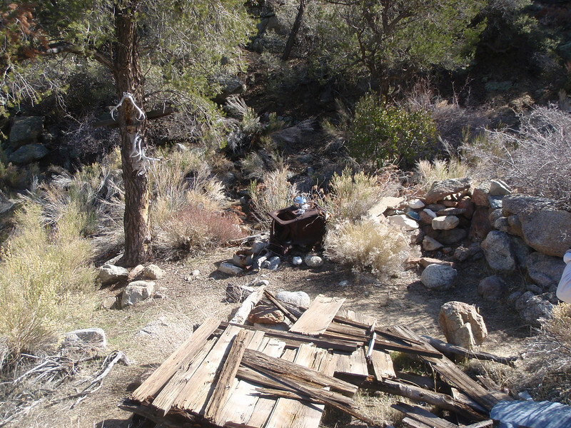
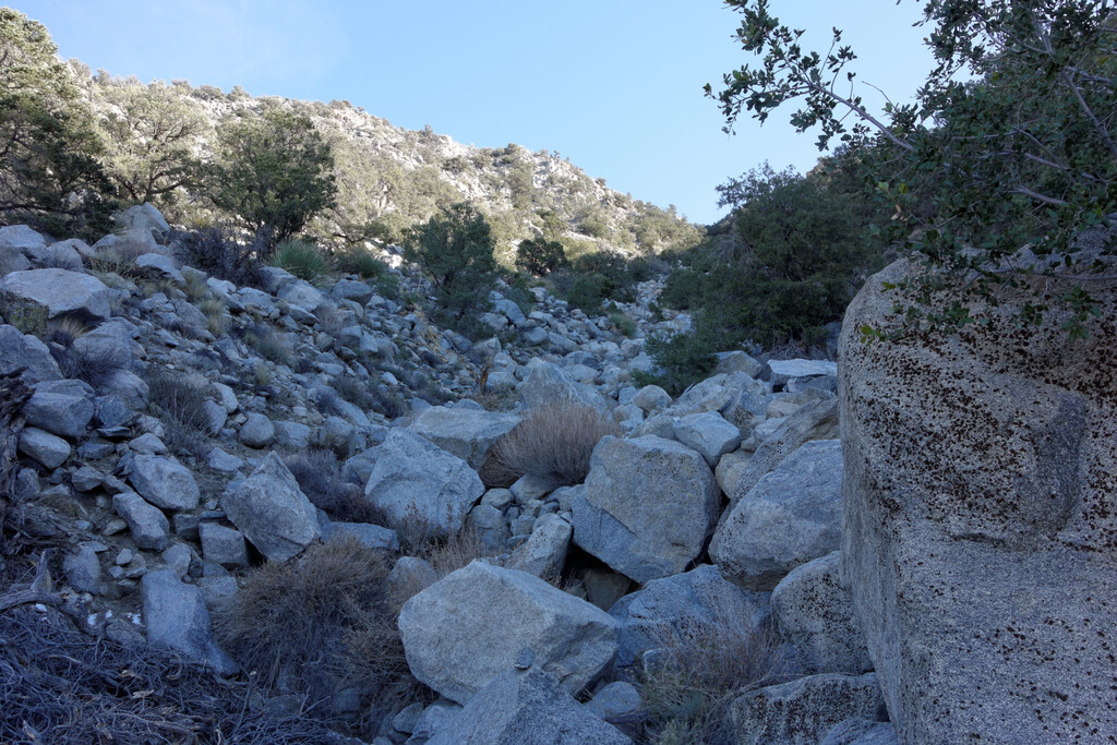
This route begins in the upper left cove of La Quinta at the Boo Hoff trail at about 300’. This is the more difficult route between the two. Although it begins with a slow build for a couple of miles on a well-maintained and popular trail with hikers, runners and mountain bikers, it begins to steepen as it traverses the lower foothills and then intersects with the unmaintained Cahuilla Indian path known as the Guadalupe Trail at about 3.3 miles just under 1900 ft. Here the challenge evolves. It helps to download a KML or GPX route if you're unfamiliar with the Guadalupe portion of this trip as it weaves through desert brush and boulders becoming faint at times. There are cairns often guiding the way so keep your eyes peeled. Approximately 3.4 miles up the Guadalupe at about 4,550’, the trail dips into a gully to meet an old cowboy camp. You'll know you're there when you see an old iron stove, a few pots and pans, stacked wood slats and some bones hanging from trees for creepy decor. It's at this point that this challenge evolves even more having started as a well-maintained trail to an unmaintained path to now a cross-country "open course" to Martinez Peak itself! Choose you path wisely! There are some great drainages, ridgelines and gullies but all have their share of obstacles. Check out Google Earth to get an idea of the terrain. Some ridgelines are sturdy and rocky but at times thick with shrubs while others are loose and sandy but bare of brush. Beware of loose boulders, as this north face to the peak is steep. It’s an adventure for sure! When you summit the initial ridge, you can see the outcropping boulders further south that sits above everything else. This is the peak! The easiest 3rd class route up the boulder to the top is from the southeast side of the summit block. Once you summit, turn around and head back to the cowboy camp area to find the trail and the final run down the Guadalupe and Boo Hoff trails. Don’t forget to keep your eyes peeled running down the Guadalupe so you don’t lose the trail. There is no dependable water source anywhere on this route so bring plenty of water. Good luck!!
Comments
Rob do you have the coordinates for the F8 crusader plane crash? I dont even know if its up La Qunita or Pinyon but coordinates solves all. Thanks sir.