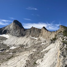
Route: Mt. Clark (CA)

Submitted by todd ulz on Sat, 07/18/2020 - 10:37pm
Location
California, US
Distance
30 mi
Vertical Gain
7,961 ft
Description

NW Arete:  From the trailhead parking for happy isles, take the mist trail up past the falls and past liberty cap.  Stay right and head east through little yosemite valley.  After Bunnel Point (10 miles) leave the trail and head due south until you gain the northwest arete of mt. Clark.  Ascend the 4th class arete to the summit, then either retrace your route or descend the northeast face (faster) and head north back to the trail.  Once you hit the trail head back to your car.

It appears Bob Burd did this route in 2002 in ~12.5 hours, and he referenced others (including Warren Storkman) as having done it in "12 hours" in the 1970s and 1980s.  https://www.snwburd.com/bob/trip_reports/clark_2.html

GPS Track
mt_clark.gpx885.95 KB
Images