From Wikiloc: O Grande São Brutão:
Born from the training event São Brutão, O Grande São Brutão is a collection of trails showcasing the beauty of one of colonial Brazil’s most historical regions. Establishing this course as an official FKT will further the mission of São Brutão to encourage health, contact with nature, and support of the local economy.
The course is based around São Bartolomeu, a small town nestled in the mountains of Ouro Preto. The region has become known for its quaint colonial architecture and sweets made for generations by local residents. The start and finish of O Grande São Brutão are in the heart of the town, at the steps of the church.
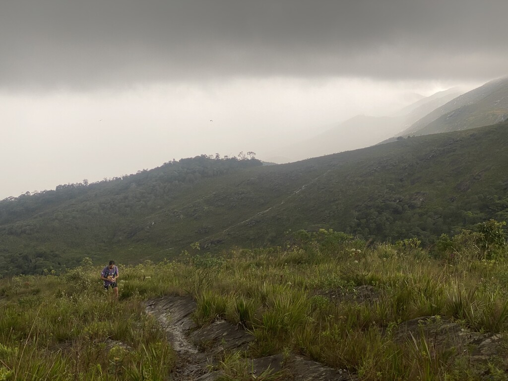
Leaving the town, the first three sections of the course take the runner to some of the highest peaks in the region by following the trails frequented hundreds of years ago by the Portuguese and their enslaved workers to carry gold mined in the same mountains to the ports of Rio de Janeiro. Rock formations along the course mark where there were once Quilombos, communities of escaped slaves.
Descending Serra do Veloso, the course passes through Adorninhas, a national park with waterfalls, rock formations, and the first springs that feed the Velhas River, a vital waterway that runs through the state of Minas Gerais.
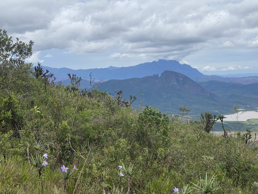
Climbing again to a neighboring peak, O Grande São Brutão looks over a sea of mountains and mining towns below, including Bento Rodrigues, which was the site of the Mariana disaster of 2015, one of the largest environmental catastrophes in modern times. The mining damn that broke wiped out the entire town and miles of nature in its path.
The trail then passes through a region of waterfalls and natural beauty along the limits of an active mining area. The stark contrast is a reminder of the impact the mining industry has had on the region and the importance of protecting the geographical wonders that still remain.
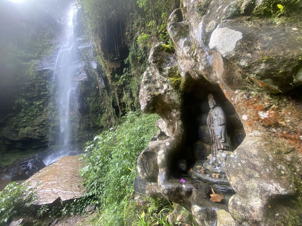
The course then ascends again to another peak before descending to São Bartolomeu Waterfall, a local treasure that marks the home stretch ending back in the heart of the town. There, runners and trekkers can spend the night at one of the family-run bed & breakfasts and enjoy the wealth of local culture.
In closing, recognizing O Grande São Brutão as an official FKT will help local tourism grow in a sustainable fashion and encourage people in the region and around Brazil to turn their focus more towards health, nature, and their local economy.
See a video of the route.
Guidelines for runners & trekkers
O Grande São Brutão was mapped out to showcase the natural beauty of the region while challenging participants to explore their physical limits. The 56 kilometers is a mixture of older dirt roads, singletrack, and very technical uphill and downhill trails. Please follow these guidelines and bring these items if you plan to undertake this challenge.
- A phone with GPS mapping of the course (there is a phone signal along most of the route)
- A portable charger for your device
- Enough food for up to 12 hours
- A filter or water purifier to drink from the streams along the course
Natural water sources can be found at these points:
- 20.5 km - River / Potable water at Adorinhas park center
- 23 km - River
- 24.5 km - Spring
- 29.5 km - Mountain stream
- 30 km - Mountain stream
- 31 km - Mountain stream
- 32 km - Mountain stream
- 33 km - Mountain stream
- 35 km - Mountain stream
- 39.5 km - Mountain stream
- 40 km - Mountain stream
- 51.5 km - Waterfall