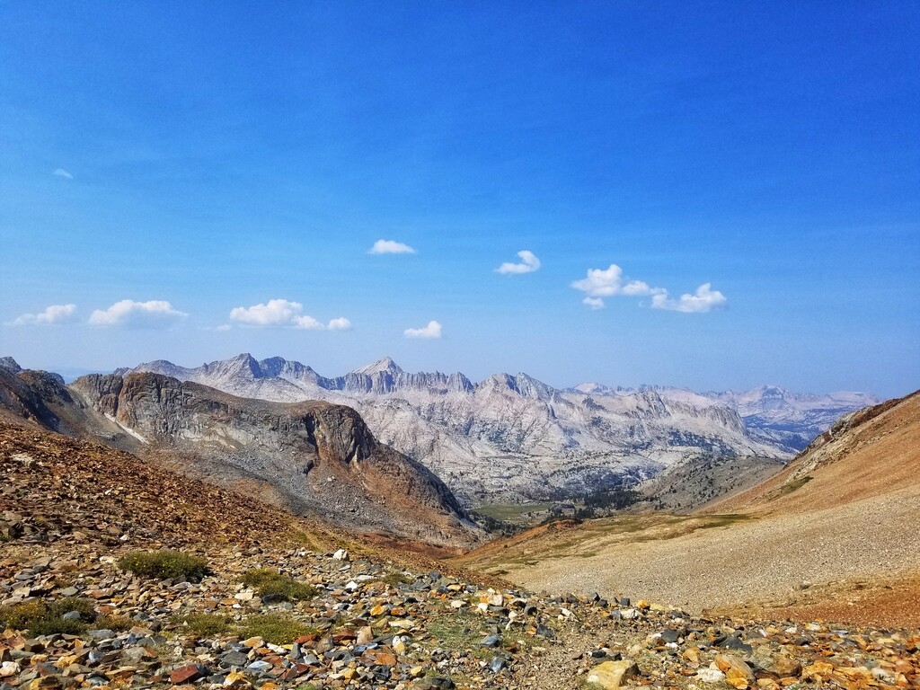
This route is an epic journey through the upper reaches of several major drainages between Rock Creek and Mammoth Lakes. It's all single track for the entirety of the 33 miles and much of the trail is narrow, rocky, technical and in some places nonexistent. It takes you over several spectacular passes staying above 10,000ft for most of the route. Mono, Hopkins, McGee, and Duck pass all provide incredible views and their own unique adventures and stringing them all together makes for ~8,000 ft* of ascent on the day. The red rocky mars-scape of McGee pass provides a stark contrast to the white granite of Mono pass and the lush meadows of Tully hole. 9 beautiful lakes are passed during the route along with sections of forested creek drainages and wide open high alpine meadows. With much of it 10+ miles from the nearest road you'll need to come prepared to be self-sufficient for the day or have a support team setup in the backcountry.
South to North route description
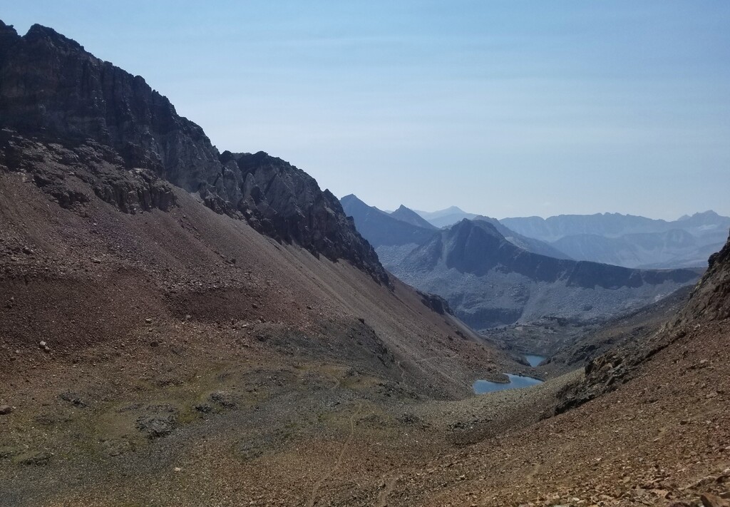
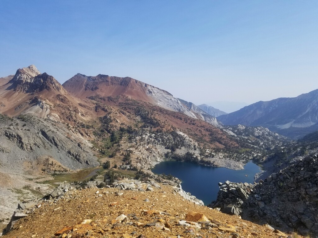
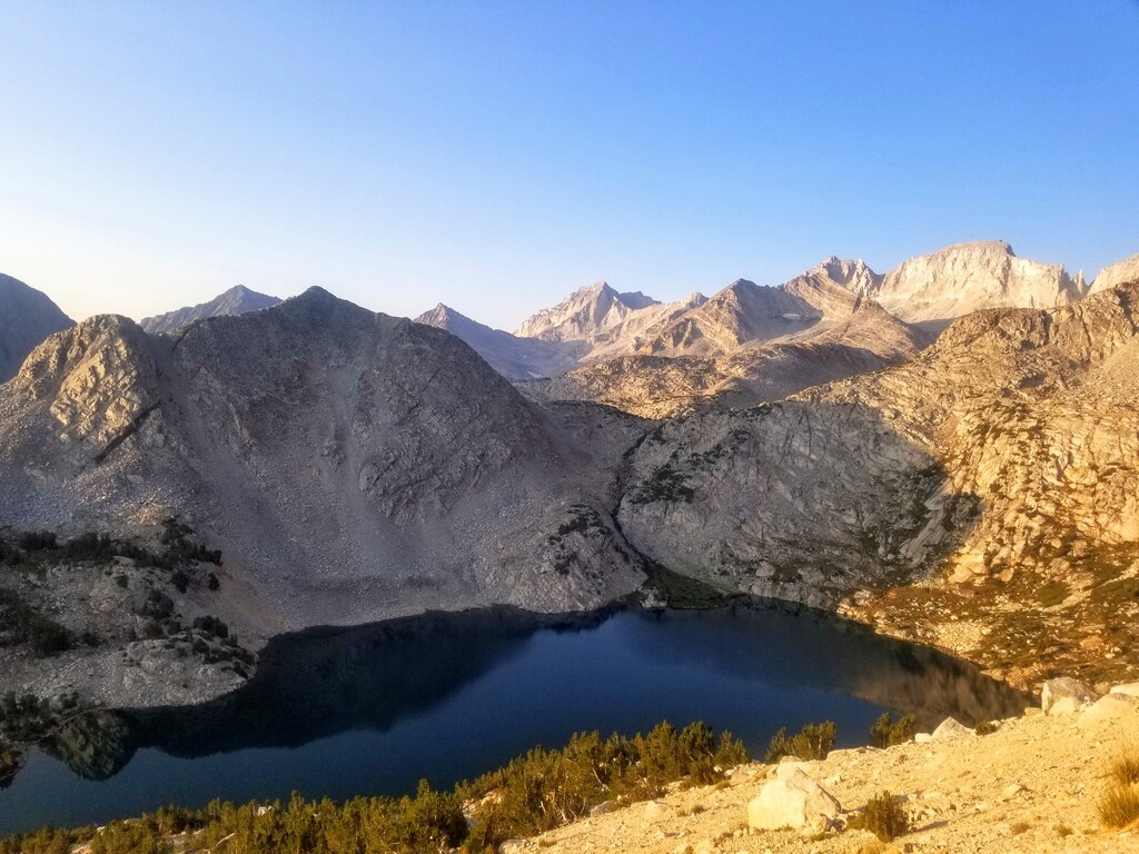
It starts out in Rock Creek canyon at the Little lakes valley trailhead at 10,272 feet. You take an early fork to start veering north around Mt Starr to Mono pass with spectacular views of Ruby lake and the many huge peaks around Rock Creek (Mt. Mills, Mt Abbot, Le petit griffon, Beer Creek Spire). At the top of Mono Pass is the high point of the route at 12,077ft after that it descends into the Golden Creek drainage then follows the creek down through the forest until turning off at the Hopkins Pass junction. Heading east out of the valley towards Hopkins pass starts out as steep switchbacks in the woods then opens up into a huge meadow with Red and White Mountain looming above. The trail becomes very faint in this section, disappearing completely for large sections and making the route up to Hopkins pass adventurous. Remember to tread lightly through here to preserve the untouched feel of the area. After Hopkins pass drop steeply down to Big McGee Lake before making the rocky trek up the canyon to McGee pass (11,900 ft). The biggest of the climbs are over at this point and there's ~2,400ft of descent, though it continues to be rocky and sharp for the first couple miles it opens up into a mellow trail through lush fish creek meadows then down well graded sandy switchbacks following along fish creek to Tully Hole. A brutal set of steep switchbacks leads out of Tully hole to the Lake Virginia area where the trail skirts around the big lake's north end and continues up just a few hundred more feet of ascent over a small pass towards Purple Lake. After Purple Lake the trail contours high above Fish Creek drainage towards Duck Lake. Skirting around the massive Duck Lake brings the last high point of the route at Duck pass (10,814 ft). Drop down the steep, rocky switchbacks to Barney lake before cruising the last 1,000 feet of descent to the finish at the Duck Pass trailhead at Coldwater Creek campground.
*: Total ascent estimates have varied between mapping the route and real world tracking between 7,800ft and 8,800ft so I've used ~8,000 ft here.


Comments
Going to attempt this route this weekend with Pierre-Yves C.
Completed this route but GPS glitched midway :(. Beautiful route, some snow on the passes and a big avalanche debris field to cross on Hopkins approach.