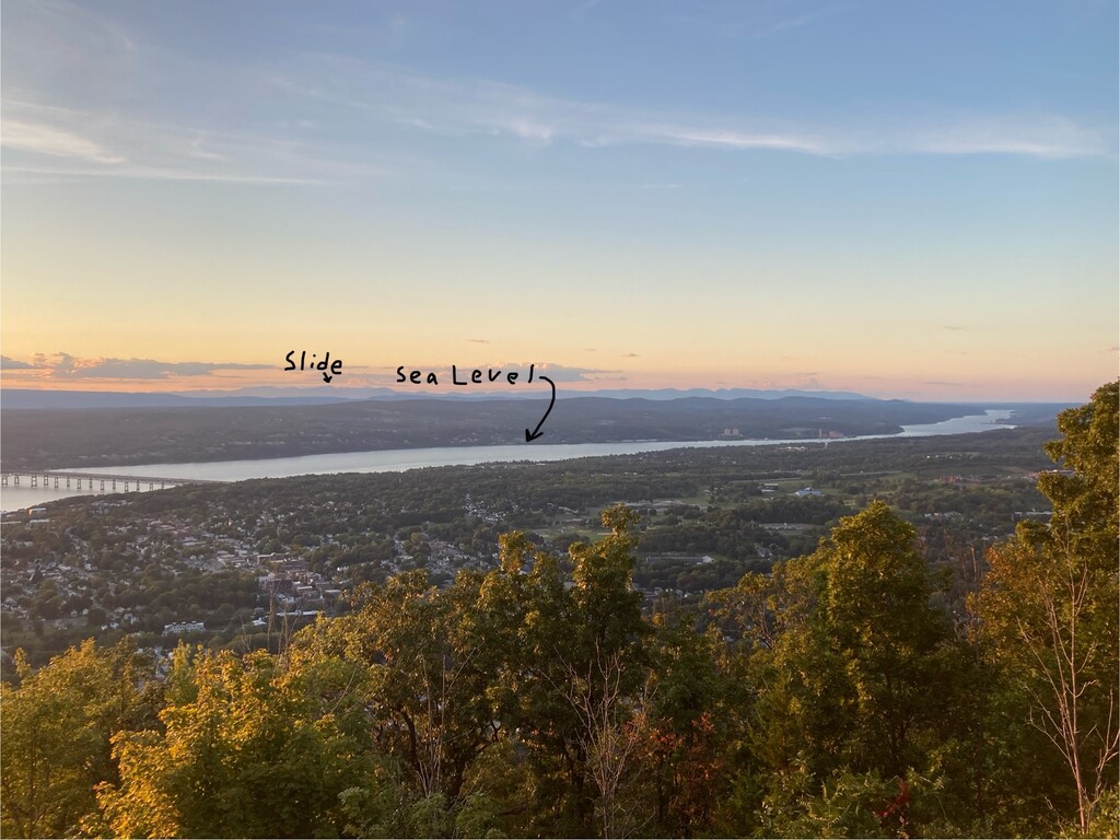
Anyone who drives across the Hudson River Valley on a clear day can’t help but notice Slide Mountain on the horizon. It’s a constant reminder that just outside New York City’s urban sprawl lays hundreds of miles of rugged mountain trails. Slide Mountain is the highest point in the Catskills and the second most prominent peak in New York, after Mount Marcy. It is the southernmost 4000 footer in the Northeast.
Most people that live in the Hudson River Valley don’t realize that the river itself is at sea level. In fact it is tidal all the way back to Albany. The Hudson River is sometimes referred to as the only fjord in the contiguous United States outside the Pacific Northwest. It doesn’t take much for a geographically minded trail runner to wonder how long it would take to run from the ‘ocean’ (sea level) to the top of Slide Mountain.
The athlete can start at any location on the Hudson River and take any legal route to the summit. There are many possible routes but the shortest is likely around 32 miles with 6000 feet of gain.