Location
Arizona,
US
Distance
74.4 mi
Vertical Gain
24,767 ft
Description
GPS Track
TEST.gpx24.56 MB
FKTs
Female
Male
| Shelby Heinz | 1d 22h 16m 0s | ||||
| Marcy Beard | 2d 9h 41m 0s |
| Brian Janezic | 2d 5h 53m 21s |


Comments
Although I'm not entirely confident in the timing, I'm planning to at least start the TEST route tomorrow morning (supported). Tracking will be running at:
https://share.garmin.com/MarcyBeard
Totally cool, good luck and enjoy!
Thanks Brian!
We ran into an area closure issue at Redington/TV trailhead last night - no camping and no access on the north side. I could have worked my way around it, but wasn't looking forward to a more difficult bushwhack on the start toward Agua Caliente. Add the extra driving to the house and back, and I didn't think I could make it off Airmen by dark today (one of my main goals). Which means another night of trying to spot to camp and then Sunday morning to finish. Not impossible by any stretch but I decided to call it "good training/scouting" for this go-round.
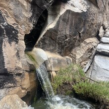
We had a fun day in Saguaro East yesterday! Great views, and the perfect, cool, windy place to be on a hot day in Tucson. Husband John helped with carrying supplies, plus he did a hero's task of climbing up Mica ahead of me to filter water from Manning Camp and stash it where I'd be coming by. I saw little seeps and stagnant pools here and there, "desperate water sources" that I thankfully didn't need to use.
One question for you - did you climb the rock on Tanque Verde peak or is the high point of the land acceptable?
My one wish was that I had leg covering for that last little drop toward Tanque Verde canyon. I'd scouted it so I knew it would be rough, but it was worse in the dark. Hard to imagine carrying pants for 35 miles just for that though!
Very interesting route, and the timing is something of a puzzle. Water sources vs. snow vs. temperature highs and lows. Thanks for the challenge!
Hey Marcy,
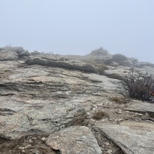
Good to know about the camping closure at Redington, that bushwhack up Agua Caliente would be a little difficult in the dark for sure. That is really cool John was able to do some support work in the park for you, I’ve often thought how much fun it would be to do that part without an overnight pack. In regards to TV peak the high point seems more than acceptable to me. When I was up there it was pretty dense fog so climbing up the rock was a no go.
Timing is definitely a challenge with the wide range of elevations, the perfect conditions might actually be November/December right before we get any snow that manages to stick around.
So stoked someone else is looking at this route and longer challenges in our backyard.
Going out for another go at it, starting tomorrow, supported. Looking forward to some holiday trekking in the hills!
https://share.garmin.com/MarcyBeard
Congrats on the FKT, pretty cool the route has been repeated now!