Route: Winona State Forest (NY)

Submitted by Tom Tighe on Sat, 06/13/2020 - 09:11am
Location
New York, US
Distance
25.57 mi
Vertical Gain
1,600 ft
Description

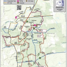
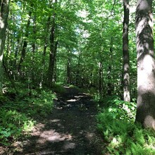
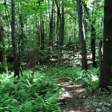
Winona is a 9233 acre state forest located on the Tug Hill Plateau.  Winona forest is one of the most popular spots for trail runners at the east of of Lake Ontario with around 70 miles of trails. It is one of the best trail systems in the state to get out and put miles on in the woods.  Although there is a good helping of roots, rocks and mud there are bridges over streams and the trails are maintained.  

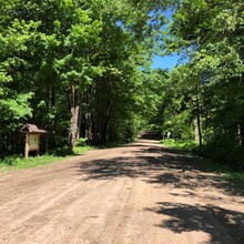
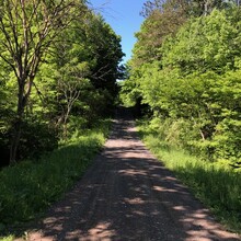
This route goes in either direction around the trail system.   This route captures dirt roads, double track and single track trails.  Less than 100 yards of pavement.   This route was selected to provide a good mix of trails and maximizing the motorized vehicle interaction.  Its a number of different trails but is mostly well marked.  Due to varied types of trails and distance it should be a physical test with a bit of navigational test mixed in. 

Strava shows the elevation gain at 1586 ft while Garmin states 3400 ft. 

This route starts at the south end of Winona Forest at the P1 parking lot on Wart Rd. In the CCW direction, it goes east on Winona Way then to the following trails and roads.  Right on Hiscock, to Bargey Rd, Larrabee Trail, Alice's Alley, Wag, Tail, Franks Fancy North, Stone Wall, Pussycat, Bronze, Marsh Rd, Musher Ridge, Brown Rd, Bakers Byway, Brown Rd Extension, Stonewall South, Otso's Ridge, Winona Way, Hessel Rd, Backus Bend, Lookout, Shady Shuttle, Bernie's Bypass, Winona Way, Jimmy's Jaunt, Bills Belly, back to Wart Rd parking lot.  The route starts and stops at the edge of the parking lot where the trail register is located. 

https://www.strava.com/activities/3578893717


GPS Track

Comments

Took another shot at this one on 6/30/24 and really enjoyed these trails and the challenge. 
There is a very small, 100yd, rerouting in the SE corner for some logging but overall the trails have improved and it was very runnable despite a ton of rain.  I think the trails have gotten a little faster so utilize a little gps help to lower some of these times! Â