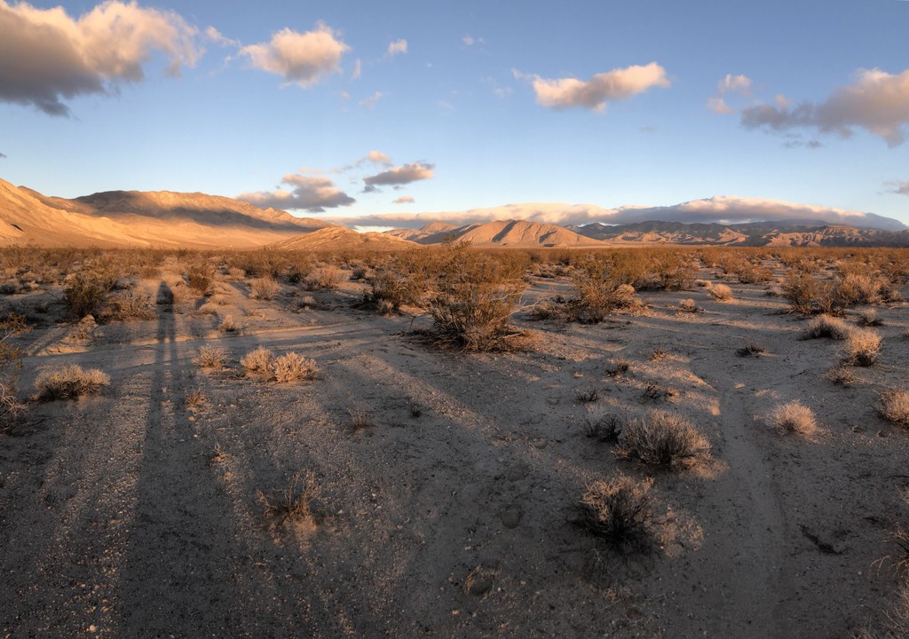
This route takes you from the northern most point of Death Valley National Park to its southern most point. No trails, no roads. It is about 160miles long and run the length of the Death Valley. The route proposed here is the one Roland Banas followed, but you are encouraged to make your own. Only the start and the end points matter. This route was first done solo, unsupported and unassisted by Louis-Philippe Loncke in 2015 in just under 8 days and done again by Roland Banas in 2018 in just under 7 days. The crossing can be done all on trails, but for an unsupported summer trip using a cart for water, that wouldn't be possible.
The route starts on Willow Creek Rd, about a 1.5 miles NE from Last Chance Canyon. Lat: 37.349741 Lon: -117.683353
The route ends at the Harry Wade Monument at the intersection of Death Valley Road (127) and Saratoga Springs Rd. Lat: 35.632850 Lon: -116.290683
The rules of Death Valley National Park forbid people from camping within a mile of most established roads or the salt flats. See: https://www.nps.gov/deva/planyourvisit/backcamp.htm and https://www.nps.gov/deva/planyourvisit/upload/508-Backcountry-and-Wilderness-Access-map_.pdf for more information.
addendum: since the creation of this route, Death Valley National Park boundaries have shifted a little and the southernmost point is no longer at the Harry Wade Monument. The new southernmost point is remote and difficult to access, but it shortens the route by 6-8 miles. For simplicity and consistency with already established FTKs, the route will remain the same and use the Harry Wade Monument has the end point.
A detailed trip report is on Explorer Web: https://explorersweb.com/2019/01/07/solo-dv-crossing-report/
Louis-Philippe Loncke described the strict unsupported ethic he followed:
Comments
Just a reminder to always do your homework. Don't follow the original route. The southern boundary of Death Valley NP is different now.
I'm not sure what you mean. If you look at the DVNP website, it does not indicate a new southern boundary to the park, and I am not aware of any changes in the park footprint. As far as I can tell, the Harry Wade Monument is still the SE border. I doubt anything will change down there in the short term, as the park is bordered by the Fort Irwin Army Base to the south.
After the historic precipitation from the last few years, I think the terrain will have changed to some degree, but not the official border. But maybe you know something that I do not?
Look at the NPS map again: https://www.nps.gov/deva/planyourvisit/maps.htm
You're right that there is a little blip of the southern boundary that goes into the Avawatz Mountains in the vicinity of Denning Spring. I'm not sure that justifies changing the FKT route, though, as it makes it pretty difficult to compare with previous efforts. Notably, the name of this FKT is the Death Valley N-S Traverse, not the Death Valley National Park N-S Traverse. I think hosting the southern terminus at the Harry Wade Monument makes the most sense anyway, since it's largely the *end* of the valley, and it is easily accessible by vehicle. Having the terminus up in the middle of the Avawatz Mountains may require a backtrack to Harry Wade Road. But I'm not sure if or how FKT routes are meant to evolve, so I'd default to the standard route.
Ah I see someone added that wording to the route description. As long as it's defined as ending at the monument and not the southernmost point of DVNP that works. Thanks!
Hello Sarah and Cameron,
Thank you both for your thoughtful contributions and the passion you’ve shown in this discussion. I’ve just read the conversation and wanted to share my perspective.
As you might have seen, I completed the crossing on December 6th, starting from the Northern Terminus and reaching the New Southern Terminus. Given the changes to the park boundaries, this route felt not only logical but also aligned with the current geography of the park. My intention was to place my journey within the framework of this new route section.
However, I’ve recently learned that the challenge on the new route has been removed, leaving only the original route as the recognized standard. This means that despite completing the new route successfully, my effort cannot be officially acknowledged.
The official boundaries of Death Valley National Park have changed, and I believe the New Southern Terminus reflects this reality. Reaching the New Southern Terminus in the Avawatz Mountains added a layer of uncertainty to my traverse: it required careful planning both to reach it and to exit the area. I ultimately had to retrace my steps back to Highway 127, reaching the original southern terminus.
In my view, these elements create a fresh dimension that could appeal to a different set of athletes while maintaining the spirit of the original challenge.
I believe there is room for both routes to coexist. This isn’t about replacing or diminishing the original route—it’s about embracing the natural evolution of the park and recognizing the value of two distinct but equally meaningful experiences. Both efforts could be celebrated without creating unnecessary competition or confusion.
I genuinely believe this approach respects both tradition and innovation, and I hope my perspective can serve as a foundation for further discussion.
For your reference, you can find my trip report at this link.
Hello Alessandro,
That's exactly the route I would have taken to reach the new southern boundary. I hope you had fun! I did a similar self supported effort a few years ago, but withdrew my FKT because I realized I camped within one mile of West Side Road, which is against the rules of DVNP. I hope to try it again before another female does. I enjoyed your trip report. I have no opinion on whether to create a new route, use the old one, or both. Maybe ask the FKT Team or submit it as a new route.
Hello fellow trekkers:
I recently competed the North to South Death Valley National Park Crossing, unsupported, and using the West Side (grave) road, 175 miles in total. I have published my report. Individuals who wish to know more about how I did this can contact me at coldandwet@myyahoo.com.
Happy Trails.
Clark
Hello FKT friends! I’ll do my attempt to do the North-South crossing starting Sunday Dec 1st 2024, solo and self-supported, leaving water caches along the path. I should reach the new southern terminus Friday 6th or Saturday 7th. You can follow me here: https://share.garmin.com/alessandrotassinari
"To get a self-supported FKT you must also beat the fastest unsupported time." It will be tough to beat Cameron's sub-4 day time! Good luck!
Tomorrow, 12/29/25, I will attempt a female unsupported crossing, adhering to all the DVNP and route rules. I previously had the self supported FKT but withdrew it after realizing I camped illegally (within 1 mile of the valley floor) at one point. So I consider that a practice hike. Since that time, I was able to connect with Ashly Winchester, whom I admire very much. I'm not fast but I'm good at suffering. If you want to follow me I'm at https://us0-share.explore.garmin.com/FreeRange
Good luck, Sarah! Hopefully you don't get slowed down too much by Lake Manly and any other residual swamp in Badwater, Middle, and Cottonball Basins. But I'm sure it will make for some beautiful photographs and an exciting adventure. May the Force be with you!
Thanks Cameron! The rangers warned me about some sketchy conditions. Hopefully I survive!
I'm bailing at mile 70ish, highway 190, the only possible place to bail. One of the great joys of desert travel is hiking down a wash. I think someone mentioned previously that you could run it. This time, after last week's flooding rain, Death Valley Wash turned to mud. Sticky mud, soupy mud, slick mud. My feet haven't been dry for days. Wednesday night's rain laid a new layer of slop. This should have been the easy part so I expect it's worse from here. The good news is that my gear, water, pack weight, and everything worked well. I started with 58 lbs; uncomfortable, but okay. I packed 1 liter of water for every 10 miles, which was more than enough, but not too much more. It was icy at the start and I slipped and turned my knee. I made a makeshift knee brace out of my shorts/underwear and it improved. I've always thought around Thanksgiving would be the best time to do this route, but it won't be me!