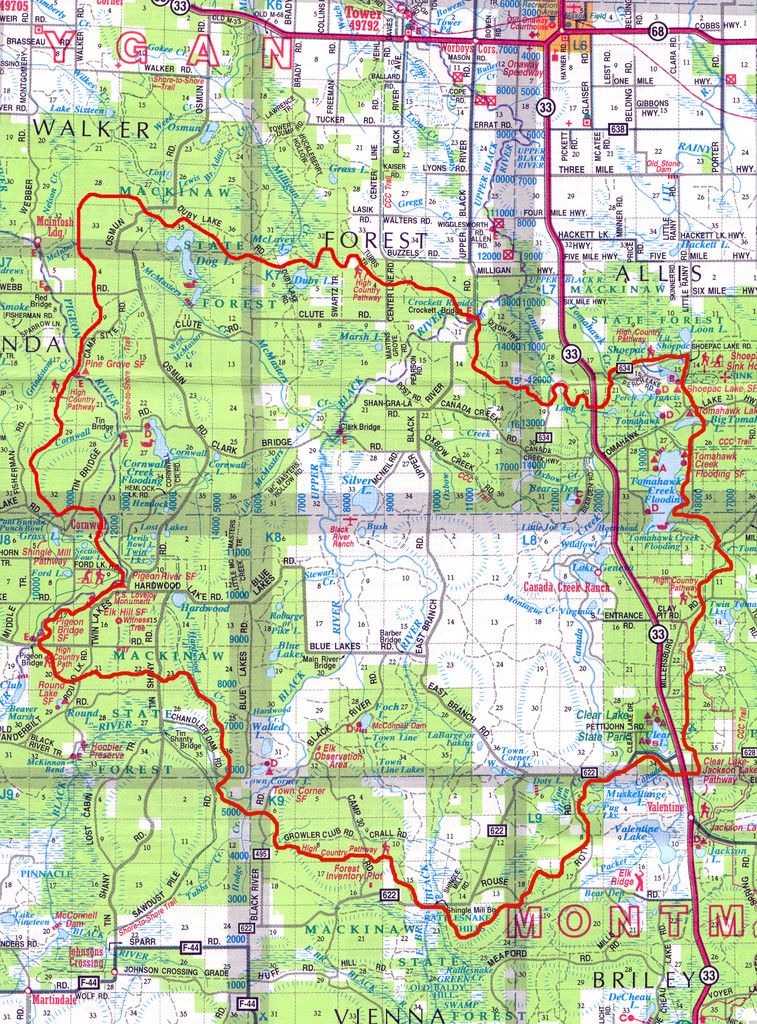
Location
Michigan,
US
Distance
75.9 mi
Description
GPS Track
High-Country-Pathway.gpx489 KB
FKTs
Male
| Adam LeClaire, Jonathan VanSweden | 20h 19m 0s |
| Stephen Sensoli | 1d 2h 34m 11s | ||||
| Jonathon Quill | 1d 5h 33m 54s |
Images
Comments
Allison Kallo and I will be doing this route unsupported starting pre-dawn August 29th.
The route is massively overgrown in places and basically turns into a bushwack. When we hit the meadows full of chest high berry bushes, type 2 fun slid into 3 and we bailed. We started at Pigeon Bridge TH and went counter clockwise, turning around after ~15mi or so.
Bummer to hear the trail was so bad you had to bail. Thanks for this update!
I found your video. Thanks for posting this! https://www.youtube.com/watch?v=RiwHbXuiFvc
Thinking about going for this FKT some weekend in June. Did you guys ever have to filter water? Or were you able to swing by campgrounds on the way enough to re-fill? Thanks for any info you're willing to share! I appreciate it!
Way to go Jonathon! I'm very happy to see someone else complete this trail! Excitingly, the longstanding Michigan Outback Relay (formerly Great Lakes Relay) announced they plan to have the relay course run the entire loop this year. That would be a first for this relay, which has taken place every year since the 90's. "We've always touched on parts of the High Country Pathway in the past, but now we are going to complete the whole loop in one day! " (MOR). If you are interested in scouting this route, join an MOR team!