Location
California,
US
Distance
22.7 mi
Vertical Gain
3,636 ft
Description
GPS Track
FKTs
Male
Female
| Aaron Tucker | 4h 21m 15s | ||||
| Jason Hardrath | 4h 34m 32s | ||||
| Steven "Aria Zoner" Thompson | 5h 12m 30s |
| Ashly Winchester | 5h 46m 8s |
Male
| Steven "Aria Zoner" Thompson | 11h 45m 26s |

Comments
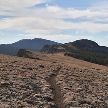
On October 16th, 2021 I took a swing at the 1-way FKT from Pepperdine to Patterson Campground via Summit Trail. I came up way short on the time goal, but gained some big trail experience & took in some amazing views. This site & these names on this list definitely motivated me to take on this effort. Thank you!! I’ll be back;)
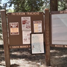
Did this route Patterson to Pepperdine 8/31/2025. Gorgeous! There was some bush whacking and chest high log hopping in the beginning then the trail was clear. Came into a meadow with Aspens and cattle, checked my onxhunt map to make sure I didn't follow a cattle trail. Saw a sheep herder at his camp with his herding dog. About mile seven I believe, there was bush whacking through mule ears and sage in loose volcanic pebbly soil on a steep incline. It seemed like a long way, but maybe only a mile or two through this section. Looked at the map to make sure I was close to the "trail." Relieved when the trail became visible again. Came across a couple camping near Slide Creek & then Forestry and a lady from the Horseman's Association in Cedarville working on the trail. They had their horses and had spent the weekend working on the trails. Gorgeous wildflowers even this late. I wouldn't want to do this route in the dark because of the non trail sections & just because of how beautiful it is. I choose this direction because I thought there's be quite a few people at Patterson lake this weekend & indeed there was a group of people there. The trail from there is fairly smooth and firm in a lot of areas...a few rocky areas. This time of year I saw quite a few groups of cattle from Patterson TH to Mill Creek TH. Once in a tunnel of Aspen I gently blew on my whistle to get them to move. I wanted to get them to move without panicking them, so spoke in a soft voice & walked whenever they were on the trail. I may try this in a month from now, if not then next year. My long runs have been 11-12 miles but with lots of climbing. Also started the hike/run hungry because of the time it took getting there and only had 4 old gels that I was scared to try. I did have almost 2 liters of diluted Tailwind, but was getting nauseous around Patterson Lake, which is unlike me, so I think I needed some fuel. Also tried a new pack that I really liked but was slightly too big and bounced, just sort of an annoyance. Oh and I used Leki Micro Poles. In some spots they were a hinderance and others I was glad to have them. I figured since I wasn't trained for the distance they might really help towards the end on the downhill. My legs were actually fine, so maybe they did help. Time was 6:40.
A friend who for years lived for months at a time in the Warner Mountains working for the Forest Service and was an ultra runner says the crown jewel of the South Warner Wilderness is the Owl Creek Trail. In the registry I saw that a runner from Ashland did the "Summit Loop" which I believe would be the Owl Creek Trail & return on the Summit Trail--about 43 miles.
From Cedarville plan on an hour and a half to the Patterson TH. It's a nice road, but has a steep incline with drop off's & wildlife & cattle. Please drive reasonably. To Pepperdine it's about forty five minutes from Cedarville or Alturas. Enjoy the scenery. No need to stress.