Welcome to Georgian Bay Islands National Park, located in the world’s largest freshwater archipelago, home to thousands of years of Indigenous history. Here, rich ecological diversity spans dense deciduous forests to the granite outcrops of the Canadian Shield.
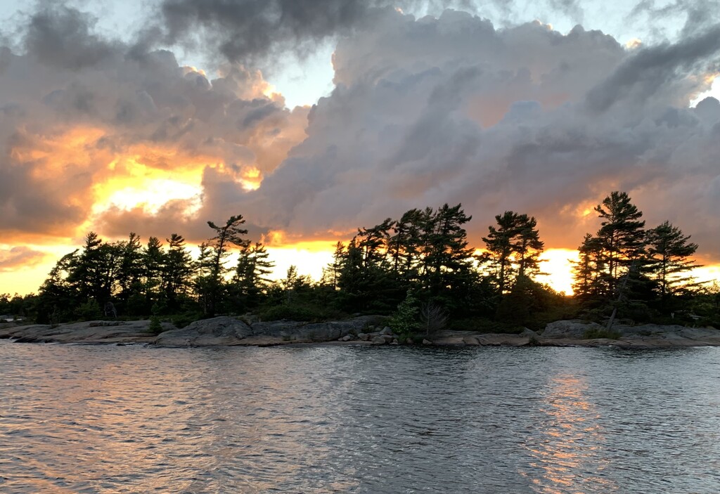
Georgian Bay Islands National Park offers an outstanding trail running experience that is nothing short of awe-inspiring. The park is within the Georgian Bay Biosphere Reserve which comprises the largest island archipelago of the North American Great Lakes. Known locally as ‘The Thirty Thousand Islands’, it consists of a complex association of bays, inlets, sounds, islands and shoals lying along the edge of the Canadian Shield bedrock, whose low lying hills and ridges characterize the adjacent mainland. This topography supports a rich mosaic of forests, wetlands and rocky habitat types with associated biodiversity. It is also noted for its extraordinary scenic views which attract large numbers of summer residents, cruising boaters and seasonal visitors.
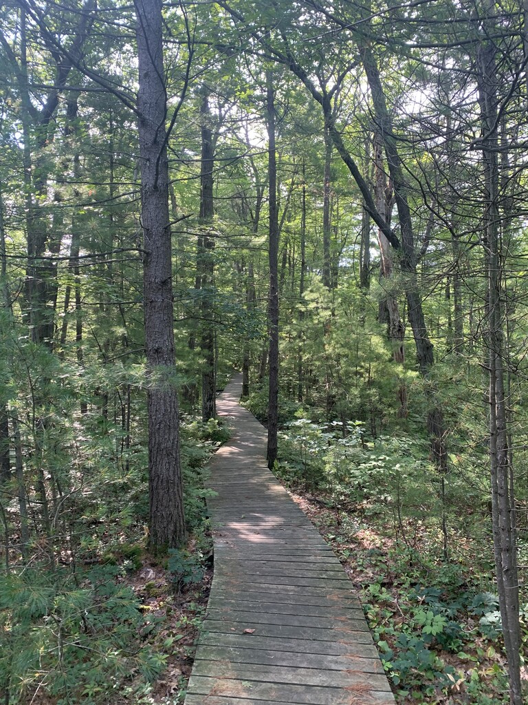
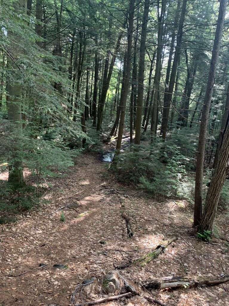
The park boasts an extensive network of well-maintained trails, catering to runners of all skill levels, from beginners seeking a leisurely jog to seasoned athletes looking for a challenging and exhilarating run. The trails wind through ancient forests of maple, oak, and pine, providing ample shade and a refreshing escape from the summer heat. As runners venture further along the paths, they are treated to breathtaking views of the sparkling waters of Georgian Bay, dotted with picturesque islands and granite outcrops.
One of the highlights of trail running in Georgian Bay Islands National Park is the opportunity to immerse oneself in nature. The park is home to a rich diversity of wildlife, including white-tailed deer, foxes, and a plethora of bird species. Watch out for the Massassauga Rattle snake - Ontario’s poisonous snake.
The park's trail system is well-marked and maintained. Along the routes, runners will encounter informative signage about the local flora and fauna, adding an educational aspect to their journey. Additionally, park rangers and staff are readily available to provide assistance and share their knowledge of the area, enhancing the overall experience and fostering a greater appreciation for the ecological significance of Georgian Bay Islands.
For those seeking a challenge, the park offers several longer and more rugged trails that test runners' endurance and determination. These paths lead to elevated viewpoints, revealing panoramas of the stunning Georgian Bay and the surrounding islands, rewarding runners with a sense of accomplishment and the opportunity to capture unforgettable memories and pics.
The FKT route chosen follows the shoreline trails exposing the runner to all the Island has to offer.
See link for excellent info on this National Park. Has a trail map that can be followed for the FKT route.
https://parks.canada.ca/pn-np/on/georg
---------
Beausoleil Island; Île Beausoleil; is an 8-kilometre (5.0 mi) long island in the municipality of Georgian Bay, District Municipality of Muskoka in Central Ontario, Canada. The island is named after Louis Beausoleil, a Métis settler whose 1819 homestead stood at the island's southern tip. The name of the island in the Huron-Wendat language is Skiondechiara which means "The land to appear floating afar". The name of the island in the Anishinaabemowin language is variously Pamedenagog, Baamidoonegog or Epenmindaagoog meaning “rocky place floating about the mouth of a river”. Located in the Thirty Thousand Islands in Georgian Bay on Lake Huron, it is the largest island in Georgian Bay Islands National Park and is the only place in the park where camping is allowed. Beausoleil Island is also part of the Georgian Bay Littoral (also called the Georgian Bay Biosphere Reserve) UNESCO Biosphere reserve.
Beausoleil Island is a refuge for the Eastern Massasauga rattlesnake, the only snake in Ontario whose venom is potentially dangerous to humans. On sunny days, Georgian Bay's cobalt waters form a striking counterpart to the light blue of the sky, the pinkish rocks of the Canadian Shield, and the dark green of the park's famous windswept pines. The Fairy Lake and Cambrian Trails, in the north of the island, offer especially striking views of these natural features. Northern Beausoleil Island's characteristic bedrock and wetland environment is rich in many species and is a major breeding area for amphibians, turtles and snakes. Southern Beausoleil Island's hardwood and mixed forests are good representations of regional woodland communities.
This is an island permimeter loop, so you'll obviously need to get here by boat. I recommend the day tripper ferry(see links below). The official start is at the head of trails sign just behind the visitors center. You will start on the lookout trail. You will also finish using this short trail as well. This is the only trail that is repeated. It's a very short lollipop stick. Then simply follow the official named trails to perimeter the island. Make sure to take a very good look at the map and also have some other way of navigation. Use the GPX provided. There are some out and backs which lead to dead ends which you will not take. The northern part of the island is much rockier and technical. The southern portion is where you should be able to move faster. This is an amazing island with great trails. Since it's a national park, the facilities are great. Visitors center, washrooms, lockers, bike rentals are all right there once the ferry docks. This is definitely a special, unique loop that I hope many will go experience!
https://parks.canada.ca/pn-np/on/georg
https://parks.canada.ca/pn-np/on/georg/activ/hike-randonne
https://parks.canada.ca/pn-np/on/georg/visit/daytripper
https://www.voyageurtripper.com/georgian-bay-islands-national-park/