Location: Jonathan Dickinson State Park, Hobe Sound, FL (16450 SE Federal Hwy, Hobe Sound, FL 33455)
Route Type: Looped
Distance: 18 miles
Elevation Gain: 284 ft
Route Type: Trail
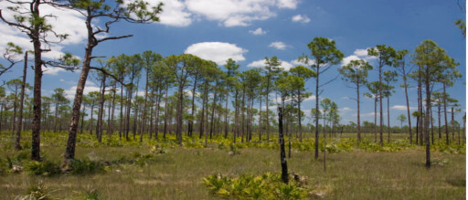
- Ecological Significance – Route pieces together various sections of the Florida Trail and sequentially progresses from the Loxahatchee River (designated one of Florida’s Wild & Scenic Rivers) through pine flatwoods into Savannah (the only true designated savannah habitat outside of the African Serengeti) into Pleistocene Sand Pine Scrub Habitat which is the only sand dune trails in South Florida. This area is also extremely rich in bio-fauna with runners having an opportunity to cross paths with Florida Alligators, numerous snake species, bobcats, black-bear, wild pigs, deer, and the occasional Florida Panther.
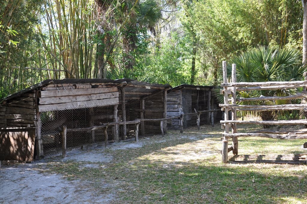
- Historical Significance – Route begins at the Loxahatchee River, one of Florida’s great wild and scenic rivers near “Trapper Nelsons”, a Florida historical site on the banks of the Loxahatchee River. Trapper Nelson homesteaded on the banks of the river and at one point had a zoo which is still maintained by the park (without animals) as a center for historical significance. https://en.wikipedia.org/wiki/Trapper_Nelson (which is at the starting point). Trapper Nelson was known as the “Wildman of the Loxahatchee”. In addition, the route gets its name as the “Camp Murphy FKT” because the route runs through historical Camp Murphy, a secret army base created by the United States military in 1942 to develop and test new developments technologies. This is where radar was developed. The military eventually turned the base into a top-secret radar training school and was closed in 1947. The route passes numerous military barracks and now defunct yet hidden bunkers. https://en.wikipedia.org/wiki/Camp_Murphy_(Florida)
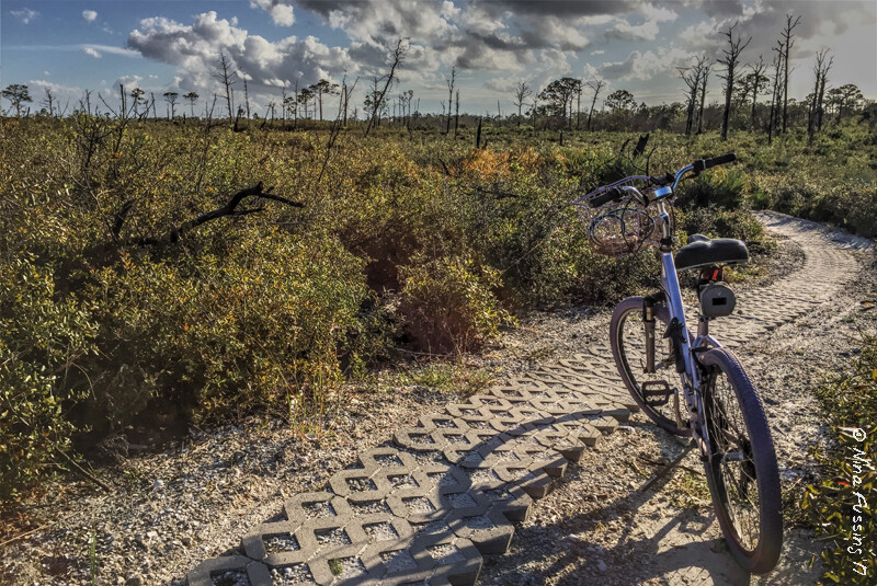
- Impact on the Running Community – Route is immensely popular with the local running and hiking community. The route links together two of the parks most popular sections of the Florida Trails system: “The Green Loop Trail” and “The White Loop Trail” (pictured below) To create a full looped route connecting these trails, progressing through numerous habitats, summiting Hobe Mountain (the highest point in South Florida) and returning via Park Road to Trapper Nelson’s at the Loxahatchee River. This route pieces together historically significant and ecologically significant areas truly endemic to just this park and area of Florida.
Miles 2 through 4.5 – Transition from Mangrove Swamp to Pine Flatwood Habitat
Miles 4.5 through 6 – Transition from Pine Flatwood Habitat to Savannah Habitat
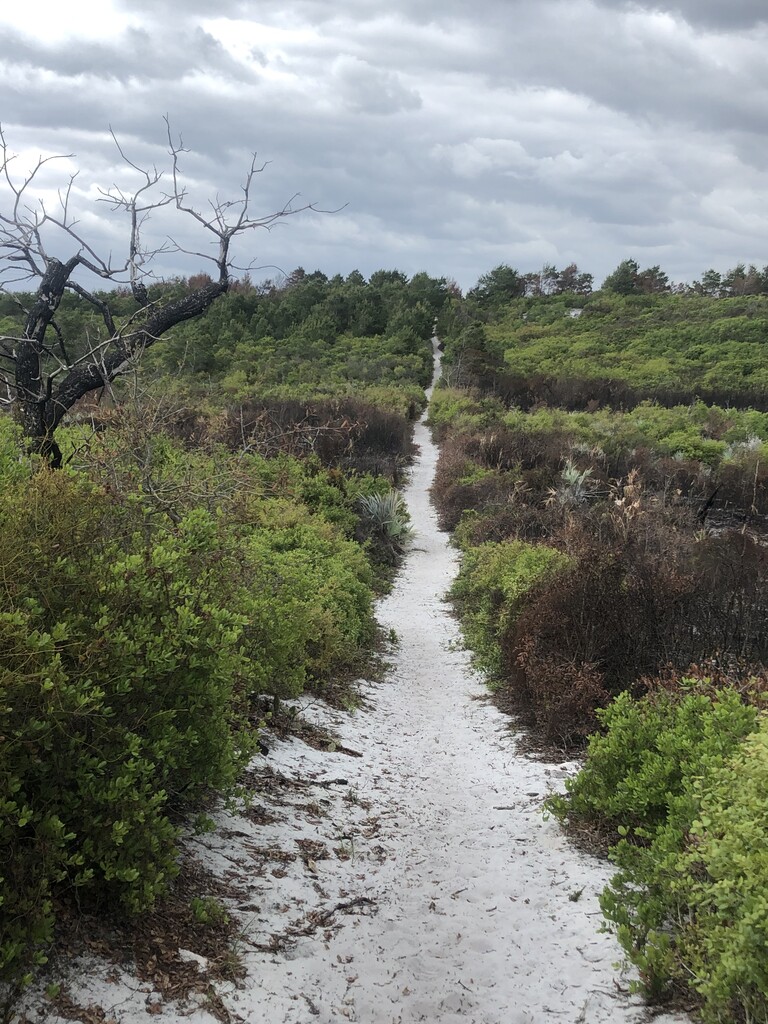
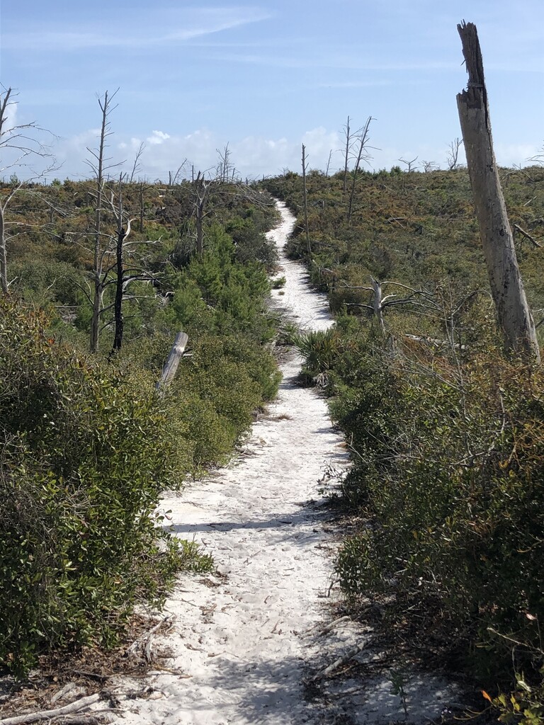
Miles 6 through 9 – Gain elevation and change habitat from the transition from Savannah to Pleistocene Pine Scrub / Sugar Sand Trail
Miles 9 through 12 – Continue to Gain elevation progress through habitat and enter historical camp murphy & begin to transition into rolling sand dune hills (This is where you connect the White Trail of the Florida Trail to the Green Trail
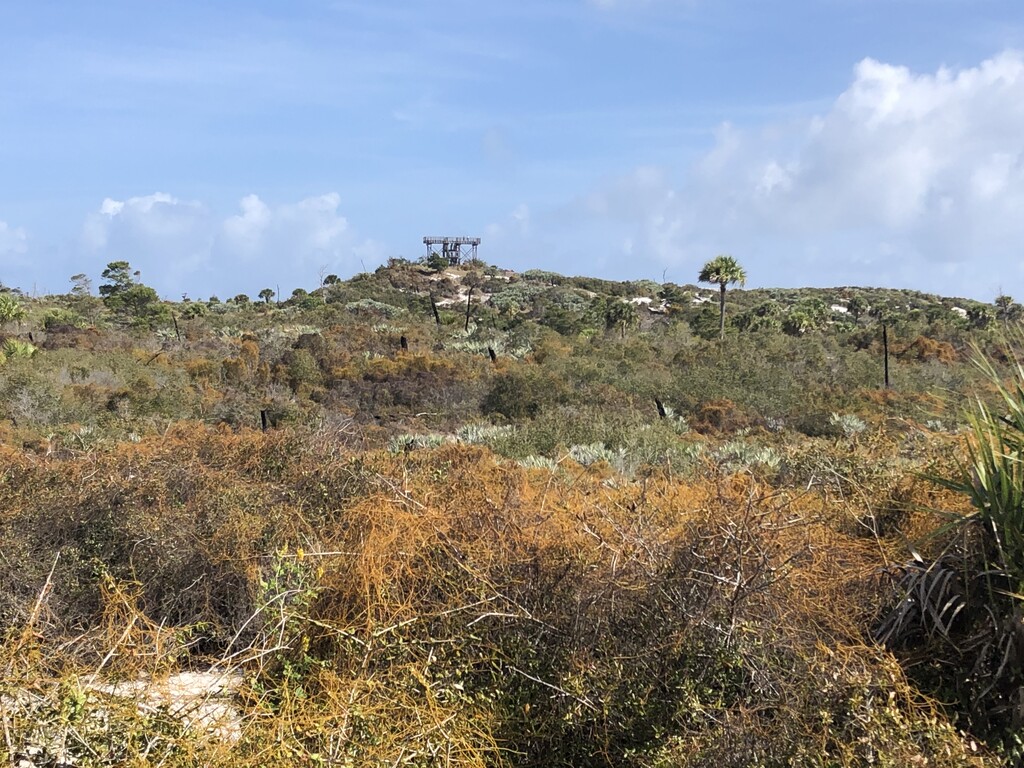
Miles 12 through 13 – Gain elevation by summiting Hobe Mountain (the highest point in South Florida @ 68 ft) and pass through historical Camp Murphy bunkers / defunct areas
Miles 13 through 15 – Transition on Green Trial to full rolling sand dunes where most elevation on the course is gained (the most beautiful and difficult section of the course)
Miles 15 through 18.63 – Finish Take the Park Road off the Green Trail back through Pine Scrub habit to the finish at the Loxahatchee River