Location
Colorado,
US
Distance
10.2 mi
Vertical Gain
3,100 ft
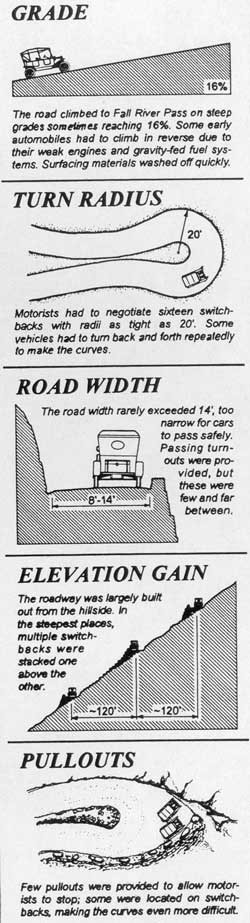
Description
GPS Track
Fall-River-Road.gpx133.52 KB
FKTs
Male
Female
| Andy Wacker | 1h 12m 40s | ||||
| Sam Beal | 1h 22m 52s | ||||
| Kevin Tilton | 1h 32m 25s |
| Karley Rempel | 1h 40m 3s |
Images
This route on the old FKT site