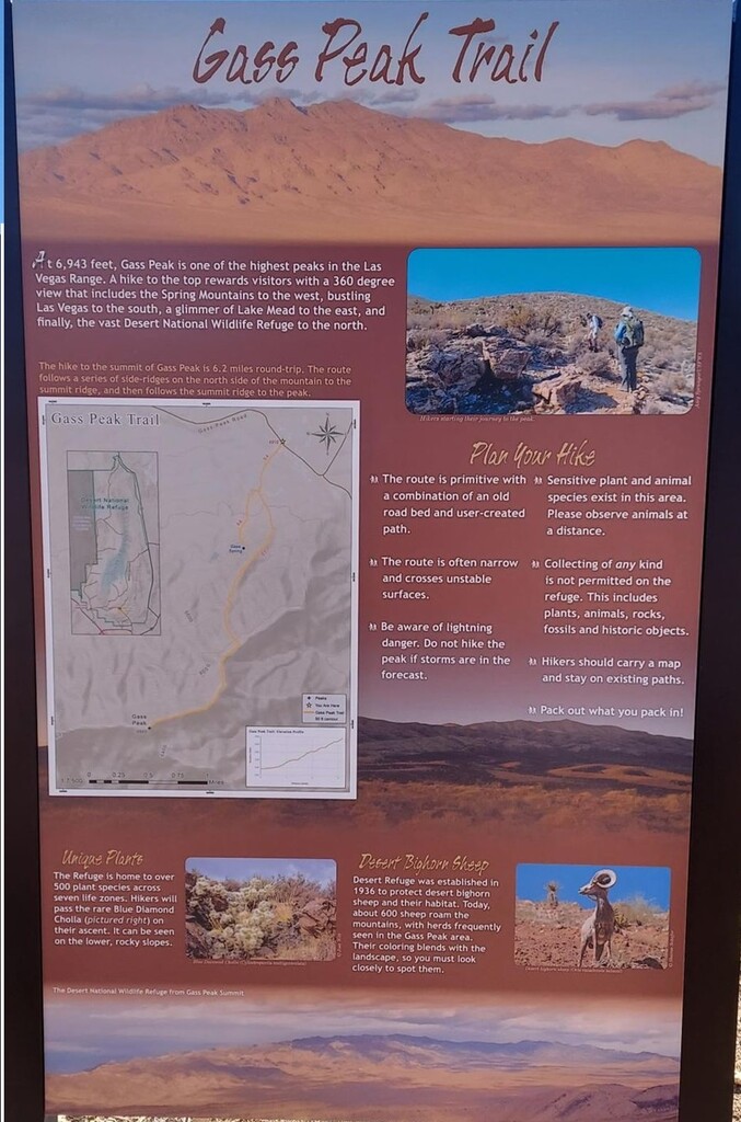
Gass peak is the highest peak in the Las Vegas Range reaching 6,943 feet above sea level. The peak overlooks Las Vegas standing out in the Desert National Wildlife Refuge.
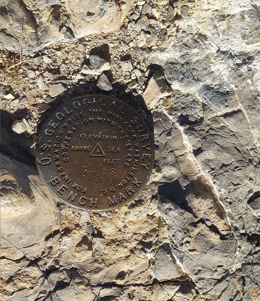
The route is made up of a combination of old roadbed and a user-created path and can be somewhat difficult to follow at points. The route gets narrow and crosses unstable surfaces and requires a little bit of scrambling. It starts and ends at the Gass Peak Trail Head with the turnaround point being marked by the U.S. Geological Survey Benchmark on top of the peak.
The Strava segment for the Gass Peak Trailhead to Gass Peak summit can be found here: Gass Peak summit | Strava Run Segment in Moapa, Nevada