Route: Gibraltar-Washpool World Heritage Walk

Submitted by Keelan Birch on Mon, 08/24/2020 - 02:03am
Location
New South Wales, AU
Distance
45 km
Vertical Gain
1,100 m
Description

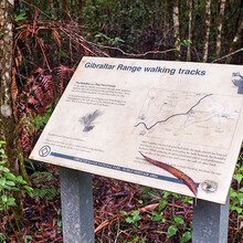
Within the mountainous Northern Tablelands, high above Clarence River Valley, a very special track links Gibraltar Range and Washpool National Parks. Gibraltar-Washpool World Heritage walk passes through dramatic and ever-changing natural environments with numerous side track options for further exploration.

Dry eucalypt forests, set amidst ridges and granite tors, are surrounded by sub-alpine swamp. Lush rainforests hold the largest tract of coachwood trees in the world. Waterfalls plummet from a lacework of streams and wild rivers.

In the 1880s, tin mining took place around Grassy Creek and remains of an ore crusher can still be seen along the eastern side of this waterway. O’Hara’s Rock marks the spot where, in 1873, a grazier by that name camped and tried to figure out a faster stock route over Gibraltar Range. Wades Mill, at Boundary Falls campground, dates back to historic logging days.

More info here: https://www.nationalparks.nsw.gov.au/things-to-do/walking-tracks/gibraltarwashpool-world-heritage-walk and here: https://www.trailhiking.com.au/gibraltar-washpool-world-heritage-walk/

Note - there is an 50km annual race called the Washpool World Heritage Trails, which deviates from the Gibraltar-Washpool World Heritage in places and is 5km longer. While times from the race are faster than the current FKT, they do not count towards the FKT due to the deviations.

Images