The Trinity Alps Wilderness, located in northwestern California, is home to more than 600 miles of trails and encompasses more than 500 acres of land. It is the second largest wilderness area in California after having doubled in size when the 1984 California Wilderness Act was passed. That same year it was added to the Wilderness Preservation System.
The landscape of the Trinity Alps is quite diverse. Creek drainages drop as low as 2,000 ft and surrounding summits top 9,000 ft. Dotted throughout are immaculate alpine lakes and rugged granite peaks. The trail network is intricate and well established.
The Trinity Alps have long been a well kept secret. Locals in surrounding towns, such as Weaverville and Trinity Center, have enjoyed the tranquility and remote feeling while out in their backyard terrain. More and more, visitation from population centers like the Bay Area, Sacramento and Portland has increased. It’s common to have a hard time finding parking at the many trailheads including those a little further in and off the main highways.
You can learn more about the Trinity Alps Wilderness on the Shasta-Trinity National Forest Website HERE.
This route, the Granite Peak Summit Trail is considered a test piece in this mountain range. It’s one of the primary summit features in the Trinity Alps with a clear view of it’s granite capped dome as you leave Weaverville (logistical hub for the Trinity Alps) headed north on California Highway 3. Like a lot of the routes here in the Trinity Alps, the trailhead is fairly easy to get to (see notes below) and the majority of trail is well established and simple to navigate. This route quickly takes you from the heavily wooded valley floor to the summit of Granite Peak. It’s the more challenging of the two primary options to summit this peak and considered the more competitive/athletic option. You average about 1,000 vertical feet per mile the entire time with little to no relief. At times the slope angle maintains a 25-30% grade. Poles are helpful and an enjoyment for vertical gain! A more thorough description of this trail is available on Summit Post HERE.
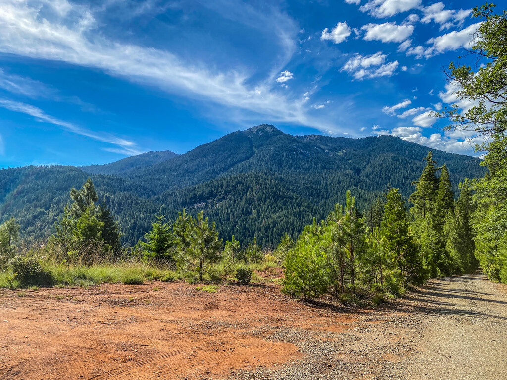
To access the trailhead, travel east or west on California Highway 3 between Weaverville and Trinity Center. From Weaverville, drive north for 16.6 miles and look for the Granite Peak Road on the left (west) side of HWY 3 (NOTE: There is NO sign as of 06/20/2020 indicating this road when coming from Weaverville. Reference the signage across the highway for Bushytrail Campground. This campground is directly across HWY 3 from Granite Peak Road). Turn onto Granite Peak Road and drive for approximately 3 miles, following signs for the Granite Peak trailhead parking. The road is narrow, winding and dirt, and a low clearance 2WD car can make it just fine. The parking lot is quite large for this trailhead. Regardless, be mindful where and how you park. The route starts at a small wooden kiosk at the base of a steep old logging road on the far end of the parking lot.
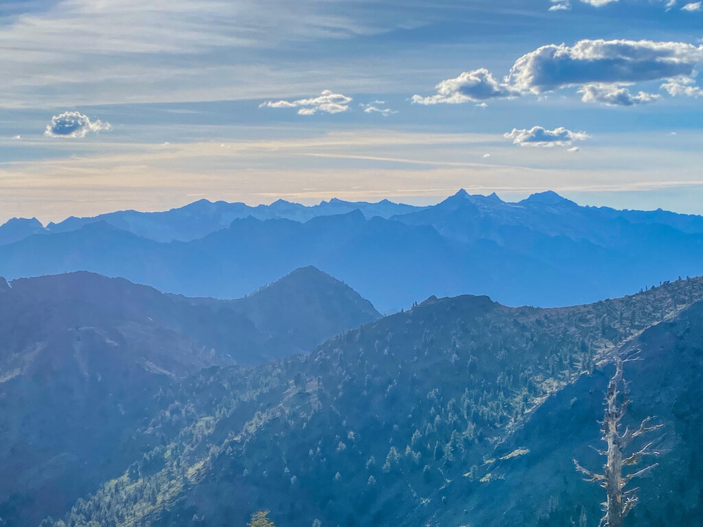
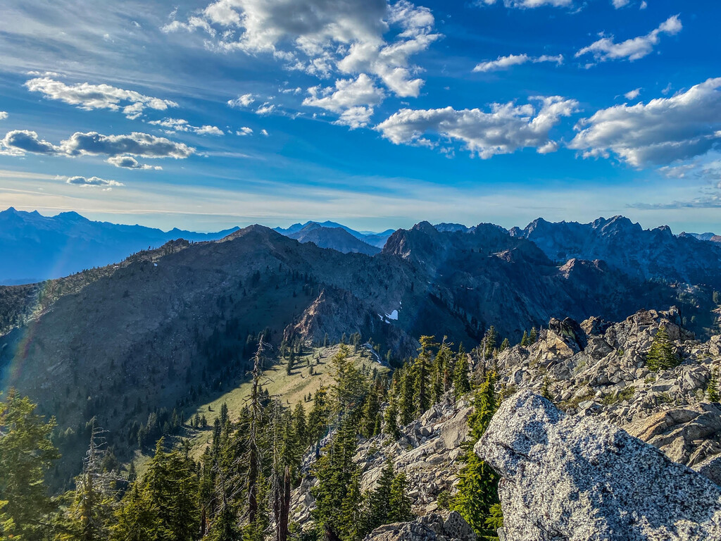
This route starts with a 0.7 mile steep climb up an old logging road. It then transitions into a single track and travels through old logging terrain. At 1.7 miles in you cross into the Trinity Alps Wilderness and the aftermath of logging ceases. You continue through thick old growth forest on a series of switchbacks before breaking treeline. Steep switchbacks continue up onto the granite ridge where you’ll come across cement footings from an old lookout tower. The summit is now insight and requires a bit of granite boulder scrambling to reach (class 3 for a few hundred feet with limited exposure). On a clear day you’ll see Mount Shasta to the north, Trinity Lake and Lassen Peak to the east, Red Mountain and Middle Mountain to the west and the multiple layers of additional peaks throughout this park of northern Claifornia. Catch your breath and follow the same trail back down to the trailhead.