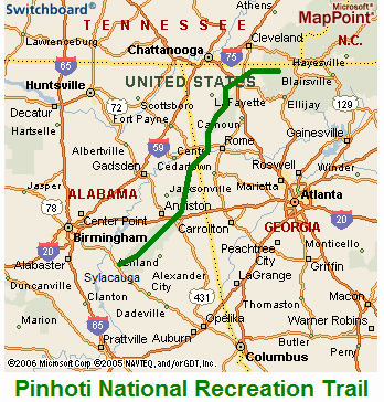
Location
Alabama,
US
Georgia,
US
Distance
335 mi
Vertical Gain
50,000 ft
Description
GPS Track
Pinhoti_Trail.gpx726.9 KB
FKTs
Male
Female
| Willie Thacker | 6d 16h 7m 0s | ||||
| Jeff Garmire | 8d 1h 19m 0s |
| Josue Rodriguez | 8d 7h 31m 2s |
| Alyssa Clark | 5d 14h 43m 48s |
| Liz Derstine | 7d 18h 22m 0s | ||||
| Katherine A Baird | 10d 8h 33m 0s |
Images
This route on the old FKT site
Comments
Starting the Pinhoti Trail tomorrow. Going self supported with no expectations https://spotwalla.com/tripViewer.php?id=1e0465ce4e8f97afc2&hoursPast=0&showAll=yes
Started today at 7:28 am alabama time. Having issues with the spot but getting some tracking to go through at https://spotwalla.com/tripViewer.php?id=1e0475ce4e93b4d29a&p=Pinhoti&hoursPast=0&showAll=yes
i will be recording a track each day on my watch which seems like the most reliable tracking method.
I’m trying to go after the self supported record starting in two days, in a potentially ill advised but nevertheless fun jaunt. Tracking here: https://us0-share.inreach.garmin.com/whereswillie
also updates on my Instagram @wamoth.
Congrats Willie! That was truly amazing! I had plans to go after this one self supported next November but after the massive miles you put up I think I will look elsewhere!
Congrats to Willie Thacker! Looks like he did it! New unsupported FKT. 6 days, 16 hours (pending verification).
https://www.facebook.com/groups/1657946791098411/permalink/2910813379145073/
Starting Thursday, April 30th, 2020 I will be attempting to set a new supported FKT for the Pinhoti. I will begin at Flagg and proceed to the Northern Terminus at the BMT. My wife, Mallory Yawn, and my in-laws, Todd and Jamie Henderson will be providing support during my effort.
Live tracking will be provided at the link provided below. I will also use my watch to record a .gpx track. Upon successful completion, I will provide the gpx track for verification.
https://share.garmin.com/Pinhoti
I was able to set a new Support FKT in 5 days 13 hrs 21 minutes. Im compiling everything and will sumbit data (gpx, photos, report) very shortly for official verification. In the meantime, heres a link to the activity in Strava.
https://www.strava.com/activities/3407270477
Hi there. I will be attempting to set a new supported FKT on the Pinhoti starting Sunday, October 18. I will be traveling northbound. Live tracking can be found here https://share.garmin.com/X9DEC. I will also wear my Coros watch to record the trip, and will provide the file if I am successful, along with a full race report, photos, etc.
Good luck! Have an amazing time out there.
I will be attempting a self-supported FKT starting Friday, Oct 23 2020. I will begin at Flagg Mountain and head north from there. I will have a gps watch going and a garmin mini inreach but am choosing for personal safety to keep the garmin track private for friends and family until completion. I will share photos, both gpx inreach and gps watch tracks, and a race report upon completion.
I will be making a supported attempt in the southbound direction starting on October 30 at 8:00am EDT. Live tracking will be available at https://share.garmin.com/houghcanty
I will be attempting a hobo supported attempt starting April 2, whenever I wake up ?. Live tracking will be available here https://maps.findmespot.com/s/2GY4 and Kevin Youngblood will be posting updated on instagram @kevlvphotography and my Facebook Athlete Page Can't wait!
Howdy! Tomorrow morning I will begin an attempt to set the self-supported FKT. Live tracking can be found here: share.garmin.com/WahooPinhotiTrail . I will likely be posting some form of updates on my Instagram (@billymeredith_ ) as well. Cheers!
I began this morning at the northern terminus at 9:31am.
Tomorrow (11/5/2021) at 11 am, I'll begin my Supported FKT attempt heading Southbound. My Live Tracking can be found here: https://live.enabledtracking.com/pinhoti2021/ . I'll also be posting a lot of updates and going live multiple times a day over on my Instagram @Hunter_Leininger . Huge thanks to this incredible community for the support and all the previous record holders for paving the way, I'm looking forward to having a special experience out there!
I will be attempting a supported nobo FKT starting Sunday, Nov 21 2021. I will begin at the northern terminus and head south from there. I will have a gps watch going and a garmin mini inreach but am choosing for personal safety to keep the garmin track private for friends and family until completion. I will share photos, both gpx inreach and gps watch tracks, and a race report upon completion.
I have decided to share the link: http://inreachlink.com/U6UL7XR
Route Question: The trail continues, with blazes, southeast from the Flagg Mt. lookout tower for about 1.5 miles. At the end, there is signage noting the southern terminus as well. Some athletes have started/ended at Flagg Mt. and some have started/ended at the signage marking southern terminus. These points are about a mile and a half apart as well as 300ish feet of elevation. Which should be considered the start/end for FKTs? Here is a link showing the signage as well as location in regards to Flagg Mt. lookout tower: https://imgur.com/a/v9wzFp9
According to the guide on the Pinhoti Trail Alliance website, the southern terminus is at the trailhead and is mile 0.0. If the blazes continue down to the trailhead and there's nothing distinguishing them to be different from the official trail (for example, trails connecting to the AT are blue blazes instead of white blazes), plus there's a sign that marks it as the southern terminus, it seems that should be considered the official start/end. There are some sources like Wikipedia and Google Maps that show Flagg Mt. as the southern terminus, but maybe it's just easier to say the southern terminus is on Flagg Mt. versus "Trailhead to Flagg Mt." I'm not personally familiar with the trail, however, so I'm sure there are many people out there with better insight than me. Anyone else want to chime in on this?
To follow up on this: it looks like originally the southern terminus was the top of Flagg Mountain, but in 2015 a new southern terminus was established at the base of Flagg Mt. So that explains why Rob Youngren started on Flagg Mountain in 2010, whereas the other six people on the board all started or ended their hikes at the base of Flagg Mountain in more recent years.
I am starting tomorrow at the southern terminus in a self supported style attempting the record. I am tracking with my gps watch and will be taking an abundance of pictures with location data. Tracks will be on strava and there might be an update or two on my instagram @bensupron
Going for redemption tomorrow! Starting a self supported NOBO effort around 5am CST hoping to average 54-60 miles/day and bring the record down to 6.5 days (or less).
You can find my InReach tracking link here https://share.garmin.com/billymeredithPinhotiTrail or I'll try to post a daily recap on my instagram ( billymeredith_)
See ya on the other side!
Hey everyone,
My name is Josue "Doc" Rodriguez and I'll be making an attempt at the unclaimed Unsupported FKT on the Pinhoti Trail starting this Saturday 2/1/25 starting at the Northern Terminus and working my way South.
I will start with 8 days of food and only use natural water sources. I believe the Southern Terminus changes to the top of Flagg Mountain on 2/1/25, but I will also finish at the trailhead for peace of mind.
Round 2. Made it 263 last time. Going for the whole tamale again. Started 4:20 am 2/25/25
Hello!
My name is J. or “Lady Shoes” and I’m attempting an unsupported NOBO thru hike starting tomorrow 3/23/25. My goal is sub 6d 12hrs. You can track me at:
https://share.garmin.com/baldingeagle
Happy Trails!
Whelp, add me to the list of Unsupported FKT attempters. Starting Next Sunday Morn/Saturday Night 3/30
Tracking at: Chickenfat_Mas_miles on Instagram
And
Strava: https://www.strava.com/athletes/74681644