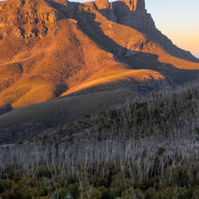
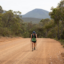
This route is the true completion of the Stirling Ranges National Park. A popular National Park for hiking and other activities. This route follows the Stirling Ridge Walk an unmarked often multiday hike as well as the other 6 climbable peaks within the National Park whilst also hiking between them. This trail truly is the greatest possible mountain hiking route in Western Australia due to the State's limited mountains.
Route written for an East to West Direction (West to East also permitted)
Section 1: Stirling Ridge Walk Ellen Peak Side to End of Bluff Knoll Trailhead (~ 0km to ~ 25km)
This route begins at the fire trail gate for the Stirling Ridge Walk on the eastern side of the national park. (-34.3181197, 118.3896036) From here follow the fire trail to the start of the unmarked Stirling Ridge trail. Follow along the unmarked trail, leading up to the top of Ellen Peak, and then continue along the whole Stirling Ridge. This unmarked trail will leave you at the summit of Bluff Knoll, where you will descend to the Bluff Knoll trailhead.
Section 2: End of Bluff Knoll Trailhead to End of Mount Trio Trailhead (~ 25km to ~ 48km)
Follow Bluff Knoll Road until the junction with Chester Pass Road. Turn left, and follow Chester Pass Road until you reach Formby Road South. Follow Formby Road South until you reach Mount Trio Road. Turn left and follow Mount Trio Road until you reach the start of Mount Trio Trailhead. Then follow the trail and it will lead you to the trig on the summit of Mount Trio. Then descend back down, to the end of Mount Trio Trailhead.
Section 3: End of Mount Trio Trailhead to End of Toolbrunup Peak Trailhead (~ 48km to ~ 62km)
Follow back down Mount Trio Road until you reach Formby Road South, where you will turn right. Continue back down Formby Road South until you reach Chester Pass Road. Turn right and follow Chester Pass Road until you reach Toolbrunup Road. Follow Toolbrunup Road until you reach the start of Toolbrunup Peak trailhead. Follow the marked trail and it will lead you to the summit of Toolbrunup Peak. Then descend back down to the end of Toolbrunup Peak trailhead.
Section 4: End of Toolbrunup Peak Trailhead to End of Mount Hassel Trailhead (~ 62km to ~ 74km)
Follow back down Toolbrunup Road until you reach Chester Pass Road. Turn left and follow Chester Pass Road until you reach Stirling Range Drive. Turn left and follow until you reach Mount Hassel Carpark. From here head to the start of Mount Hassel Trailhead. Follow the marked trail and it will lead you to the summit and trig of Mount Hassel. Then descend back down to the end of Mount Hassel Trailhead.
Section 5: End of Mount Hassel Trailhead to End of Talyuberup Peak Trailhead (~ 74km to ~ 93km)
Leave the car park and turn left to continue down Stirling Range Drive. Follow Stirling Range Drive until you reach the start of Talyuberup Peak Trailhead. Follow the marked trail and it will lead you to the summit of Talyuberup Peak. Then descend back down to the end of Talyuberup Peak Trailhead.
Section 6: End of Talyuberup Peak to End of Mount Magog Trailhead (~ 93km to ~ 110km)
Continue down Stirling Range Drive until you reach the unnamed yet signposted gravel road. Turn right and follow the gravel road until you reach the start of Mount Magog Trailhead. Follow the marked trail and it will lead you to the summit of Mount Magog. Descend back down to the end of Mount Magog Trailhead.
Thus completing "The Stirling Completion."


Comments
So stoked that The Stirling Completion is an official route and can't wait to see others give it a go and see that time come down! We will be releasing a Short Film of the route in early 2024 and you can also check out my Insta & Tiktok for a bit more of how the adventure played out
Insta: https://www.instagram.com/indeedjakereid/
Tiktok:https://www.tiktok.com/@indeedjakereid
I am looking forward to having a go at this on February 8th, 2025. Thanks for creating it Jake.
Where’s the film Jake?
excited to get myself back into some kind of shape and give this a crack.