Route: Arizona Trail Santa Catalina Loop

Submitted by mattyjee on Sat, 06/22/2024 - 02:40pm
Location
Arizona, US
Distance
41.77 mi
Vertical Gain
12,938 ft
Description

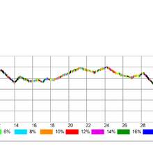
This route makes a large loop through the southern Santa Catalina mountains, by taking Arizona Trail passage 11 and Arizona Trail alternate passage 11E to create a 40+ mile loop with over 12K+ feet of elevation gain & loss.

It includes a lot of trail that is rugged and technical trail but nothing that requires gear. Temperatures at the highest elevations may be 20 degrees cooler than Tucson so this route can potentially be attempted year round, weather dependent. It crosses Mt Lemmon highway twice, roughly halfway around the loop, making it more accessible to supported attempts.

The route takes you through:
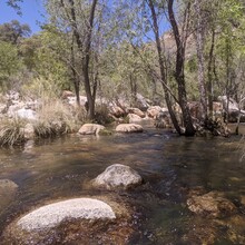
- Lush desert oasis along the west fork of Sabino Canyon
- A steep climb northeast up Mt. Lemmon, passing large rock outcroppings
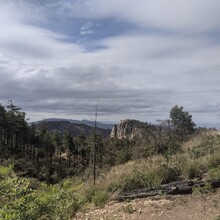
- Dense pine forest speckled with granite boulders
- Short section of paved road through the town of Summerhaven atop Mt Lemmon, and then a short section of forest road
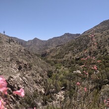
- Winding trail with significant elevation gain and loss along the south east ridges of the range passing many granite walls

See the Arizona Trail website for maps, water sources and more information about the passages:
- Passage 11: https://aztrail.org/explore/passages/passage-11-santa-catalina-mountains/
- Passage 11E: https://aztrail.org/explore/passages/passage-11e-pusch-ridge-wilderness-bypass/

Images

Comments

User Picture
Profile picture for user marcy_beard

I'm planning to try this tomorrow, looking forward to exploring some new-to-me trails in the Catalinas

User Picture
Profile picture for user marcy_beard

Completed (self-supported) in 16:48, just submitted.  That was tougher than it looked!