Location
Massachusetts,
US
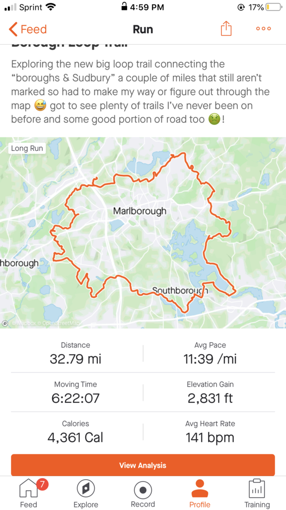
Distance
32 mi
Vertical Gain
2,800 ft
Description
GPS Track
Borough.gpx159.77 KB
FKTs
Male
| Adam Ribeiro | 4h 49m 27s |
| Brian Butterfield | 5h 26m 22s |
Male
| Adam Ribeiro | 4h 33m 39s |
| Pierre Massat | 4h 36m 38s |
| Brian Butterfield | 4h 53m 30s | ||||
| Brian Butterfield | 5h 29m 39s |
Male
Female
| Pierre Massat | 4h 17m 7s | ||||
| Nick Poles | 4h 19m 52s | ||||
| Adam Ribeiro | 5h 7m 7s |
| Brian Butterfield | 4h 19m 22s |
| Robyn Bratica | 7h 5m 51s |
| Kristen Gardella | 10h 57m 2s |
Images
Comments
Adam, I’m going to give this a try tomorrow! I’m going to follow your GPX file as I don’t think any new trail work has been done this summer. I’ll let you know how it goes.
I finished in approximately 5:05 today. I’ll work on compiling all the data and post it to the site in a couple days. Great run, but it was hot out!
Brian-
Just wanted to add that there was a new section of trail added this year on the far Southeast corner of the trail. Heading in a clockwise direction, it's just past that fence at the dam. I'm not sure if/when it was marked, but it just puts you out further onto Pleasant St. Looks like the interactive map on SVT has the change, but not the GPX track on here. It doesn't change much distance-wise, but it's a fun little stretch of single track!
I'm thinking of giving the loop a go unsupported next weekend, just depends on how some ankle tendonitis is feeling. I've been on the stretch that parallels the BCT and it's a beautiful section of trail.
Ran the loop in 4:29 today, missed the fkt by 2 minutes!! You've got a strong time on there Brian. I definitely want to come back and give this a try when there's no snow on the ground, the thin layer and slush/ice along the aqueduct and those open stretches along the start of the reservoir really tired me out. It might close to a year before I'm able to come back and try it though, sadly.
Just a couple notes for others:
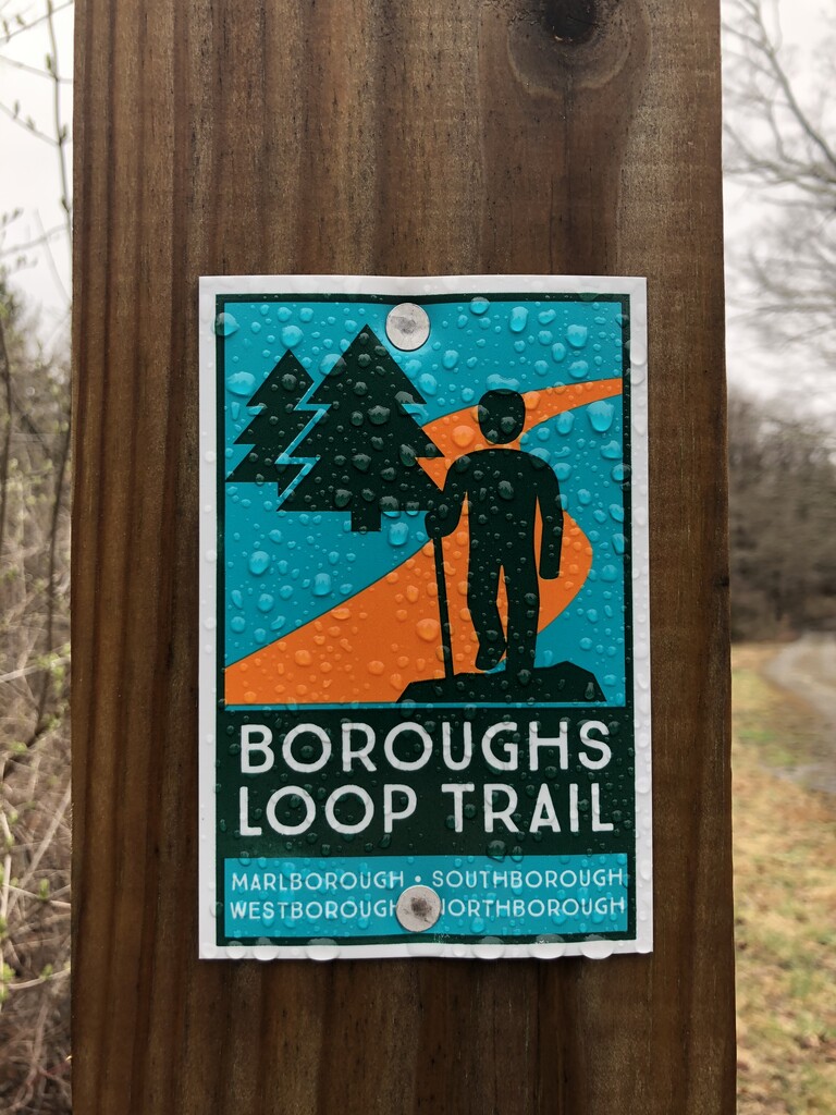
-That stretch of trail I was talking about is blazed now and I'm assuming it's open for use. I took it on my route
-I followed Brian's route through callahan state park. I didn't see any borough loop markers through there and the BCT quickly deviates from the gps track. I'm thinking the route should follow the BCT through here? But not certain
Fun trail. I'm hoping they can get some trail down in Marlborough though because that's a lot of road running right there.
Shane,
That’s an awesome time given the trail conditions! I had perfect conditions for my FKT.
I did see the new section of trail, and I’m excited it’s there now. I believe the section in Marlborough off West St is starting to get some work too. Hopefully it’s all open soon and we can do a true boroughs loop!
I’d like to give it another go next year.
Oh, and I believe I followed the SVT map on ArcGIS though Callahan, so I think the GPX is accurate on that section.
Due to the new section of trail opening around the damn, I gave the FKT another shot today. I missed the FKT by 1 min and 3 seconds!! I analyzed my two GPX tracks and determined the new section of trail added about 15-20 seconds on to my time. So I don’t think it’s worthwhile to distinguish between the FKT pre and post that trail segment opening. Oh, and I took 3 minor wrong turns today totaling about 1 min and 30 seconds!!! Ugh!
Just a note both Nick Pole's unsupported FKT, and my new self-supported FKT have followed the newly completed Borough's Loop trail in the South East corner of the trail by the dam. If you are attempting this route, I suggest you download my self-supported GPX file and follow this, it's accurate and I didn't take any wrong turns.
This past summer the trail section between Dufresne and Pleasant St in the North West corner in Marlborough was completed, so the trail is now 99% complete. Unfortunatly it isn't marked with Boroughs Loop Trail markers, but it's very clearly marked with White Dashes and Arrows. For all future attempts please follow this route which is now labeled as "Pleasant St Bypass". The trail administrators say the final small section from Pleasant St to the Rail Trail should be completed in 2023, at which time we will be able to complete the "Full Loop"!
Please note that the final section between Pleasant St and the Rail Trail is finally open! Please use the GPS on the Full route only, and don't use the bypass loops anymore. Good luck to all!