Location
Michigan,
US
Distance
35 mi
Vertical Gain
4,850 ft
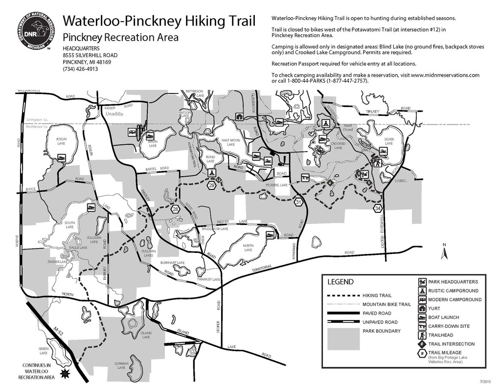
Description
GPS Track
FKTs
Male
Female
Mixed-gender team
| Zach Crim | 4h 41m 42s | ||||
| Scott Hayter | 9h 9m 49s |
| Charles Hornburg | 4h 59m 7s | ||||
| Charles Hornburg | 5h 2m 50s | ||||
| Josh Sanders | 5h 39m 35s | ||||
| Charles Hornburg | 6h 2m 9s | ||||
| Nicolas Cornell | 7h 35m 33s |
| Nicole Monette | 6h 18m 43s | ||||
| Victoria Zakrzewski | 7h 8m 44s | ||||
| Jessica Storrison-Carmean | 7h 28m 8s | ||||
| Kristyne Cole | 8h 32m 27s |
| Sierra Bowden, Upton Bowden | 6h 42m 39s |
Male
| Stephen Sherman | 13h 8m 47s |
Images
Comments
I, Jamieson Hatt, will be attempting an unsupported, out and back variation of the Waterloo Pinckney trail on Monday, Oct 28/19. I plan on starting at portage lake bright and early. I’ll be carrying all my food and utilizing the water on the course. Water fountain 1/4 and 3/4 of the way. Well 1/2 way. Hopefully this does the job. Here’s my live tracking link. https://share.garmin.com/JamiesonHatt
On 5/30/2020, Upton Bowden and I will be attempting a self-supported FKT on this route as a mixed-gender team. We will start at Portage Lake around 6:30 EST and end at Silver Lake, caching a resupply of food/water/shoes in advance. Live tracking: https://livetrack.garmin.com/session/540fbdd5-07c7-45c7-ac2a-99e81dc0ca…
I, Victoria Zakrzewski, will be attempting an unsupported FKT on this route starting at Portage Lake in Waterloo Recreation and ending at Silver Lake in Pinckney Recreation area on December 5th 2020.