The Weaverville Basin Trail System (WBTS) was established in 1986 with the intention of circumnavigating the small Gold Rush town of Weaverville, California with an intricate network of 50 miles of diverse trails. Local enthusiasts have poured 100's of hours into creating and maintaining these single track gems. The WBTS project is still ongoing with upcoming plans (2020) for additional expansion and further linkage. These trails were home to the World Endurance Mountain Bike Organization (WEMBO) 24 Hour Solo World Championships in 2015 and see mixed use by hikers, runners and mountain bikers alike. The annual LaGrange Classic Mountain Bike Race is a regional favorite. Local trail running legend Roxanne Woodhouse is piecing together a 50k trail race here with hopes of a successful first launch in 2021.
Weaverville is located in Northern California in Trinity County. Nestled at the foot of the beautiful Trinity Alps Wilderness, Weaverville provides direct access to the plentiful outdoor recreation opportunities in this vast and remote alpine landscape situated between the Californian coast and central valley. Weaverville offers many historical attractions while maintaining it's simple and quiet atmosphere.
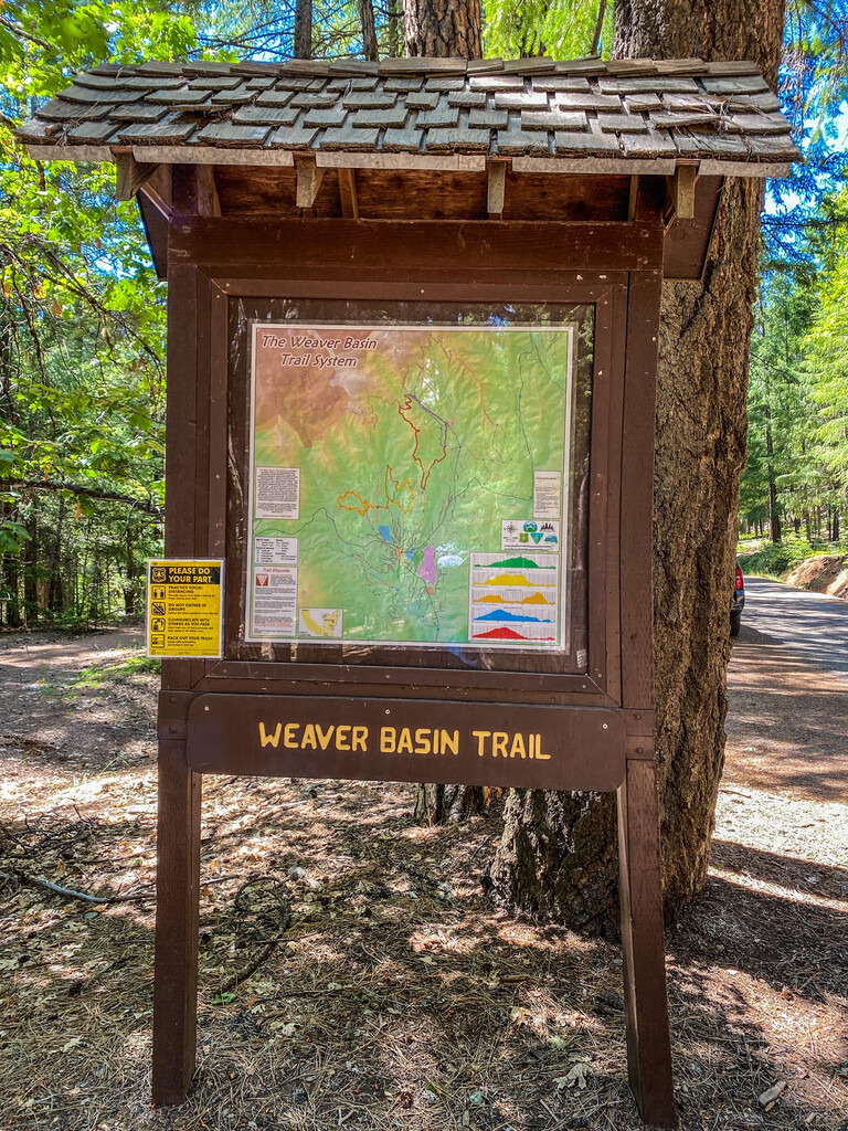
The Trinity County Resource Conservation District (RCD) has published THIS MAP which identifies 5 different trail loops. 3 of these share a trailhead off of Weaver Bally Road while the other 2 share a trailhead at the East Weaver Campground. Each loop is a bit different in it's distance and vertical gain. When combined, they form unique challenges that are attractive to local talent and have the potential to draw attention from regional runners looking for a bit of fun and diversity with their more routine routes.
This route, the East Weaver Campground Loops 5 & 6 Link Up, is a combination of both of the Loops accessed from the trailhead at the East Weaver Campground at the end of East Weaver Creek Road off of Highway 3 northeast of downtown Weaverville. The WBTS map calls each of these the East Weaver Campground Loop 5…6... On the map they are identified by the colors blue and red. The blue loop (East Weaver Campground Loop 5) and the red loop (East Weaver Campground Loop 6) each share a portion of trail. See map for clarification.
To access the trailhead, travel east on Main Street out of Weaverville. Almost immediately after leaving downtown look for a left hand turn (northeast) onto Trinity Lake Bolvedard (Highway 3). Travel approximately 2.2 miles northeast on Trinity Lake Bolvedard (Highway 3) to a left hand turn (north) onto East Weaver Creek Road. At this intersection there should be a sign pointing toward East Weaver Creek Road which indicates the East Weaver Campground. Turn left (north) onto East Weaver Creek Road. Continue until reaching the East Weaver Campground. Once at the campground, stay to your right a couple hundred feet until a solo information kiosk with a map of the WBTS on your left (east) side of the road. Park off the road here. The trail goes northwest or south from here. There is signage.
This route is set up such that you start and end each of the 2 loops at the trailhead kiosk. It doesn't matter which loop you do in which order and which direction you choose to go. Simply cover each loop completely before starting the next. For example, you could:
-Leave the trailhead kiosk going northwest and run the East Weaver Campground Loop 6 (red) counter clockwise and return to the trailhead kiosk.
-Leave the trailhead kiosk going northwest again and run the East Weaver Campground Loop 5 (blue) counter counter clockwise and return to the trailhead kiosk.
What's most important is that you create your own version of this link up and have fun!
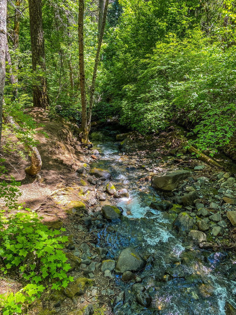
Sections of these loops run along the East Weaver Creek and are well shaded. Much of the East Weaver Campground Loop 6 (red) climbs up to a high point along Jackass Ridge and is quite exposed. Pay attention to temperatures and consider heat exposure if attempting on a hot day. This area is dog friendly but realize that the majority of this link up does not provide access to water for your pup.
Think mostly single track with a diversity of surfaces from buttery smooth to hard packed rutted with some rocks and roots thrown in for added challenge. As is typical with WBTS trails, the uphill is just steep enough to spike the heart rate and the down is the perfect angle for going fast. Overall, these are well built and maintained trails and very enjoyable.
A little extra beta…There are many 3 and 4 way trail intersections throughout this link up with limited signage. Pay close attention to the map. Carrying a digital copy on a smartphone is helpful. It’s easy to take a wrong turn and be on a different trail that isn’t intended for this link up.
When you're done, grab a beverage at the Trinity Country Brewery, take a stroll down historic main street, absorb some history at the local museum or get a coffee to go at Mamma Lamas. Locals are friendly. Terrain is abundant. Trails are worth the travel.
NOTE: This route is associated with another FKT page: Weaver Bally Road Loops 1, 2, 3 (CA). Consider giving both a go!
Submitter: Nate Smith