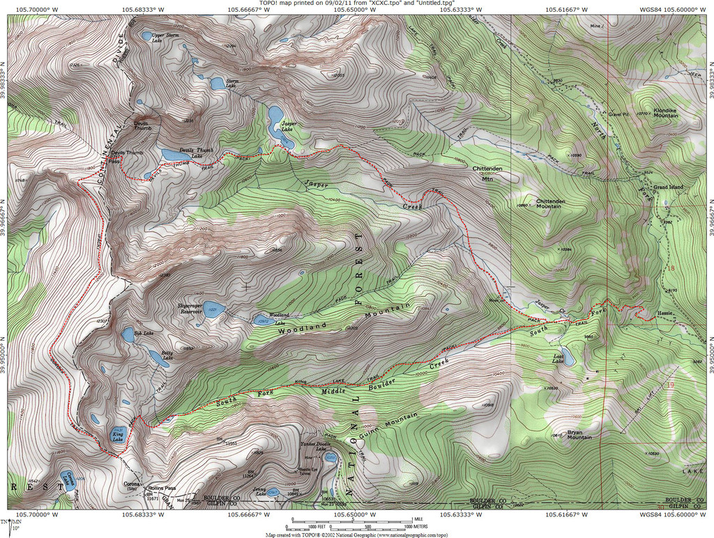
Route: High Lonesome Loop (CO)

Location
Colorado, US
Distance
14.5 mi
Vertical Gain
3,300 ft
Description

The High Lonesome Loop is a super-popular 15 mile loop in the Indian Peaks Wilderness of Colorado's Front Range. The route begins and ends at the Hessie Trailhead just west of Nederland. This is one of the quickest and shortest ways Boulder's many trail runners to access the Continental Divide, which accounts for the route's popularity.  Once upon a time this route was known as "The King & Devil".

For purposes of the FKT, the "official" route is as follows (described CCW, though either direction is fine): From the Hessie TH (officially, the bridge over the North Fork of Middle Boulder Creek, just west of the last legal parking spot) head west on the Devil's Thumb Trail. After about 1 mile (just before the bridge over the South Fork of Middle Boulder Creek) take the Devil's Thumb bypass, and rejoin the Devil's Thumb Trail a bit farther up. Continue to Devil's Thumb Pass. From the pass, descend a short distance west to meet the High Lonesome Trail and head south. At Corona Pass turn east on the King Lake Trail and descend past King Lake and back down the South Fork drainage to the trailhead.

Oddly, there are 2 Strava segments for this route:

https://www.strava.com/segments/1573256 

https://www.strava.com/segments/4614143

Also, besides the Strava data & FKTs recorded here, Bill Briggs indicates that Bret Wilson did this loop in 2h17m10s (counter clockwise) in 2000.

GPS Track
Images