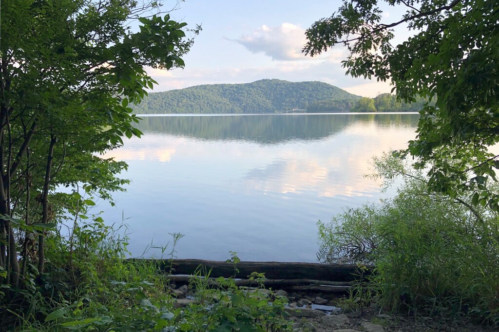
The Quemahoning Reservoir, also known to locals as The Dam, is created by the Quemahoning Dam, located on Quemahoning Creek on the border of Quemahoning Township, Conemaugh Township, and Jenner Township in Somerset County, Pennsylvania just south of Hollsopple. The dam was constructed by the Manufacturers Water Company to supply water for the Cambria Iron Company's works in Johnstown, Pennsylvania. Construction was begun in 1910 and completed in 1913. The reservoir created by this dam is about five miles long and two miles wide at its widest place, and drains into the Stonycreek River and thence into the Kiski-Conemaugh system. It is one of the largest artificial bodies of water in Pennsylvania, and is known as a stopover for migratory waterfowl, including geese, swans, and herons. It was sold by Bethlehem Steel Corporation (successor to Cambria Iron) to the Cambria Somerset Authority in 2000, which now operates it both for recreation and industrial water supply.
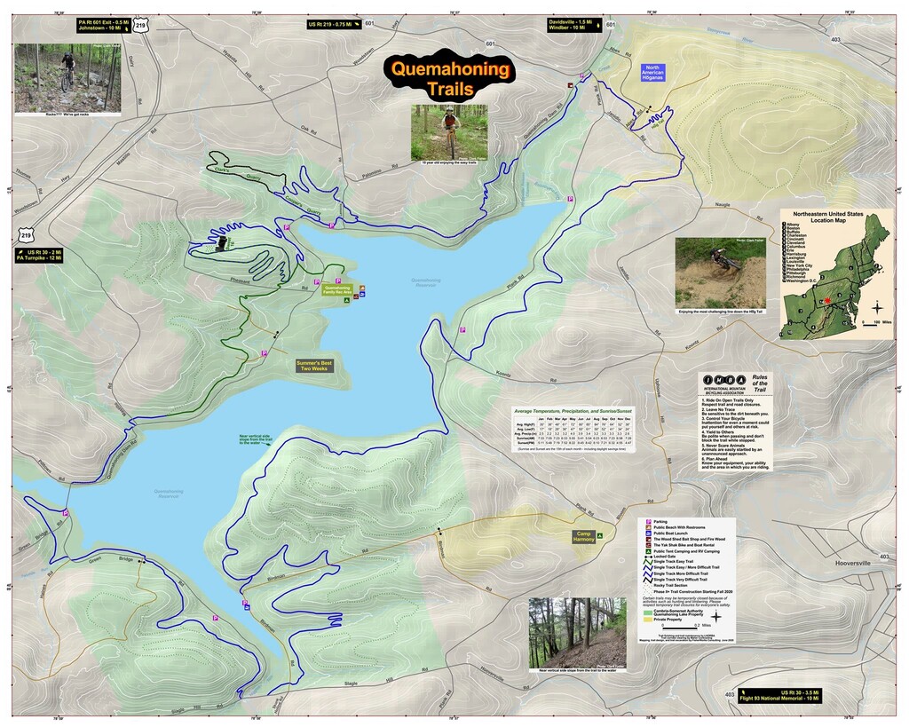
In 2019, multiple small trail sections that circumnavigated the reservoir were finally connected to form a continuous trail system. The Quemahoning Reservoir offers a total of 17 miles of rolling, single-track trail for mountain biking, cross-country skiing, walking or trail running. But the basic loop around the reservoir is only 14.25 Miles. Once it was completed, I incorporated the loop into my training as it was a great change of scenery having a body of water continually to one side of you. The sunrise and sunsets on the water are gorgeous. Many local trail running groups routinely meet at the reservoir for group runs, and in 2021 On the Dam Trail: Quemahoning Relay Race will hold its second annual event. I plan to attend.