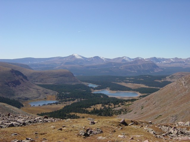
Location
Utah,
US
Distance
78.1 mi
Description
GPS Track
Uinta_Highline_Traverse.gpx1.23 MB
UHL200_0.gpx267.42 KB
FKTs
Male
Female
| Emily Brackelsberg | 1d 3h 24m 0s |
| Raquel Zimmerman, Kris Rosser | 1d 15h 46m 32s |
Male
| Joey Campanelli | 2d 10h 46m 0s |
Images
This route on the old FKT site
Comments
I can't figure out from the description if the standard route is 100 miles or 80 miles. Either way, Campbell's a beast.
Anyone know if a 'double Highline' (out-and-back) has ever been accomplished or reported?
Joey Campanelli just did one a couple days ago. Some details on his Instagram.
Thanks! And wow... that is very impressive.
Starting a Yo-Yo of the UHT today (8/16) from Hayden pass to McKee Draw and back to Hayden Pass, so the full 104 mile route both ways totalling 208 miles. Not sure how fast this will go for me, this is a hike not a run, but wanted to log my intention here and give the link to my Garmin:
https://share.garmin.com/MilissaGillen
If things go well, maybe I will submit for a women's self-supported FKT, either way, totally stoked to be taking on a new adventure!
HappyTrails,
Milissa Gillen
(MaryPoppins)
So that was interesting. Its a DNF due to weather, the Uintas are no joke when the weather rolls in, got a heli ride out with another hiker yesterday. Hope to get back out there at some point. Humbling experience. ~Peace, MP
Just a heads-up: The Highline Trail is pretty much obliterated by forest fire from the junction with the trail to Brinkley Lake to Ledge Lake (approx. 10 miles and 15 miles east of Hayden Pass TH respectively). I found it quite impassable at night, and not much better by day. Excruciatingly slow and painfully schwacky. Until the trail is cleared, I would suggest maybe researching a detour to Jack and Jill Lakes to the north then back to the Highline. In short, do some research and maybe check out the burned section closer before committing to an FKT on the Highline!
7/31/2023 Update on the Rock Creek Basin section of the Highline Trail. Looks like the forest service if finally getting to clearing the section from Ledge Lake to the Rock Creek stream crossing. The trail is still difficult to follow mainly because it has just vanished, but many of the fallen trees have been cleared, or will be soon. Once you cross the creek however, that section up to the Rocky Sea Pass trail junction is still pretty bad with out any trail work at all, and not sure if they will get to that this season or not. But overall, the trail conditions are much improved than the last couple of years.
I also checked out the Jack and Jill route, it's much worse (and longer), I would not recommend going that way.
thinking about doing the 200 this coming summer, anybody know if it’s been attempted (i’m sure it has) and what time it was completed in (even if it’s unverifiable) ?
Myself (Raquel) and my friend Kris will be going for the women’s unsupported record on this in the next few weeks! We will be traveling as a team with everything we need to travel from Leidy to Mirror Lake :)