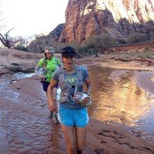
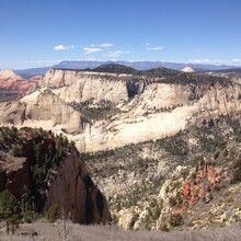
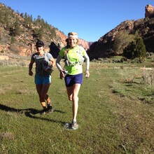
Zion Crossing is 3/4 of the famous Trans-Zion route, a portion of which was closed due to massive rockfall on August 25, 2019, which made the full Trans-Zion route impossible. The Park Service closed all trails in that area, there is no way around the closure, and as of November 2021, they have no plan in place to re-open these trails.
Zion Crossing is excellent! 37 miles of beautiful backcountry, ending with a spectacularly thundering descent down the West Rim Trail into the Valley. There are private shuttles to take you to the Lee Pass TH on the west side of the Park, and a free NPS shuttle to take you from the West Rim TH out to the Visitor Center or Springdale. The Start is the sign at the paved road at Lee Pass and the Finish is the paved road in the Valley.
Trails are maintained and signed, there is no official potable water but there are springs, and a road crossing if you want to stash or receive water. Be safe and knowledgable of desert running, as it is often hot, dry, and remote. This route cannot be done most winters due to snow; by the time the higher sections are mud-free, the Valley is quite warm. The bottom of the West Rim Trail is the same as the uber-popular Angels Landing; note that FKT aspirants do not have the right-of-way over other trail users.
One may run in either direction but west to east will obviously be faster, so that will be the only FKT direction. An Out-Back Variation is possible, and that would be approved with runners starting/finishing at either of the two ends.


Comments
It's almost certain the NPS will never reopen the Weeping Rock Trail due to rockfall danger; 31,292 tons crashed down in 2019, and there are perched slabs still above. This is a major loss, as that means Hidden Valley Trail is closed, as is this section of Observation Point and the East Rim Trail. So "Zion Crossing" is your FKT route; "Trans-Zion" is kaput.
https://ugspub.nr.utah.gov/publications/reports_of_investigations/ri-281.pdf
A close friend and I hiked this route as a scouting exercise on 6/14/24 and wow, there is a ton of sand! Temps were quite hot in the afternoon and topped out 101 in the canyon, but water sources were plentiful. We filtered from Beatty Spring, cached at the Hop Valley trailhead, filtered from a precursor seep ahead of Wildcat Spring, could not find Potato Hollow Spring, and then filtered from Cabin Spring.
I definitely see now why so many folks have done this route in spring when temps are lower and water sources are more likely to have high flow rates. Initially, taking a stab at Buzz's supported time or setting an initial men's unsupported time were on my radar, but that sand seems awfully daunting. Beautiful views abound on this hike and it is one of the best trails I have personally ever run.