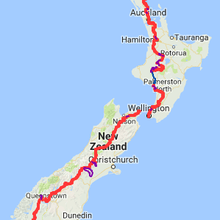
Location
New Zealand
Distance
3,039 km
Vertical Gain
77,000 m
Description
GPS Track
FKTs
Male
Female
Mixed-gender team
| Karel Sabbe | Multi-sport | 31d 19h 40m 0s | |||
| George Henderson | 49d 14h 27m 0s | ||||
| Jez Bragg | Multi-sport | 53d 9h 1m 0s |
| Billy "Wahoo" Meredith | Multi-sport | 52d 11h 57m 36s | |||
| Tim Wright | 69d 20h 37m 0s |
| Paulina Zack | 54d 9h 48m 0s |
| Tom Bartlett, Madison Wait | 54d 13h 58m 26s |
This route on the old FKT site


Comments
I will be attempting to set a new self-supported FKT in the coming days, starting at Cape Reinga. I will play by the self-supported rules (no outside support, no hitching etc) and will aim for a ~65 day hike. Due to the nature of the trail and official TA guidelines it will however be necessary to use publicly-available transport as follows:
-Ferry from Opua to Okiato, road walk detour due to starting late in the season and no kayak operators willing to rent kayaks to single persons.
-Ngunguru river crossing via James, as per the official TA route and trail notes (tide dependent)
-Marsden Point river taxi via Blair, as per the official TA route and trail notes
-Kayak section starting from Whakahoro rather than Mangapapa due to kayak rental availability as a single persons. This is in line with what the current FKT holder did.
-Water transport from Picton to Ship Cove
-Rakaia braided river bypass, via Shuttle
-Rangitata braided river bypass, via Shuttle
-Lake Wakitapu hazard zone/not officially part of the TA trail, via shuttle or taxi
TBC locations that I’ll send a box to once in Wellington:
St Arnaud
Boyle River
Arthurs Pass
Birchwood
I will track the hike on my public Strava account, using a Coros Apex Pro 2 watch:
https://www.strava.com/athletes/40506007
I take that all back - ha! I already knew this trail absolutely wasn’t for me after day 4. Preserving the body for some other fun adventures. I know there’s a couple others attempting an FKT right now, so best of luck to them!
Hi Tim, I would be really interested in hearing more about your FKT planning as I'm looking to attempt an FKT at some point - if you still have all that info and are happy to share it please let me know at this email address aricompton26@gmail.com :-)
Kia ora!
Assuming I get a successful hitch up to Cape Reinga this afternoon, I will be starting a self supported FKT attempt of the Te Araroa around 4am. My goal is to also break the current overall supported time of 49.5ish days. I’ll be traveling southbound hoping to end in Bluff by March 20th or so.
I’ve linked my tracking page and will be posting on my Instagram page as well.
Cheers!
https://explore.astraldesigns.com/te-araroa-fkt-x-wahoo/?fbclid=PAZXh0bgNhZW0CMTEAAaaLiMJU6wkD4INfDRuxcvXVE-Nql312NUQPwow_SiN77Kc-7ormsfLvimk_aem_4Jv3lHUgBX3K56wzvEyVpg
I'm trying for a self-supported FKT going Northbound starting early February. I will be posting on Instagram @linazac.
Thanks for the update, say hi to Karel, best of luck.
/Torben
Hey there everyone! I am interested in the self-supported category of this FKT, does anyone know if there is a 'rulebook' of some kind. I am mostly interested in finding out how frequently I am allowed to restock food water etc.
Hi Jacob
Please refer to the FKT Guidelines on rules for self-supported category.
https://fastestknowntime.com/guidelines
Self-Supported means you may have as much support as you can manage or find along the way, but not from any thing or person just for you; any support you employ must be equally available to anyone else. This can include caching supplies in advance, purchasing supplies along the way, staying at motels, and finding or requesting food or water. Camping in a friend's yard would be supported, because it is not available to the public. Except at the start and finish, spectating pre-arranged by an athlete is considered support. Many long thru-hiking routes are done self-supported. To get a self-supported FKT you must also beat the fastest unsupported time.
As long as you are consistent with the above for self-supported then you can restock as frequent as you want
Cheers
Keelan
Current FKT Editor for Aus and NZ