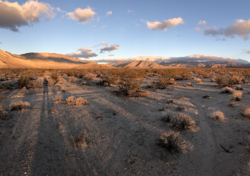
This route takes you from the northern most point of Death Valley National Park to its southern most point. No trails, no roads. It is about 160miles long and run the length of the Death Valley. The route proposed here is the one Roland Banas followed, but you are encouraged to make your own. Only the start and the end points matter. This route was first done solo, unsupported and unassisted by Louis-Philippe Loncke in 2015 in just under 8 days and done again by Roland Banas in 2018 in just under 7 days. The crossing can be done all on trails, but for an unsupported summer trip using a cart for water, that wouldn't be possible.
The route starts on Willow Creek Rd, about a 1.5 miles NE from Last Chance Canyon. Lat: 37.349741 Lon: -117.683353
The route ends at the Harry Wade Monument at the intersection of Death Valley Road (127) and Saratoga Springs Rd. Lat: 35.632850 Lon: -116.290683
The rules of Death Valley National Park forbid people from camping within a mile of most established roads or the salt flats. See: https://www.nps.gov/deva/planyourvisit/backcamp.htm and https://www.nps.gov/deva/planyourvisit/upload/508-Backcountry-and-Wilderness-Access-map_.pdf for more information.
addendum: since the creation of this route, Death Valley National Park boundaries have shifted a little and the southernmost point is no longer at the Harry Wade Monument. The new southernmost point is remote and difficult to access, but it shortens the route by 6-8 miles. For simplicity and consistency with already established FTKs, the route will remain the same and use the Harry Wade Monument has the end point.
A detailed trip report is on Explorer Web: https://explorersweb.com/2019/01/07/solo-dv-crossing-report/
Louis-Philippe Loncke described the strict unsupported ethic he followed:
Comments
Super Psyched that Saramoira just started at 11:22am today 1-8-2020 with goal of beating the overall mens time :) THIS IS BIG! AND BRUTAL!
Good call out. Death Valley is amazing - lots of hidden (and some not so hidden) gems there. The N-S Crossing is ... Jason said it! Way too hard for me. "Salt to Snow" OTOH is reasonable (Badwater to Telescope Peak).
I'd like to announce that I will be attempting this FKT solo and unsupported starting tomorrow, February 6th. Super stoked about this one! You can follow along on my live tracking link here:
https://share.findmespot.com/shared/faces/viewspots.jsp?glId=0o7Z7SACOz…
Super excited for you Ashly! ~165 miles of desolate, rugged Death Valley...solo, unsupported!!!
This is huge and brutal! Glad I could help with some beta (read:mistakes) from my attempt!
and...After 2 attempts coming up short on this just this year, I really hope it goes for you :)
temps up into the 80s now...those reflective salt ovens will be hot!!!
with all the stoke!!! get it girl!
Hey FKT community,
These routes have special history. It is very important to note the difference in route and ethic between the summer route and the winter route of this Death Valley Crossing.
The non-summer (standard) variation has followed a very strict off-trail ethic (no walking roads or trails) and a very strict "use nothing man made" ethic...as such one must carry all their water in a pack because wheels aren't allowed through some of delicate desert wilderness areas. This is what makes this effort so unique and so brutal to master. To soften on this would be to change the whole nature of the effort from the original records. The tab should perhaps be named "strict off-trail route" to better capture this expectation.
Then, it is important to note, the "July-August Variation" is the exact opposite in that it exclusively follows roads so that you can pull a cart in order to meet your ridiculous water needs during the insane heat. This tab should perhaps be named "July-August Road Variation". It is important to note that in this road variation the unsupported ethic is still very strict against refilling water or other resources from any man-made structure or faucet, even publically available ones. To use these would be self-supported in this instance, do to the style of prior attempts. This is because the water and weight issues are what make this effort so enormous. To change that is to deviate from both the aesthetics and logistical challenge originally faced in conquering these experiences.
Perhaps there could be a "non-summer road variation" tab as well for those who want the M-S crossing experience without the brutal, strict off-trail or the summer heat.
With stoke and humility,
Jason Hardrath (Follow on IG or FB)
Hello FKT community!
I wanted to formally announce here that I will be attempting the Death Valley N-S crossing starting at first light on December 26th in the style that Louis-Phillippe Locke describes above: solo and unsupported, carrying all my water and supplies from the start, adhering to LNT ethics, and acting as of I am the only one on the planet (an easy feeling to achieve in Death Valley.)
After my last go-round with this route, I'm feeling confident in my ability to finish, however, the weather forecast is calling for rain... Death Valley is prone to flooding, so that could make things interesting!
Live tracking link: https://maps.findmespot.com/s/P88T
Much love ? and stay wild! ?
Ashly
Hello!
I'm planning a self-supported attempt starting Feb. 21st, weather permitting. I've been hiking the sections, tweaking gear, practicing water/food caches. I'll post a tracking link when I know for sure. I'd welcome any advice from those who completed or attempted it. Also, still working on transportation to the start. I can't imagine carrying all that water! Thanks in advance!
Sarah
Sarah,
Definitely connect with Ashly Winchester (linked to her IG) it is awesome you will be the first to do this in self-supported style!
Will you be following the "on road" variation or the strict "off-trail"?
with stoke,
Jason Hardrath
Thanks, Jason! Off-trail!
Sarah
I am going to attempt an unsupported North-South traverse this coming Sunday, March 7, 2021 at dawn. Consistent with the original description, I will hike solo and unsupported, carry all food and water* from the start, obey leave-no-trace principles, abide by the rules of DVNP (e.g., no sleeping on the valley floor), and avoid all contact with civilization and other people (no trails, no roads, no entering campsites, etc.).
After exhaustive research and on-site investigation, I have identified a few natural surface water seeps (i.e., shallow, salty, mud puddles) at strategic locations through the park that I am hopeful will be able to provide me with additional water periodically along the way, about every 40 miles. This is entirely consistent with Loncke's original description, where he himself resupplied water from a shallow puddle near Mesquite Dunes. These water sources are not in restricted areas (e.g., Lower Vine Ranch closure, behind the fences at Sand Spring), and after having spoken to the DVNP hydrologist, I have confirmed that I am not breaking DV rules by consuming a small amount of water from them, if extracted in a careful manner so as to not disturb these delicate ecosystems.
I will be carrying a Garmin inReach device which will broadcast my location live to: http://share.garmin.com/skywalker . I will also carry a camera and try to document this as best I can. See you guys on the other side, hopefully!
Inspiring!
May the force be with you!
I don't see any tracks yet....
Hey everyone. I've been fighting off some sort of illness the last 2.5 weeks. I thought I was over it, so I headed to DVNP as planned on Saturday, but I felt like complete garbage that day and evening. I postponed a day hoping that I'd feel better and I went to get a second covid test in Pahrump to confirm I didn't have covid. I still felt bad Monday morning, so I drove home and postponed to next week. I got the test results back Monday night as negative, and I have a doc appt to get to the bottom of this ailment. I'll update here when I know what is up, but right now the plan is to give this one last shot this season next Monday if I'm well enough. Sorry for the false start--I thought I was ready to rock, but I don't want to begin this effort when I'm still feeling lousy, or I'm afraid I won't be able to successfully complete it!
I hope you feel better soon. Weather still looks good next week.
Hi everyone, I just replied to an email from a person who is planning a thru hike and asked how to get the permit. To avoid breaking privacy, the initials of the person are R.S. so i case we would see comments coming we'd know the person is getting info from this site as well.
PERMITS: As DVNP. Search "deva_permits@nps.gov" to find the websites mentioning about the permits that might change. I'm not aware of the rules after 2015 as only visited DVNP once.
* Happy to see more people are going for a challenge in DVNP. I'm sure more people will have speed records in the future. So let me comment on this.
First the seasons (Astronomical): Winter: 21/12 - 20/03 / Spring: 21/03 - 20/6 / Summer: 21/6 - 20/9 / Autumn: 21/09 - 20/12.
My crossing was "exactly" mid-Autumn. Roland's crossing during early winter. It makes a lot of difference in terms of heat and exposure to the sun as it is less hot and it has way shorter days in the winter. I'd love to see someone doing an attempt mid-Autumn as well to compare. I obviously would love an attempt in the summer. I've been trying to simulate a trek starting with around 500 liters of water and moving each day the water further doing back and forth days for up to 3 months. Yes indeed to do in in the summer, we have like max 90 days to do it. So it's about knowing our prolonged tolerance to water scarcity,effort heat and mental and heat exhaustion. The last remaining challenge in DVNP is a mix of body+mind+mathematics.
UNSUPPORTED
For the winter. I think it is possible in 4-5 days so shaving off 2-3 days to Roland's record.
For the autumn/spring: no idea as I gave my best but I think it can be done in 6-7 days. I was also heavy with a tripod, camera, mic, large 360 camera, satphone+GPS. Now a garmin tracking would just replace all that and just a tiny gopro with 2 batteries would do for souvenirs. A lighter tent of bivybag could do.
SUPPORTED or SELF-SUPPORTED
Winter: No much difference when you can almost imagine not carrying more than 3-5kgs. Running / Jogging it and it's possible for an athlete to do it in less than 48 hours. Probably running during the night, walking and sleeping during the day. Autumn : 3 days max really (Ray did it in 4 days+ in summer)
With my newsletter, you'll be able to hear the best of my news (films, talks, new projects): https://sendfox.com/louphi
I agree that the supported and self-supported can be done much faster than I did it. Most of the first 60 miles is runnable, as well as much of the last 30-35 miles. Almost as soon I was done I wanted to do it again!
Hi All!
I’m new here (Louis-Philippe referred me). I’d like to announce my attempt at a N-S unsupported crossing of Death Valley this coming fall. My plan is to start October 17. I am currently training and would love to hear how everyone is preparing/has prepared for this trek!
I'm excited to follow your trek this fall! I only did it with a light pack and my training was just running and hiking, including sections of the crossing to become familiar with it and know how much water I would need. Carrying all your water sounds horrible to me, but it will be an epic accomplishment!
Hi Robin:
Did you manage to do your trip. I just finished mine. I did the roads and pulled a cart. Not exactly fast, but unsupported and enjoyable. I can send you m,y trip report if you like.
Clark
Fellow adventurers!
My name is Sam Kottoor, and I will be attempting the N-S solo, unsupported and unassisted crossing of Death Valley on Saturday, March 27th, in the manner described by Louis-Phillippe Locke. I will be carrying all my food and water in my pack, following the principles of Leave No Trace, and adhering to park rules, such as avoiding the Lower Vine Ranch area, and abstaining from camping in the region between the Mesquite Sand Dunes and Ashford Mill, as advised by my conversation with a ranger and thorough research on the website. I have a water filter on me as a backup, only to be used at permitted locations.
I will be hiking predominately at night with my headlamp and will be sleeping during the day to avoid the heat. I will not be using trails and will be acting as if I'm the only human in the solar system.
Thank you to all who have put out information about your attempts. After three months of thorough training and research, I feel prepared.
You can track me at this link: https://share.garmin.com/samkottoor
I'll be using a Garmin inReach MINI to upload my tracks, with send intervals of 20 minutes. I plan to start at approximately 1 PM on Saturday.
Email me with any questions at samjkottoor@gmail.com
We'll see you then.
Desert nights are magical! I'll be following your tracks! Good luck!
Thanks Sarah!! Yes, I look forward to the starry nights :)
Hello everyone!
I am safely back from attempt #1. An absolutely unforgettable experience. Due to two main mistakes, I realized soon I would not be able to complete the journey, and so I opted for Stovepipe Wells instead.
It was the most brutal 112 hours of my entire life. Through it, I gained an extensive amount of knowledge about Death Valley, adventuring, and life itself. I hope to attempt again within the next two years. I believe I now know how to approach this journey differently to be successful.
I will post an in-depth trip report here later for all those interested in reading it!
What a life!
- Sam
I would be interested in reading your trip report, Sam.
Hello all!
I've been a bit busy, but I was finally able to finish the trip report. It's part of the larger document that I used to plan for the trip. The Trip Report can be seen under the "Rationale" section. Enjoy!
https://docs.google.com/document/d/1tKGkHtbhgZabiOIfWdXYBPcpebqcKAfanI1…
I thoroughly enjoyed your trip report, Sam. I did not write the death valley crossing message in the dirt. It was fresh when I did some recon February 13th and had been driven over when I started on February 20th. I also followed some fresh shoe tracks in the snow and saw those tracks from time to time along at least the first half of the route. They were from larger feet than mine and I wear a men's size 9. Epic birthday trip!
Glad you enjoyed it! Can't wait for attempt #2!
Great Report. I enjoyed it. Brings up memories... and still need to film time to edit a self-shot film about it.
Hi all! I start my attempt at the N-S crossing tomorrow afternoon. Here's my link if you want to keep track, it will go live a little later today!
https://share.garmin.com/DeathValleyRobynScott
Best of luck, Robyn! Rooting for you!
Hello everyone!
It's me again, and I'm excited to announce my plans for attempt #2 of the N-S solo, unsupported and unassisted crossing of Death Valley on Saturday, December 18th, 2021, in the manner described by Louis-Phillippe Locke. I will be carrying all my food and water in my pack, following the principles of Leave No Trace, and adhering to park rules, and will have a water filter on me as a backup, only to be used at permitted locations. Same as last time!
I will not be using trails and will be acting as if I'm the only human in the entire solar system.
You can track me at this link: https://share.garmin.com/samkottoor
I'll be using a Garmin inReach MINI to upload my tracks, with send intervals of 20 minutes. I plan to start anywhere from 4AM to 8AM on Saturday, depending on how I'm feeling. I think you can view my old tracks on the Mapshare link as well, so be sure to click on the proper settings in order to view the most recent tracks!
Email me with any questions at samjkottoor@gmail.com
Here's to a hell of a life!
Sam
Exciting, Sam! Stoked to see how this goes for you this time! Good luck!
Real time update: north end is unreachable by car due to snow. I’ve made the game time decision to drive to the southern terminus and do a south to north crossing instead. I believe this still meets the requirements of the challenge. I will attempt regardless.
It's a perfect time to go! Good luck and have fun!
Have a blast, Sam! Looking forward to the report, and good luck with the FKT!
Congratulations Sam!
Legendary finish up into the snowstorm on this!
Definitely should be added to this year's FKT of the Year nomination list
With stoke
Jason
Congratulations, Sam! I was worried about you in the snow at night. It's not easy finding your way out of that canyon under the best of conditions. I can't wait for your report!
Hello all!
A few days later now, and I'm still in shock from the absolute bewildering insanity that this adventure was. Thank you all so much for the love and support you've shown. I'm so thrilled to have completed this crossing. I took the last two days to just let my body and mind recover from the journey. Now, I'm excited to debrief the mission.
I'll have a trip report and a video out soon! Additionally, I'll work on uploading my FKT to this website. I am slightly worried about the FKT, as there was a four hour section of time where my GPS accidentally powered off, and my tracks are missing. Of course, if you take a look at the map and times, the timing all checks out of when I discovered this mishap and continued tracking. I've been super passionate about this crossing for a bit, and I assure you all this was not some convoluted attempt at cheating. I ask that you all believe me, and also just read about what happened so that we're all on the same page. I've detailed what happened in this document below.
https://docs.google.com/document/d/1mDxtfzGHvq8dzp2PR7ltAAi6eik_acayX_t…
Please let me know if you have any questions about that specifically.
I'm super excited to share this trip report with you all as soon as I'm done typing it up. Otherwise, for any future adventurers who want to attempt this crossing, please reach out to me! I'd be super happy to share everything I've learned with you. You can email me at samjkottoor@gmail.com
What. A. Life.
Peace,
Sam
Sam, I read your Google Doc. You explained it very well. Having been there, I know that Last Chance Road isn't even a road anymore. There were no services near the places where your GPS turned off. Maybe if you had been near Stovepipe Wells it would have been a problem, but you couldn't have had enough time to go somewhere and get back on the route. I hope it's not a problem. And it's good to know that happens. I have the same device.
Thanks for looking over it Sarah!
Sam! Incredible effort! This route is no joke, and you did an oversight job with it. Looking forward to the trip report!
That was supposed to read "incredible," not "oversight" ?
Thank you Ashly!
Hello FKT community!
I have finally finished writing the trip report. I think you'll enjoy it.
You can either start from the top, or skip to Page 3 where it says "Attempt #2 Trip Report". It is very important that you read until Page 32.
https://docs.google.com/document/d/12PqwitkQ9P8PV3sT2x9jpIVszyNJdbMzkQh…
I have withdrawn my submission for this FKT. In the trip report, you will learn the reasons for my doing so.
I hope you all are understanding of me.
Either way, I'm really thankful I ever found this webpage. It gave me access to one of the most incredible experiences I've ever had in my life.
Please, let me know if you have any questions. I am still very, very happy to share everything I've learned with anyone who wants to attempt this crossing in the future. Just shoot me an email me at samjkottoor@gmail.com
What. A. Life.
Peace,
Sam
I am going to attempt an unsupported North-South traverse tomorrow, February 14, 2022 at dawn. Consistent with the original description, I will hike solo and unsupported, carry all food and water* from the start, obey leave-no-trace principles, abide by the rules of DVNP (e.g., no sleeping on the valley floor), and avoid all contact with civilization and other people (no trails, no roads, no entering campsites, etc.).
After exhaustive research and on-site investigation, I have identified a few natural surface water seeps (i.e., shallow, salty, mud puddles) at strategic locations through the park that I am hopeful will be able to provide me with additional water periodically along the way, about every 40 miles. This is entirely consistent with Loncke's original description, where he himself resupplied water from a shallow puddle near Mesquite Dunes. These water sources are not in restricted areas (e.g., Lower Vine Ranch closure, behind the fences at Sand Spring), and after having spoken to the DVNP hydrologist, I have confirmed that I am not breaking DV rules by consuming a small amount of water from them, if extracted in a careful manner so as to not disturb these delicate ecosystems.
I will be carrying a Garmin inReach device which will broadcast my location live to: http://share.garmin.com/skywalker . I will also carry a camera and try to document this as best I can. See you guys on the other side, hopefully!
Congratulations Cameron! Way to go on that last 24+ hour push!
Stoked and honored to know my my man!
I completed my FKT on Friday morning, February 18 at 9:25AM, finishing in just under four days. It was a rough time out there, especially since a major windstorm hit me on days 2 and 3, but I ended up finishing OK. Thanks for the support, guys!
Hi Cameron: I just completed this., buy on the road and pulling 18 gallons of water. You did the trail?
It's good to have a Google Alert on my name. Got this morning in my Inbox the LAtimes article about Cameron Hummels' FKT.
First of all. Well done and well done to all who completed or attempted it.
Cameron: great idea of researching the water sources. It's completely valid. I myself hope in the coming years to attempt the unsupported length of Atacama desert (+-2000km) and for this one I need to do reconnaissance to find water sources + landmines fields (war Peru/Bolivia/Chile) + forbidden mines (any metal ore) + army terrains I better not go in to (or get a permit)
Back to DVNP:
I'm still the only one doing it outside the winter, in mid autumn (warmer, longer burning daylight). I hope a person will want to experience this. I believe it's a level up compared to winter. In the adventure world, how to define winter? Well most of the time: 21dec to 21 march. The Brits use 1dec to 28feb.
So who will do it mid autumn or mid spring?
Also I agree with the "tab" July-August for the super warm version of the challenge.
The last world first (to me and many) in DVNP is unsupported (no cart/no roads etc...) in the summer. I haven't solved yet the "math problem" of starting with perhaps half a ton water and spending 2 months (or less) going back and forth moving jerricans of water until reaching perhaps 30 miles from the end with 2 gallons (no idea) and completing the last "day". This is planning that needs to start from the distance to be covered the last day and estimating the real amount of water/distance covered each day and the volume of water moved each day further south.
Also want to highlight that I'm not based in the USA (I think all current walkers are?) and it's harder as I can't just check the weather and decide to go in 2 days. Nope. I've to book a cheap plane 2-3 months in advance and expect to not injure myself during this period.
I never heard of FKT before Roland Banas added the entry and added my name. I just like world firsts, mainly unsupported, as it means you have to think and take all the risks as the first to really do it. I only visited DV once and did the job. I write this because now that it's becoming a "competition", it is not the philosophy I have.
4 days is the time to beat. The "thing" with Cameron Hummels' strategy is that "knowing" where water is for sure can have a dramatic change to this FKT. If Killian Jornet or François D'Haene (or other super athlete) know this, they could perhaps make an attempt in 2-3 days, which is still in line with the rules set but are different from the idea of carrying everything from the start. Running or Walking. Of course, I'd never had done it if not lucky to stumbled on this pool of fresh water in 2015. I hope to do the film soon, you're gonna see it's kinda "funny" seeing me fishing for water with a jar taped to my hiking pole and taking water from the pool avoiding to sink with my shoes in the soft mud around the pool.
Any person in the future trying this FKT/Challenge is brave. It's surely a mad and great experience to have. I hope you all appreciate the value of the blue gold and advocate to not stupidly waste fresh water. Especially in CA it's a true problem.