Route: Mt Eddy via Sisson-Callahan National Recreation Trail (CA)

Submitted by Aria Zoner on Fri, 09/11/2020 - 08:58am
Location
California, US
Distance
18.6 mi
Vertical Gain
5,523 ft
Description

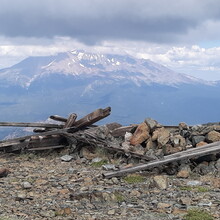
The Sisson-Callahan is a National Recreation Trail that historically was used by forest rangers to connect stations in Callahan and Sisson, nowadays called Mt Shasta City. Discover Siskiyou writes "The Sisson-Callahan (SCT) is the longest trail in the Mt Shasta area, with the sole (and obviously significant) exception of the Pacific Crest Trail." The SCT also follows the North Fork of the Sacramento River to its headwater divide, atop an exposed shoulder of the mighty Mt Eddy. From the divide, the Sisson-Callahan Trail continues descending north to Deadfall Lakes, seen just below. This route however, continues up the divide on the Mt Eddy Summit Trail, to an up close view of the majestic Mt Shasta. After reaching the remains of an old lookout tower, rewind to the North Shore Trailhead. Time stops back at road's end.

Water is accessible often during the lower part of this route.

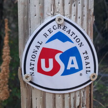
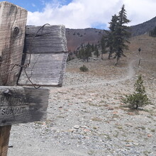
Directions: During my own adventure on this trail, Google maps led me correctly to the North Shore Trailhead. The road ends here at a campsite on the river. A few more campsites were passed during the final mile as well. The route begins from the end of the road. To start, cross the river at many swimming holes then locate the National Recreation Trail marking post. A second marking post is encountered ~5,000ft higher on the shoulder of Mt Eddy. From it, continue to the summit following an obvious and extremely scenic trail.

In historic days, the Sisson-Callahan connected with the Southern Sisson Climbers Route, also called the Sisson Historic Climbers Route, which nowadays picks up at Gateway Trailhead, in Mt Shasta City. Consider combining these 2 routes as well when visiting this exceptional area.

It's also worth noting that on Sept. 5th, 2020, the Siskiyou Outdoor Recreation Alliance announced that the "Shasta McCloud Management Unit received $117,000 from the Regional Office to work on heavy deferred maintenance on the Sisson-Callahan Trail. The FS Enterprise Trail Crew will be here from Sept. 15 - Sept. 27th to work on the first section."  Therefore, I expect to see some much faster times in the future!

Images

Comments

Hey there, Aria Zoner! I'm interested in adding a female to this FKT.  How clear was this trail?  Clear enough to at least find it ok?

Thanks,

Becky

For hiking, this trail was already in great shape. The $100,000 just spent on this trail was to make it more mountain bike friendly, since that's mainly who's been utilizing this trail in recent years. I'm glad to see this route getting some foot traffic, as the summit climb from the upper PCT or Park Trailheads is practically flat and overly traveled. Before the PCT was put in, and the road from Stewart Springs paved, this was the preferred way to reach the summit. Once the upper trailheads were in, this part of the SC was almost forgotten about, till a recent push to revamp it was made. Putting this route up as an FKT is part of that push to revitalize this trail, and honor those who've created it.

Thanks so much for posting some hx on the SC ..  The new "trail maintenance " grant that they used, was not at all associated with the trail association or trail builders .. it was a couple of forest service guys in a mini excavator that plowed a double track into the side of the hill..  I am pretty sure there was a big push to make it safer from the equestrian use advocates ..Â