This is from the Denver Water website:
The High Line Canal, designated as a National Landmark Trail, was completed in 1883 to deliver irrigation water. Today, the canal is owned and operated by Denver Water. The canal trail has become a major recreational amenity in the Denver area, as people enjoy using the canal’s trail for hiking, biking, jogging and horseback riding.
The Guide to the High Line Canal Trail is available in hard copy or pdf format.
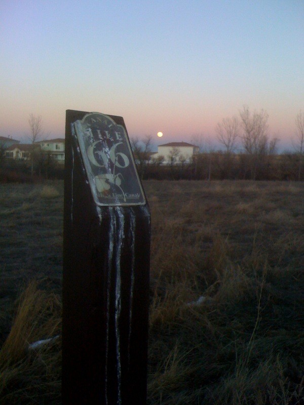
The canal itself runs 71 miles from a diversion dam in Waterton Canyon south of Denver, to the Rocky Mountain Arsenal Lateral in the Green Valley Ranch area in northeast Denver. However, the first 1.7 miles (in Waterton Canyon) and the last 5 miles are not accessible to trail users, so the High Line Canal Trail (HLCT) is 64.3 miles long. As such, it is surely one of the longest suburban recreation trails in the United States. It provides a scenic and extremely indirect tour of Denver's southern, eastern and northeastern suburbs.
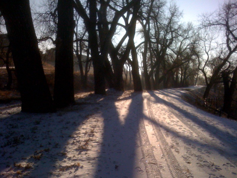
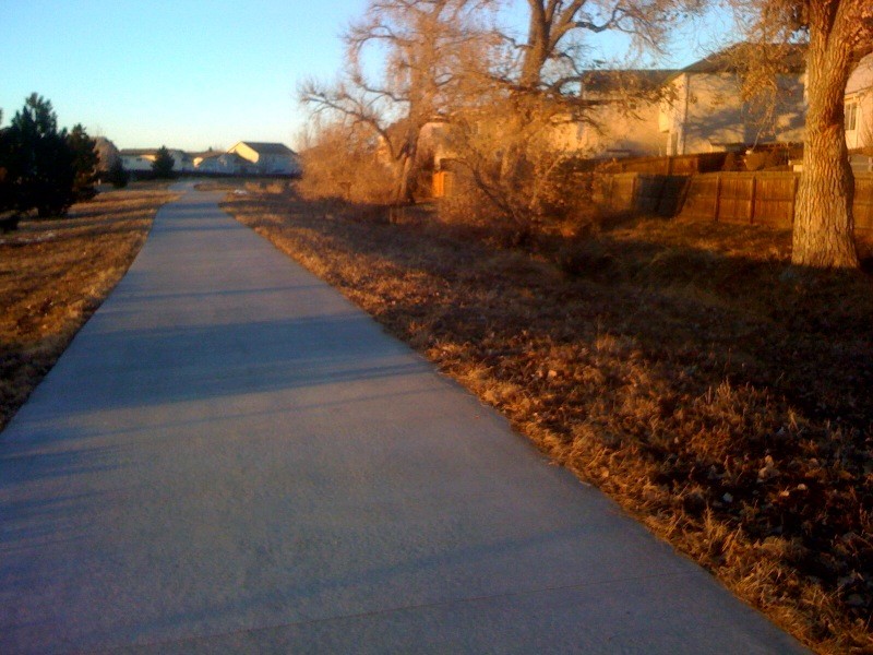
From Mile 1.7, where the trail starts at Waterton Road, to about Mile 37, the trail is almost all dirt. From Mile 37 to about Mile 50 the trail is mostly asphault, and from Mile 50 to Mile 66 the surface is primarily cement. However, it is almost always possible to run on dirt along side of the paved sections of the trail.
With one exception, the route is obvious -- you just follow the canal. Any questions are quickly cleared up by consulting the Denver Water guide. The tricky bit comes at Mile 8.6 where the canal disappears into a siphon to cross an extensive low-lying wetland area. The work-arounds for this section are long, cumbersome and unaesthetic (private property, busy roads). The obvious choice is to simply cross the wetland, which is of course both really hard and un-ecological -- unless the wetland happens to be frozen, such as on a cold January morning, when the crossing is direct and straightforward. After the wetland and some private property, the trail resumes at Mile 9.8. Note: Most people now are using the work-around, which adds ~1.3 miles, but avoids private property and is easy running vs. crossing a swamp! This takes Titan Rd and then runs along Santa Fe to rejoin the High Line Canal.
Resupply stops (mini-marts) are passably frequent along the HLCT.
This is a surprisingly good route! Up to about Mile 50 it is especially nice -- rural, peaceful, lined with cottonwoods, and with frequent big views of the city and the Front Range of the Rocky Mountains to the west. After 50 it becomes a little more "urban" feeling, though part of that is probably the cement. Besides being tough on the legs, running on cement just feels more urban because you get the impression you are on a sidewalk. Around Denver, everyone has run or biked on the HLCT, but it is rare to hear of anyone running the whole thing. While 64 miles is definitely long, the trail is basically flat, the surface is good, and resupply is easy, so this is a good winter project -- especially if you can get someone to drop you off and pick you up!
The people who built the High Line Canal more than a century ago didn't envision that people would be using their ambitious project as a recreational outlet in the midst of a busy urban area. In fact, to the builders of the 71-mile High Line, the canal was solely a commercial scheme to bring South Platte River water to settlers for drinking and farmers for agricultural purposes following a gold rush in 1859 near the confluence of the South Platte and Cherry Creek. -- From the Denver Water "Guide to the High Line Canal Trail"
Comments
Making an FKT attempt on this route self supported this coming Friday/Saturday June 12-13 2020.
Update: Raccoon ate all of my drop bag fuel and ruined my water at mile 22, decided to pull the plug at 50k as I didn't have supplies to make it to my next drop at mile 40 and no convenience stores that I ran by were open around 12-1 am. Glad I did as I went to retrieve drop bag 2 around mile 40 this AM and also had been destroyed by raccoons. Maybe attempt in cooler weather during normal business hours later this year.
Did you end up giving it another shot this year? I’m thinking about giving it a go in a couple of weeks.
I will be making an unsupported FKT attempt on this route this coming Saturday, December 19th, 2020.
The official route should be updated, as the work-around at Mi 8.6 (due to private property; the siphon was never a problem) was completely resolved in 2021. There is a straightforward designated trail cutting through that arm of Chatfield Res that is lovely and cuts off maybe .5 mile. I see the recent FKTer went out onto Titan Rd and Santa Fe Dr, which is laudable in that Jeffrey stuck to the official route, but that section is terrible, somewhat dangerous, and not recommended for future attempts (or anyone).
The High Line is great! It was constructed prior to the city, and water law in Colorado takes precedence over any other, so it cuts right through the entire urban area - everything else had to work around it. It's basically unused for irrigation now, so wonderful the "Friends of Highline Canal" have re-invigorated it as a recreational trail. And as Jeffrey mentions, there do remain some bump-arounds to navigate where the canal goes under a road while the trail goes around.
The High Line is an exceptional gravel bike route due it's distance and cruisability. One can loop it via the Platte River Greenway and a few connectors. Note there is also a "Farmers High Line Canal" just north of this one which is different.
Buzz - thanks for pointing out the connector trail option...the route is much more appealing that way. Can you clarify the designated route through Chatfield? The route on MTB project looks like it fits your description (https://www.mtbproject.com/trail/7036868/highline-canal-trail) but it cuts off 3 miles from the current FKT route. Is this the route you would suggest?
The highlinecanal.org site is a bit vague:
"The Plan for the High Line Canal prioritizes connecting the Canal through the Plum Creek gap, and work to form this critical trail link will continue. Visit highlinecanal.org for updates. In the meantime, Chatfield State Park has developed a network of trails and bridges that cross the Plum Creek riparian corridor. There is a connection from the High Line Canal trail to these state park trails just east of the Roxborough Park Road Trailhead. Consider leaving the High Line Canal trail around mile 8.25 (mile 6 on the FKT route) to enter Chatfield State Park and explore this peaceful open space...Crossing railroad tracks near mile 11.0 is prohibited."
Thanks!
Giff - I've done the route both ways through Chatfield. The one that follows the exact high line canal goes (almost to) Tower road but you need to go through private property, bushwhack and cross the South Platte in order to connect back to the canal path.
The one Buzz is suggesting: take a left off the path at mile 8, new dirt path that eventually becomes old asphalt leading to a dirt parking lot. Once at the lot, exit to the north/east and continue on concrete pathway up to the top of the dam (1.5miles). Cross railroad tracks (prohibited) and exit Chatfield back onto the canal path.
Wanted to give an update on this route: I rode the Highline canal on my bike to determine where this routes ends. The old route finishes on the first pass of Picadilly road. This is the route that all FKTs have been set (~67miles). However, the new route has been extended another 4+miles (to end at 64th ave and Picadilly road (Gaylord hotel). There's a lot of construction on the route from Aurora Sports Park to 64th and Picadilly. Here's a link to an interactive map: https://visit.highlinecanal.org/
Sooo.... I guess there can be a new FKT set soon?? I'd wait until the spring or summer 2024 to allow for construction to finish, or at least have proper signage. I will say there are High line canal logos (white) on the ground where signs are lacking, even on the surface streets after Green Valley golf club.
-Scott Jaime
Dude did you record this on strava or no? Did you avoid titan entirely? Living over here near the start, I'll probably make a go of it at some point.
hey friends, kinda last second here but wondering about skipping a race i had planned to run saturday and attempting an FKT here instead.
how’s this route look? i can’t figure out a way to lengthen it from its current ending point.
https://www.strava.com/routes/3426595237930106038
cheers!