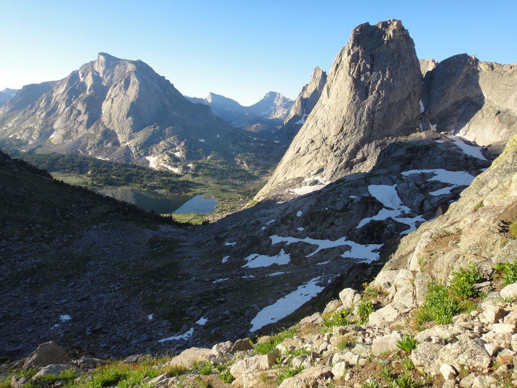
Location
Wyoming,
US
Distance
97 mi
Vertical Gain
30,000 ft
Description
GPS Track
Skurka-WRHR-move.gpx235.9 KB
FKTs
Male
Female
| David Ayala | 1d 13h 41m 0s | ||||
| Gabe Joyes | 1d 23h 7m 0s | ||||
| David Ayala | 2d 3h 35m 24s | ||||
| Skyler Williams | 2d 14h 59m 13s | ||||
| Andrew Skurka | 4d 2h 3m 0s |
| Kelly Halpin | 2d 5h 34m 20s | ||||
| Kelly Halpin | 2d 11h 37m 0s |
| Sara Aranda, Emma Mure | 3d 17h 20m 0s |
Male
Mixed-gender team
| Fred Casey Most | 1d 13h 19m 17s |
| Kelly Halpin, Ryan Burke | 2d 15h 0m 0s |
Images
Comments
I hope to make a go at the female unsupported record starting this Sunday or Monday, as long as the weather and smoke cooperate. And if not, I have to head back to CA to attend to responsibilities...
I will be sharing my location at the MapShare website: https://share.garmin.com/ReneesWindRiverHighRouteFKT
PW="ReneeFKTs"
I got shut down by fresh snow, extreme winds, and cold temperatures. Maybe next year ...
Keep up the stoke and learn the route more. You’ll get it !!
I am heading out to Wyoming to make another go at the FKT. I am either starting tomorrow to beat the storms coming in, or waiting until they (hopefully!) clear and starting this Saturday at the earliest. I'll be sharing my location at the InReach MapShare website: https://share.garmin.com/ReneesWWHRFKT
Password: ReneeFKTs
I went for it, but couldn't quite make it happen. Route finding delays and hard snow caused delays and night, putting me behind my schedule. Significant rain and Tstorms on the last day made me decide to bail after New York Pass. I will be writing a trip report and will share the link when it's done! What an experience.
My trip report from this attempt:
https://reneeelsdon.wordpress.com/2022/08/28/sleep-deprived-and-ecstati…
I put in an effort on the route starting on 08/20/22 at 2:00am. I took a total of 40hrs 21mins 35sec to complete the route. Not a new FKT, I came in after David's 2021 time by about 2.5hrs, but I'm deeply proud of the effort I put in. Nothing was lost for me in the "failure" to achieve a new FKT. A couple of major learnings (including a need for better acclimitization) give me a lot of excitement for another attempt in the future! A huge thanks to David for contributing to my stoke on this route and offering some advice in preparation. This is truly an incredible mountain range, I feel privileged to have moved through it all in a single push.
You can find a link to my Strava activity here (was using UltraTrac hence some inaccuracies with distance/vert): https://www.strava.com/activities/7680776769
For anyone interested, my friend Greg Hewitt and I made what we believe to be the first ski traverse of this route between 5/9-5/14/26. It took us 5 days, 5 hours, and 27 minutes. We traveled from north to south, and didn't see another person from when we left the Trail Lakes Trailhead until we were less than a mile from Bruce's Bridge. We had overall good conditions for a ski traverse. The snow line was just over 10,000', and travel conditions were mostly good. We put skis on for the first time 8.5 miles into the traverse and took them off for the last time about 13 miles from Bruce's Bridge. Between those two points we were travelling on snow, either skinning, skiing, or bootpacking, for over 90 percent of the time.
This route worked really well as a ski traverse, and traveling in the spring made for a committing wilderness experience. Obviously we were much slower than the overall FKT, and a fit skier/party of skiers who was committed to going fast could take days off our time. But we had an incredible experience, and would encourage other folks to consider doing this on skis too!
Hey man, this is certainly not the first completed traverse of the High Route. Forrest McCarthy skied from Lander to Jackson and completed most of the high route (continued towards Jackson instead of Dubois). Adam Fabrikant has also traversed the entire range on skis.