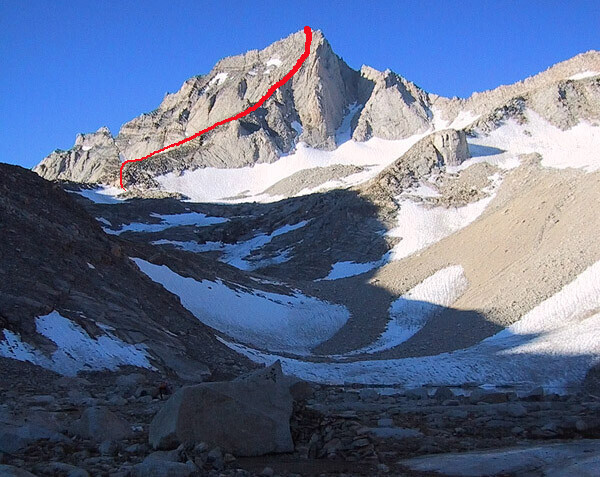
Route: Bear Creek Spire (CA)

Submitted by joeymaloney12 on Mon, 08/17/2020 - 10:15am
Location
California, US
Distance
11.64 km
Vertical Gain
3,512 ft
Description

The North Arete route ascends 800' of rock, 4th Class with some 5.7-5.8 cruxes.  The FKT is Car to Car, starting the track at the Mosquito Flat Trailhead, Climb the North Arete, descend the normal descent route and back to the car. 

The Northeast Ridge (second photo) was first ascended by Norman Clyde in 1931.  The route follows an obvious ridge that gradually steepens from talus hopping to near vertical. There are many places to read up on this route and the grading varies quite a bit; some say 4th class, some say 5.6, and others place it anywhere in between. I figure somewhere around 5.3 is about right with good route finding. One can traverse to the south before meeting the North Arete route, but the best climbing is on the ridge proper and well worth the slight increase in difficulty.

In addition to climbing the peak itself, one approaches from the Mosquito flats trailhead, which adds ~5 miles each way and ~3000 feet of elevation gain on terrain varying from flat, smooth trails to steep talus and scree. We figured the route should start and end at the trailhead sign by the bathrooms just a few steps past the parking lot. Also, this should go without saying, but it doesn’t count unless you do the summit block mantel!  

Images

Comments

For anyone interested, right now there is a rare set of conditions ideal for speed on this route: The climbing route and hiking trail are dry, the off-trail approach and descent (including all the nasty talus) are covered in snow. It's highly unusual for all this to happen at once, so someone faster than me should take advantage of this!