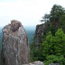
Location
North Carolina,
US
Distance
9.5 mi
Vertical Gain
1,900 ft
Description
GPS Track
Crowder+Pinnacle.gpx188.84 KB
FKTs
Male
Female
| Kevin Thompson | 1h 21m 17s | ||||
| Alex Garcia | 1h 21m 23s |
| Laura Matacia | 1h 41m 14s |
| Marcy Beard | 2h 20m 21s |
Male
Mixed-gender team
Female
| Owen Thornton | 1h 56m 24s | ||||
| Kevin Thompson | 2h 4m 11s | ||||
| Owen Thornton | 2h 12m 20s | ||||
| Kevin Thompson | 2h 27m 34s | ||||
| Kevin Thompson | 2h 32m 9s | ||||
| Scott Dempsey | 3h 40m 54s |
| Brad Johnson, Brittany Rodriguez | 3h 36m 6s |
| Lindsey Bowen | 4h 23m 29s |
Male
| Kevin Thompson | 50m 5s | ||||
| Owen Thornton | 58m 32s |


Comments
I made an attempt at the standard route on Saturday, I think I got the route pretty well despite not hitting some Strava segments, but missed Kevin's time by 2 and a half minutes. Major respect for his, and the other times on this. Loved the route, very fun, highly recommended.
https://www.strava.com/activities/6251965850